Cantitate/Preț
Produs

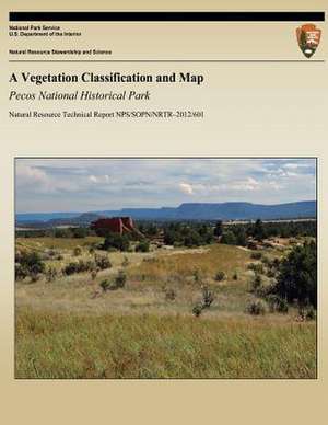
A Vegetation Classification and Map

Autor Esteban Muldvin, Yvonne Chauvin, Terri Neville
en Limba Engleză Paperback
The U.S. Geological Survey (USGS)-National Park Service (NPS) Vegetation Mapping Program and the NPS Southern Plains Network (SOPN) of parks in cooperation with Natural Heritage New Mexico (NHNM, a division of the Museum of Southwestern Biology at the University of New Mexico), and the staff at Pecos National Historical Park (PECO), set out to develop vegetation maps that meet or exceed USGS-NPS standards of 1:24,000-scale and 0.5-ha minimum map unit size (USGS 2010). The maps were based on high-resolution aerial photography along with extensive ground sampling. The project was initiated in 2006 with ensuing field surveys of the vegetation communities through 2011. The vegetation survey data were entered into a database and used to develop a park-wide vegetation classification following the National Vegetation Classification System (FGDC 1997, 2008; Grossman et al. 1998) guidelines.* Then, using the vegetation classification and associated ground control points, vegetation maps were generated at a 1:12,000 scale using a combination of automated image analysis (image segmentation and supervised classifications) and direct image interpretation. Map units were designed to support ecologically based natural resources management with an emphasis on use in fire and wildlife management. The authors provide here the details on how the maps were constructed, an overview of the classification and ecology of the vegetation communities of the monument, the vegetation maps with associated map unit descriptions, plant community descriptions and a diagnostic key, and a vouchered species list. The maps are presented in both paper and digital form as part of a geographic information system (GIS) compatible with that used in the park and national USGSNPS national mapping program. In addition, all field data were compiled into a relational database compatible with USGS-NPS database guidelines, and all data and report elements made ready for web-based applications. Finally, the authors provide an accuracy assessment that reflects both user and producer confidence in the map.
Citește tot Restrânge

Preț: 14084 lei

Nou

Puncte Express: 211

Preț estimativ în valută:
2696 2803$ 2235£

Carte disponibilă

Livrare economică 17-31 ianuarie 25

Preluare comenzi: 021 569.72.76

Specificații

ISBN-13: 9781492715375
ISBN-10: 1492715379
Pagini: 230
Dimensiuni: 216 x 279 x 12 mm
Greutate: 0.54 kg
Editura: CREATESPACE