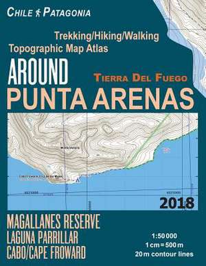
Around Punta Arenas Trekking/Hiking/Walking Topographic Map Atlas Tierra del Fuego Chile Patagonia Magallanes Reserve Laguna Parrillar Cabo/Cape Frowa
Autor Mazitto, Sergioen Limba Engleză Paperback
Magallanes National Reserve, Laguna Parrillar National Park, Cape Froward etc.
20 meter contour lines, road network, trails & paths, transportation, food, campsites, shelters, guest houses & hotels. Mercator projection with both UTM and WGS84 coordinate grids.
The map scale of 1:50000 (1 cm = 500 meters) provides a wealth of detail while keeping low the weight of the atlas itself. The large page format of 8.5x11in minimizes page count and along with an overlapping map design allows for comfortable navigation.
The details included in the topographic maps of this atlas were specifically selected to be useful for trekkers, hikers and walkers of all interests, and make it easy to plan and enjoy both short excursions and hikes as well as long multi-day adventures along the main marked routes and/or adjacent trails and paths, which are also shown on the maps.
With this ultralight atlas you will always have a detailed, reliable, information-rich, battery-independent, shatter-proof map for your adventure.
Preț: 96.45 lei
Nou
Puncte Express: 145
Preț estimativ în valută:
18.46€ • 20.04$ • 15.50£
18.46€ • 20.04$ • 15.50£
Carte disponibilă
Livrare economică 01-15 aprilie
Preluare comenzi: 021 569.72.76
Specificații
ISBN-13: 9781983873546
ISBN-10: 1983873543
Pagini: 46
Dimensiuni: 216 x 280 x 3 mm
Greutate: 0.17 kg
ISBN-10: 1983873543
Pagini: 46
Dimensiuni: 216 x 280 x 3 mm
Greutate: 0.17 kg