Best Tent Camping: Your Car-Camping Guide to Scenic Beauty, the Sounds of Nature, and an Escape from Civilization: Best Tent Camping
Autor Sam Mitchell, Johnny Molloyen Limba Engleză Paperback – 17 noi 2014
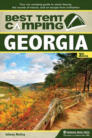
Whether it’s rafting down the Chattooga River, hiking along the Bartram Trail, or sea kayaking around Cumberland Island National Seashore, Georgia is stuffed with opportunities for outdoor enthusiasts of all abilities. To help these adventurers on their way, Best Tent Camping: Georgia by Johnny Molloy reveals the best places in the Peach State to pitch a tent, from mountainous Amicalola Falls State Park, starting point for Appalachian Trail thru-hikers, to the windswept dunes of Cumberland Island. Written to steer campers away from concrete slabs and convoys of RVs, Best Tent Camping: Georgia points tent campers to only the most scenic and serene campsites in the state.
Painstakingly selected from hundreds of campgrounds, each of the 50 campsites is rated for: beauty, noise, privacy, security, spaciousness, and cleanliness. In addition, each campground profile provides essential details on facilities, reservations, fees, and restrictions, as well as an accurate, easy-to-read map, making the campground a snap to locate. Also included are suggestions for nearby outdoor recreation and sightseeing, pinpointing attractions that often go unnoticed.
Painstakingly selected from hundreds of campgrounds, each of the 50 campsites is rated for: beauty, noise, privacy, security, spaciousness, and cleanliness. In addition, each campground profile provides essential details on facilities, reservations, fees, and restrictions, as well as an accurate, easy-to-read map, making the campground a snap to locate. Also included are suggestions for nearby outdoor recreation and sightseeing, pinpointing attractions that often go unnoticed.
Din seria Best Tent Camping
-
 Preț: 87.20 lei
 -
 Preț: 86.98 lei
 -
 Preț: 88.02 lei
 -
 Preț: 90.11 lei
 -
 Preț: 97.94 lei
 -
 Preț: 98.95 lei
 -
 Preț: 96.90 lei
 -
 Preț: 93.81 lei
 -
 Preț: 177.50 lei
 -
 Preț: 191.35 lei
 -
 Preț: 217.97 lei
 -
 Preț: 187.62 lei
 -
 Preț: 224.57 lei
 -
 Preț: 217.97 lei
 -
 Preț: 177.50 lei
 -
 Preț: 217.97 lei
 -
 Preț: 223.47 lei
 -
 Preț: 178.17 lei
 -
 Preț: 93.81 lei
 -
 Preț: 94.86 lei
 -
 Preț: 99.99 lei
 -
 Preț: 94.86 lei
 -
 Preț: 233.34 lei
 -
 Preț: 88.31 lei
 - 23%
 Preț: 125.16 lei
 - 28%
 Preț: 129.86 lei
 - 23%
 Preț: 124.25 lei
Preț: 85.97 lei
Nou
Puncte Express: 129
Preț estimativ în valută:
16.46€ • 17.88$ • 13.83£
16.46€ • 17.88$ • 13.83£
Carte disponibilă
Livrare economică 31 martie-14 aprilie
Preluare comenzi: 021 569.72.76
Specificații
ISBN-13: 9780897324984
ISBN-10: 0897324986
Pagini: 192
Ilustrații: 51 maps
Dimensiuni: 150 x 226 x 13 mm
Greutate: 0.23 kg
Ediția:Revised.
Editura: Menasha Ridge Press Inc.
Seria Best Tent Camping
ISBN-10: 0897324986
Pagini: 192
Ilustrații: 51 maps
Dimensiuni: 150 x 226 x 13 mm
Greutate: 0.23 kg
Ediția:Revised.
Editura: Menasha Ridge Press Inc.
Seria Best Tent Camping
Cuprins
Northwest Georgia
1.Cloudland Canyon State Park
2.Doll Mountain
3.Fort Mountain State Park
4.Hickey Gap
5.Hidden Creek
6.Jacks River Fields
7.Lake Conasauga
8.McKaskey Creek
9.The Pocket
10.Harris Branch
Northeast Georgia
11.Amicalola Falls State Park
12.Andrews Cove
13.Black Rock Mountain State Park
14.Cooper Creek
15.Frank Gross
16.Desoto Falls
17.Dockery Lake
18.Fort Yargo State Park
19.Hart State Park
20.Lake Blue Ridge
21.Lake Chatuge
22.Lake Russell
23.Lake Winfield Scott
24.Rabun Beach
25.Sarah’s Creek
26.Shady Grove
27.Tate Branch
28.Unicoi State Park
29.Upper Chattahoochee
30.Vogel State Park
31.War Hill
32.Wildcat
Middle Georgia
33.Bussey Point
34.F. D. Roosevelt State Park
35.George L. Smith State Park
36.Hesters Ferry
37.Stateline
38.Lake Sinclair Beach
39.Magnolia Springs State Park
40.Oconee River
South Georgia
41.Coheelee Creek
42.Cotton Hill
43.Fort McAllister State Historic park
44.General Coffee State Park
45.Kolomoki Mounds State Historic Park
46.Faceville Landing
47.Rood Creek
48.Sea Camp at Cumberland Island
49.Skidaway Island State Park
50.Stephen C. Foster State Park
Notă biografică
Johnny Molloy is a writer and adventurer based in Johnson City, TN. He has written more than 40 books about the outdoors, including hiking guidebooks, camping guidebooks, paddling guidebooks, comprehensive guidebooks about a specific area, and true outdoor adventure books throughout the Eastern United States. Molloy writes for varied magazines and websites, and he is a columnist and feature writer for his local paper, the Johnson City Press.
Extras
Dockery Lake
An exceptional campground beside a trout-filled lake beneath the shadow of the Appalachian Trail. And that is only the beginning of Dockery Lake Campground. Set in a large cove on the southern shore of 3-acre Dockery Lake, this campground is as aesthetically pleasing as its natural mountain surroundings of the Cedar Ridge Mountain Range. The sites are landscaped using native stones with plenty of trees and ground cover that blend in well with the upland landscape. The tent pads are bordered in concrete with gravel pebbles for drainage. Not much leveling was needed, as the slope of the campground is negligible.
The sites are arranged on either side of a one-way gravel road, beneath a pine and hardwood forest with an understory of hemlock and mountain laurel. Five sites lie directly lakeside; the other six are only yards away but have the advantage of being high enough to overlook the lake. At the campground’s end, a retaining wall encloses a small grassy area beside the lake, producing an ideal spot for fishing, sunbathing, or just relaxing.
Two combination water fountains and spigots are positioned around the campground, and a comfort station with flush toilets for each gender stands on the uphill side of the campground. The campground host resides at the campground’s center, adding an element of security for visitors. The intimate lakeside environment spells vacation for any camper whose destination is Dockery Lake.
Dockery Lake is fed from the chilly headwaters of Waters Creek, tumbling off the slopes of Jacobs Knob along the Appalachian Trail. The pure water is sufficiently cold to support a healthy population of trout, so it comes as no surprise that fishing is a popular pastime at Dockery Lake. The lake is stocked on a regular basis by the Georgia Department of Natural Resources. Anglers can be found here using a rod and reel lakeside or in a canoe or other small craft. No motors are allowed, however. The 0.6-mile Lakeshore Trail snakes around the lake. Short side trails leading to platforms at the water’s edge provide good fishing and lake views. A wooden platform with handrails sits over the small dam. It’s a good vantage point for lake enthusiasts to take in the entire 6 acres of the crystalline body of water. The trail is graveled throughout the campground.
The one-way gravel road bisecting the campground leads a short distance to the picnic parking area. It is there that the Dockery Lake Trail begins. It leads 3.4 miles up to Miller Gap and the Appalachian Trail. Look for deer and grouse feeding in the shadows. After a mile of trail treading along tributaries of Waters Creek, you’ll be lower than when you started. The trail climbs for the remainder of its journey to Miller Gap, just shy of 3,000 feet. It is 2.9 miles west on the AT to Woody Gap and GA 60. It is just over 5 miles east to Blood Mountain, at 4,458 feet, the highest point of the AT in Georgia.
For a scenic overview of the surrounding mountains, drive back to GA 60 and turn right. A quarter-mile on your right is the Chestatee Overlook, a cleared area offering a vista of the Chattahoochee National Forest to the east. Another mile up GA 60 is Woody Gap and a view of the Yahoola Valley. The AT passes through the grassy gap. If you need supplies, drive back to Dahlonega.


