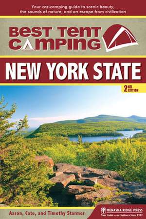
Best Tent Camping: Your Car-Camping Guide to Scenic Beauty, the Sounds of Nature, and an Escape from Civilization: Best Tent Camping New York State
Autor Catharine Starmer, Aaron Starmer, Timothy Starmeren Limba Engleză Paperback – 28 oct 2013
Wilderness abounds in New York State. From the Great Lakes to the Atlantic Ocean, from the Adirondack Mountains to the Catskills, from the St. Lawrence River to the Hudson, millions of acres of public lands are dotted with hundreds of campgrounds—but you probably only have a precious amount of limited time. Where should you go? When should you go? That’s what Best Tent Camping: New York State is for—to help you make the wisest use of your time in the wilds of New York.
Divided geographically into seven sections—Long Island, Catskills/Hudson Valley, Central/Leatherstocking, Adirondacks, St. Lawrence River, Finger Lakes, and Western—the book is a helpful reference for camping enthusiasts throughout the state. Historical tidbits, descriptions of wildlife and the occasional personal anecdote add flavor to the campground descriptions. Star ratings and maps make choosing the best place to pitch a tent a simple task.
Making reservations online or blindly over the phone can put a camper miles from the restroom, stranded with no shade, or in the middle of a busy campground trail. Maps will help campers avoid those pitfalls, and wherever possible the author has even recommended specific campsites for maximum privacy, spaciousness, or beauty.
Preț: 88.24 lei
Nou
Puncte Express: 132
Preț estimativ în valută:
16.89€ • 17.58$ • 14.27£
16.89€ • 17.58$ • 14.27£
Carte tipărită la comandă
Livrare economică 10-24 martie
Preluare comenzi: 021 569.72.76
Specificații
ISBN-13: 9780897327169
ISBN-10: 0897327160
Pagini: 208
Ilustrații: 51 maps
Dimensiuni: 150 x 226 x 13 mm
Greutate: 0.28 kg
Ediția:Revised.
Editura: Menasha Ridge Press Inc.
Seria Best Tent Camping New York State
ISBN-10: 0897327160
Pagini: 208
Ilustrații: 51 maps
Dimensiuni: 150 x 226 x 13 mm
Greutate: 0.28 kg
Ediția:Revised.
Editura: Menasha Ridge Press Inc.
Seria Best Tent Camping New York State
Cuprins
New York Campground Locator Map
Locator-Map Key
Authors¿ Top New York Campgrounds
Acknowledgments
Preface
Introduction
Long Island
1 Sears Bellows County Park
2 Watch Hill
3 Wildwood State Park
Catskills and Hudson Valley
4 Clarence Fahnestock Memorial State Park
5 Devil's Tombstone
6 Little Pond
7 Mills-Norrie State Park
8 Mongaup Pond
9 North-South Lake
10 Peekamoose
11 Taconic State Park: Copake Falls Area
12 Woodland Valley
Central, Leatherstocking, and Capital
13 Bowman Lake State Park
14 Cherry Plain State Park
15 Delta Lake State Park
16 Fair Haven Beach State Park
17 Glimmerglass State Park
18 Green Lakes State Park
19 Max V. Shaul State Park
20 Moreau Lake State Park
21 Whetstone Gulf State Park
Adirondacks
22 Adirondak Loj: Wilderness Campground at Heart Lake
23 Alger Island
24 Ausable Point
25 Brown Tract Pond
26 Buck Pond
27 Cranberry Lake
28 Eighth Lake
29 Forked Lake
30 Indian Lake Islands
31 Lake George Islands
32 Lake Harris
33 Lincoln Pond
34 Little Sand Point
35 Luzerne
36 Meacham Lake
37 Putnam Pond
38 Rollins Pond
39 Sacandaga
40 Saranac Lake Islands
Thousand Islands
41 Mary Island State Park
42 Wellesley Island State Park
Finger Lakes
43 Buttermilk Falls State Park
44 Keuka Lake State Park
45 Stony Brook State Park
46 Taughannock Falls State Park
47 Watkins Glen State Park
Western New York
48 Allegany State Park: Cain Hollow (Quaker Area)
49 Lakeside Beach State Park
50 Letchworth State Park
Appendix A: Camping-Equipment Checklist
Appendix B: Sources of Information
Appendix C: Suggested Reading and Reference
Index
About the Authors
Map Legend
Notă biografică
Aaron Starmer is a freelance writer and editor specializing in children's novels and travel guides. His far-flung adventures inform much of his writing and include chasing down leopards in Kenya's Maasai Mara, rafting through the Grand Canyon, crossing mountain passes in New Zealand's Fiordland National Park, tripping over iguanas in the Galapagos Islands, and swimming beneath waterfalls in Tahiti. When closer to home, he takes every opportunity to explore the mountains, lakes, and rivers of New York, New Jersey, and New England. He lives in Hoboken, New Jersey with his wife Cate.
Cate Starmer has reviewed New York City restaurants, written a guidebook to camping, edited dozens of non-fiction books, and produced a daily-updated travel blog. She received a dual degree BS in marketing and tv-radio-film from Newhouse School at Syracuse University and a certificate in Editing from New York University's School of Continuing and Professional Studies. Whether it's horseback riding in the Colombian jungle, running the NYC marathon, or trekking to a backcountry hut in winter, she is always up for a new challenge--especially if it involves an adventure that can be turned into a story.
Timothy Starmer has always been an outdoor enthusiast and spent most of his childhood seeking out remote and wild areas whenever possible. During a brief hiatus from Brown University during 1997, he drove across the United States for six weeks, camping the entire way. Along the way he explored many of the West's national and state parks, including Canyonlands, Yellowstone, Arches, Bryce Canyon. At the trip's conclusion, he headed down to Australia, where he backpacked for a few months exploring the eastern Outback, the Great Barrier Reef, and the caves of Tasmania, as well as traversing the Tasmanian World Heritage Area along the Overland Track. Tim currently works in upstate New York as a timber framer and can still be found exploring the wilds whenever possible.
Extras
PEEKAMOOSE CAMPGROUND
Denning, New York
It's all free-of-charge on a first-come-first-served basis, and the sites are large, flat, shady, and private.
RATINGS
Beauty: 4 stars
Privacy: 3 stars
Quiet: 2 stars
Cleanliness: 2 stars
Security: 1 star
Spaciousness: 4 stars
KEY INFO
Address: County Route 42, Denning, NY 12725
Operated by: New York State Department of Environmental Conservation
Information: (845) 240-6788;
Open: Year-round
Sites: Approximately 25
Each site has: Fire ring
Assignment: Choose from available sites; no reservations
Registration: Not required
Facilities: Port-a-potties from June–September
Parking: At designated lots
Fee: Free
Elevation: 1,096 feet
Restrictions: Pets: Dogs on leash with proof of currently valid rabies vaccination. Fires: In fire rings only. Alcohol: At site. Vehicles: None permitted; all sites walk-in. Other: Quiet hours 10 p.m.–7 a.m. (not enforced). Reservations: None taken, but call ahead if planning to stay more than 3 nights.
At the southern end of the Catskills, in the Sundown Wild Forest, lies the Peekamoose Valley, where 2,000-foot peaks—Samson, Van Wyck, and Peekamoose Mountains—funnel water into Rondout Creek through a series of picturesque waterfalls. In the midst of all of this is a campground that, while administered by the Department of Environmental Conservation (DEC), is decidedly different than any of the Catskill's other offerings. If you're looking for a place to pitch your tent that's somewhere between backcountry camping and primitive but established properties like Devil's Tombstone (see page 28), then you'll find this is your sweet spot (or sweet 25 spots, to more exact).
The campground is stretched out over a mile and is made up of three separate fields, each containing 6 to 9 walk-in sites. (There's also a trailer field that requires permits; contact the DEC for more information on that area.) There's no running water, no trash pickup, no picnic tables, and only seasonal port-a-potties at the parking lots. But it's all free-of-charge on a first-come-first-served basis, and the sites are large, flat, shady, and private. From nearly every corner of the campground, you can hear the sound of the trickling Rondout Creek.
With the exception of two group sites and two accessible sites, each other one is limited to nine people and three tents. Part of the fun is exploring the winding paths to discover the best available spot for you. Be careful to select a site with a designated camping sign, as the DEC occasionally rotates locations to spread out the impact of campers. Admittedly, some of the former sites can be very tempting. And don't let the name "field" fool you; only a few sites are actually in fields. Most are nicely wooded options with ample of vegetation.
Approaching from the northeast along Peekamoose Road/County Route 42, the first area after the trailer field is the upper field with its two parking lots. Closest to the eastern lot, sites 1 and 2 sit across from the trailer field along a dry creek bed (or at least it's been dry when we have visited). Sites 3 and 5 are closer to the road, but are nicely situated among spruce trees on the opposite side of the field's well-worn main trail. Numbers 4 and 8 are even closer to the trail, while 6 and 7 are tucked away on little spurs near the western parking lot.
Further along Peekamoose Road, toward Sundown, the middle field features six sites and one small parking lot. While sites 1 and 2 (set off to the right of the lot) are both close to the creek, they are also somewhat close from the road. Still, they're a better choice than site 3, which is within spitting distance of the lot. We prefer sites 4 and 5 for their privacy and their soft, sandy perches next to the creek (and a nice little swimming hole), and site 6 for its grassy seclusion near an open field. As in other parts of the campground, small dry creek beds (some used as default trails) criss-cross near most of the sites, so be wary during periods of heavy rain.
The lower field, not much further down the road, houses nine sites. The sites are nicely spread and, thanks to their distance from the large parking lot and their location across an old bridge, they tend to be the quietest choices. From the lot, walk down a hill, cross the bridge to the information kiosk, and you will find sites 1 to 6 to the right and sites 7 to 9 are to the left. For the most privacy, check out site 1. About a quarter a mile removed from the rest of the sites past an old stone wall, it's remote and woodsy enough for the greatest of recluses. Site 3 is not far from the edge of the creek. While numbers 2, 4, 5 (the largest), and 6 are all scattered along the edge of a tall grass field bordering a steep hill thick with fir trees that cast shade upon the sites. Number 7 sits just past the information kiosk, while 8 and 9 (always good choices) are closer to the creek and are often home to some interesting art created with stones worn smooth by the water.
Because there are no reservations, you could show up and find the campground already full. On the plus side, impromptu getaways can be rewarded with free streamside campsites and absolutely no paperwork. Still, summer weekends fill up fast so don't arrive after dark on a Friday evening and expect luck to be on your side. Local DEC rangers do occasionally patrol, but rules, especially quiet hours, are treated differently by all. Be wary of rowdy parties, especially on holiday weekends. Previous tenants may leave presents for you, ranging from trash bags to well-stacked stone cairns. Just because there's no staff on-site, be sure to leave Peekamoose as you would like to find it.
Nearby in the Peekmoose Valley, you'll find a stunning swimming hole, lots of accessible waterfalls, and a variety of hiking options. Across the road from the upper field's eastern lot, a large boulder marks the trailhead to Bengle Hill and Vernooy Kill Falls, and just east along Peekamoose Road is the Peekamoose-Table Trail, a strenuous hike that rewards with a great views. For an easier route to views, drive to the nearby town of Denning for 1.2 mile hike to Red Hill Fire Tower. After all that climbing and sweating, be sure to cool off with a trip to the famous Blue Hole, a legendary swimming hole just 2 miles east along Peekamoose Road. It's chilly even in the peak of summer, but don't let that stop you from taking a memorable leap into the crystal clear water.
GETTING THERE
From I-87, take Exit 19, New York 28/Kingston/Rhinecliff Br. At the traffic circle, take the 1st exit and follow NY-28 W for 16 miles. Take a slight left onto NY-28A/New York City Rd. for 3 miles. Take a slight right onto CR 42W/W Shokan-Peekamoose-Sundown Rd. for 11 miles to the upper field entrance on the right.
PARK ENTRANCE COORDINATES
Latitude N 41°54'34"
Longitude W 74°27'13"
