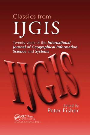
Classics from IJGIS: Twenty years of the International Journal of Geographical Information Science and Systems
Editat de Peter Fisheren Limba Engleză Paperback – 23 oct 2019
Classics from IJGIS: Twenty Years of the International Journal of Geographical Information Science and Systems contains articles that shaped the way we approach the science of GIS, provided seeds from which grew key developments that have molded the field, opened new avenues of discovery across the landscape of modern GIScience, and some that may mark how it will change in the future. Accompanying nearly every article is a commentary written by at least one of the original authors. In these commentaries, the authors reflect on various aspects of the original work, including what drove their original research, why the concepts were widely adopted (or in some cases, why not), and what the future may hold for new research embarking on these and similar areas. The 20th article in this collection is an original contribution that examines the social and collaborative networks operating within and shaping the body of research in the field.
Preț: 378.69 lei
Preț vechi: 504.61 lei
-25% Nou
Puncte Express: 568
Preț estimativ în valută:
72.47€ • 76.20$ • 59.88£
72.47€ • 76.20$ • 59.88£
Carte tipărită la comandă
Livrare economică 16-30 aprilie
Preluare comenzi: 021 569.72.76
Specificații
ISBN-13: 9780367390587
ISBN-10: 0367390582
Pagini: 572
Dimensiuni: 156 x 234 x 37 mm
Greutate: 0.91 kg
Ediția:1
Editura: CRC Press
Colecția CRC Press
ISBN-10: 0367390582
Pagini: 572
Dimensiuni: 156 x 234 x 37 mm
Greutate: 0.91 kg
Ediția:1
Editura: CRC Press
Colecția CRC Press
Public țintă
Academic and Professional Practice & DevelopmentCuprins
Introduction - Twenty Years of IJGIS: Choosing the Classics. A Mark 1 Geographical Analysis Machine for the Automated Analysis of Point Data Sets. A Review and Conceptual Framework of Automated Map Generalization . Propagation of Errors in Spatial Modelling with GIS . A Comparison of Techniques for Calculating Gradient and Aspect from a Gridded Digital Elevation Model . Object-Oriented Data Modelling for Spatial Databases . Point-Set Topological Spatial Relations . Modelling Accessibility Using Space-Time Prism Concepts within Geographical Information Systems . Geographical Information Science . Algorithm and Implementation Uncertainty in Viewshed Analysis . Development of a Geomorphological Spatial Model Using Object-Oriented Design . Integrating Geographical Information Systems and Multiple Criteria Decision-Making Methods . The Geography of Parameter Space: An Investigation of Spatial Non-Stationarity . Qualitative Spatial Reasoning: Cardinal Directions as an Example . Assessing, Representing, and Transmitting Positional Uncertainty in Maps . Loose Coupling a Cellular Automaton Model and GIS: Long-Term Urban Growth Prediction for San Francisco and Washington/Baltimore . Overcoming the Semantic and Other Barriers to GIS Interoperability . Interactive Maps for Visual Data Exploration . Geographical Categories: An Ontological Investigation . Extending GIS-Based Visual Analysis: The Concept of Visualscapes . Collaboration Networks Revealed by IJGIS Authors. Contributor List. Index.
Descriere
Spanning the 20-year history of the International Journal of Geographic Information Science (IJGIS), this reverential chronicle contains articles that shaped the way GIS is approached, provided the underpinnings of fruitful branches of development, and opened new avenues of discovery across the landscape of modern GIScience. Along with nearly every article is a commentary written by at least one of the original authors. In these commentaries, the authors reflect on what drove their original research, why the concepts were widely adopted (or in some cases, why not), and what future researchers can expect in the field. The final article examines the social networks that have evolved in the GIS community.
