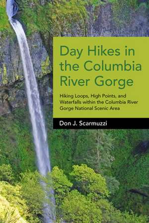
Day Hikes in the Columbia River Gorge: Hiking Loops, High Points, and Waterfalls Within the Columbia River Gorge National Scenic Area: Day Hikes
Autor Don J. Scarmuzzien Limba Engleză Paperback – 31 aug 2015
Preț: 138.14 lei
Nou
Puncte Express: 207
Preț estimativ în valută:
26.44€ • 28.71$ • 22.21£
26.44€ • 28.71$ • 22.21£
Carte disponibilă
Livrare economică 01-15 aprilie
Preluare comenzi: 021 569.72.76
Specificații
ISBN-13: 9781941821701
ISBN-10: 1941821707
Pagini: 216
Dimensiuni: 152 x 229 x 18 mm
Greutate: 0.43 kg
Editura: Westwinds Press
Seria Day Hikes
ISBN-10: 1941821707
Pagini: 216
Dimensiuni: 152 x 229 x 18 mm
Greutate: 0.43 kg
Editura: Westwinds Press
Seria Day Hikes
Notă biografică
"San Juan" Don grew up in northeastern Ohio, graduated from The Culinary Institute of America in New York, and has lived in eight different states, his favorites being Colorado, Alaska, and Oregon. Part ski bum, part chef, part bartender and waiter, he long ago gave up mountain biking to hike full-time and wrote two popular guides for Southwest Colorado (TELLURIDE TRAILS series). In his first year abiding in Portland, Oregon, he hiked every conceivable trail in Forest Park (largest urban forested park in the US) while getting familiar with the region and especially the Columbia River Gorge. A five-year labor of love, Don's definitive manual, DAY HIKES IN THE COLUMBIA RIVER GORGE, will be published by WestWinds Press® in September 2015. Also a passionate photographer, Don has always documented his explorations while constantly upgrading his cameras and thus skills at taking pictures from precarious positions on the sides and tops of beautiful mountains and landscapes. Don also works vibrant maps into his guides, and has held up his promise to only publish guidebooks with maps and photos in full color. He compares Washington State to Colorado in overall splendor, and is working on his next major project: DAY HIKES IN THE PACIFIC NORTHWEST.
Cuprins
Overview Map
Oregon (W to E)
1 Latourell Falls Loop
2 Shepperd's Dell Falls
3 Bridal Veil Falls
4 Pepper Mountain
5 Angel's Rest Loop
6 Devil's Rest Loop
7 Multnomah Falls
8 Wahkeena Falls Loop
9 Larch Mountain Loop
10 Cougar Rock to Bickel Point
11 Oneonta Gorge
12 Triple Falls to Franklin Ridge Loop
13 Rock of Ages Ridge Loop
14 Nesmith Point
15 Elowah Falls to Upper McCord Creek Falls
16 Wauneka Point Loop
17 Munra Point
18 Wahclella Falls
19 Wauna Point
20 Tanner Butte
21 Eagle Creek Trail to Twister Falls
22 Ruckel Ridge Loop
23 Dry Creek Falls Loop
24 Indian Point Loop
25 Green Point Mountain
26 Wahtum Lake to Chinidere Mountain
27 Tomlike Mountain
28 Indian Mountain
29 Shellrock Mountain
30 Mount Defiance Loop
31 Viento Point Loop
32 Mitchell Point
33 Hood River Mountain Ridge
34 Mosier Falls
35 Tom McCall Point and Nature Preserve
36 White River Falls
37 Lower Deschutes River to Gordon Ridge
Washington (E to W)
38 Haystack Butte
39 Stacker Butte
40 Klickitat Rail Trail
41 Catherine Creek Arch Loop
42 Coyote Wall Loop
43 Spirit Falls
44 Dog Mountain Loop
45 Augspurger Mountain
46 Wind Mountain
47 Grassy Knoll to Big Huckleberry Mountain
48 Greenleaf Peak
49 Table Mountain Loop
50 Aldrich Butte to Cedar Falls Loop
51 Hamilton Mountain Loop
52 Beacon Rock
53 Hardy Ridge to Phlox Point
54 Three Corner Rock
55 Birkenfeld Mountain
56 South Birkenfeld Mountain Loop
57 Archer Mountain
58 Cape Horn Loop
59 Silver Star Mountain
60 Sturgeon Rock Loop
Acknowledgments
Index
