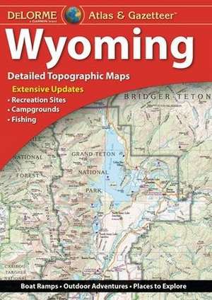
DELORME ATLAS & GAZETTEER
en Paperback – 26 sep 2017
Full-color topographic maps provide information on everything from cities and towns to historic sites, scenic drives, recreation areas, trailheads, boat ramps and prime fishing spots
Extensively indexed
Handy latitude/longitude overlay grid for each map allows you to navigate with GPS
Inset maps provided for Yellowstone National Park, major cities as well as all state lands
Dimensions: 15.5" x 11".
Preț: 132.96 lei
Nou
Puncte Express: 199
Preț estimativ în valută:
25.45€ • 26.77$ • 21.23£
25.45€ • 26.77$ • 21.23£
Carte disponibilă
Livrare economică 19 decembrie 24 - 02 ianuarie 25
Preluare comenzi: 021 569.72.76
Specificații
ISBN-13: 9781946494085
ISBN-10: 1946494089
Dimensiuni: 276 x 393 x 10 mm
Greutate: 0.41 kg
Editura: Delorme Mapping Company
ISBN-10: 1946494089
Dimensiuni: 276 x 393 x 10 mm
Greutate: 0.41 kg
Editura: Delorme Mapping Company
