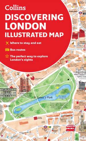
Discovering London Illustrated Map
Autor Collins Maps, Dominic Beddowen Limba Engleză Sheet map – 17 mar 2022
- Railway stations, bus routes, London underground map, taxi ranks and car parks
- Shop-by-shop street maps for Oxford Street, Bond Street, Covent Garden, Portobello Road, King's Road, Brompton Cross, Exmouth Market, Beauchamp Place, St. Christopher's Place and South Molton Street, Knightsbridge, Jermyn Street and Kensington
- London's theatres and cinemas
- Places to eat, internet cafs and good places for a picnic
- An inset map of the City of London
- Comprehensive index
- Historical and contemporary anecdotes
Preț: 26.53 lei
Preț vechi: 31.26 lei
-15% Nou
Puncte Express: 40
Preț estimativ în valută:
5.08€ • 5.23$ • 4.28£
5.08€ • 5.23$ • 4.28£
Indisponibil temporar
Doresc să fiu notificat când acest titlu va fi disponibil:
Se trimite...
Preluare comenzi: 021 569.72.76
Specificații
ISBN-13: 9780008492618
ISBN-10: 0008492611
Pagini: 2
Ilustrații: Illustrations, unspecified
Dimensiuni: 119 x 201 x 10 mm
Greutate: 0.07 kg
Editura: HarperCollins Publishers
ISBN-10: 0008492611
Pagini: 2
Ilustrații: Illustrations, unspecified
Dimensiuni: 119 x 201 x 10 mm
Greutate: 0.07 kg
Editura: HarperCollins Publishers
Descriere
A new edition of London's most original map. This hand-watercoloured map contains individual paintings of all the main sites and landmarks, shop-by-shop street maps, theatres and cinemas, comprehensive travel information and index. This detailed map of Central London is at a scale of 1:8,250 (7.5 inches to 1 mile).
