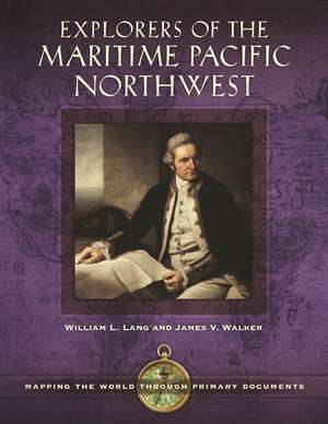
Explorers of the Maritime Pacific Northwest: Mapping the World through Primary Documents: Mapping the World through Primary Documents
Autor William L. Lang Ph.D., James V. Walkeren Limba Engleză Hardback – 8 mai 2016 – vârsta până la 17 ani
Preț: 505.18 lei
Preț vechi: 873.99 lei
-42% Nou
Puncte Express: 758
Preț estimativ în valută:
96.67€ • 101.18$ • 80.46£
96.67€ • 101.18$ • 80.46£
Carte tipărită la comandă
Livrare economică 31 martie-14 aprilie
Preluare comenzi: 021 569.72.76
Specificații
ISBN-13: 9781610699259
ISBN-10: 1610699254
Pagini: 336
Ilustrații: 15 bw illus
Dimensiuni: 216 x 279 x 19 mm
Greutate: 1.18 kg
Editura: Bloomsbury Publishing
Colecția ABC-CLIO
Seria Mapping the World through Primary Documents
Locul publicării:New York, United States
ISBN-10: 1610699254
Pagini: 336
Ilustrații: 15 bw illus
Dimensiuni: 216 x 279 x 19 mm
Greutate: 1.18 kg
Editura: Bloomsbury Publishing
Colecția ABC-CLIO
Seria Mapping the World through Primary Documents
Locul publicării:New York, United States
Caracteristici
Supports Common Core Standards relating to primary source analysis as well as National Geography Standards, including how to apply geography to interpret the past and understanding the processes, patterns, and functions of human settlement
Notă biografică
William L. Lang is professor emeritus of history at Portland State University and founding editor of The Oregon Encyclopedia.James V. Walker is a retired physician and map collector living in Eugene, OR, with research interests focusing on the Pacific Northwest and early 19th-century Trans-Mississippi West material.
Cuprins
PrefaceIntroductionSelected ChronologyChapter 1: Sebastián Vizcaíno, Expedition to California, 1602-16031. A Port for the Manila Galleon, 15852. Viceroy Conde de Monterrey's Sailing Orders, 16023. At the Port of Acapulco, 16024. Scurvy Interrupts the Voyage, 16035. Navigating with the Bolaños Derrotero, 16036. Rio de MartÍn Aguilar, 16037. Port of Monterey, 16038. California as an Island, 16259. Coastal Chart of the Vizcaíno Voyage, 1802Chapter 2: Vitus Bering and Aleksei Chirikov, Second Kamchatka Expedition, 1733-174310. Joseph Delisle Map, 173311. Orders from the Empress Anna, 173212. Imperial Ambitions, 1732, 173413. Reports from Kamchatka, 174214. Georg Stellar on Bering Island, 174315. Tragic Cost of Scurvy, 174116. Social Costs of Natives of Kamchatka, 174317. Joseph Delisle's Map of New Discoveries, 175218. Gerhard Müller's Attack on Delisle, 175419. The Russian Map, 1754Chapter 3: Juan Francisco de la Bodega y Quadra and Bruno de Hezeta, Second Bucareli Expedition, 177520. Defense of Empire, 175721. Viceroy Antonio Bucareli's Orders, 1775 (1773)22. Shipboard Conditions, 177523. Hazards of Navigation, 177524. Ceremonies of Possession, 177425. Bruno Hezeta's Map of the Columbia River, 177526. Ayala in San Francisco Bay, 177527. Human Cost and First Encounters, 177528. Bruno Hezeta's Coastal Map, 177529. Rare Publicized Reports, 1776, 1781Chapter 4: James Cook, First British Foray to the Northwest Coast, 177830. Secret Instructions from the Admiralty, 177631. On the Oregon Coast, 177832. Ship Repairs at Nootka Sound, 177833. Buying Nature at Nootka Sound, 177834. Native Art, 177835. Looking for the Northwest Passage, 177836. At the Bering Strait on the Edge of the Continent, 177837. Meeting the Russians, 177838. Death of Cook, 177939. Cook's Great Chart, 1784Chapter 5: Fur Traders, Commerce, and Cartography, 1785-179240. George Dixon's Discoveries in the Pacific Northwest, 178741. John Kendrick's Land Purchases, 179142. John Meares and the Nootka Sound Controversy, 179043. John Meares's Orders to Explore New Markets, 178844. A Conniving Letter to Joseph Banks, 178845. Alexander Dalrymple's Fur Trade Plan, 178946. Tragic Human Costs of Pursuing Furs, 178747. James Hanna's Conflict with Natives, 178548. John Meares's Map, 179049. Aaron Arrowsmith's Map of the Northwest Coast, 1790Chapter 6: Jean-François de Galaup, Comte de La Pérouse, Following Cook, 1785-178850. The King's Instructions, 178551. Sighting the Northwest Coast, 178652. Map of Port des Français, 179753. Lituya Bay Tragedy, 178654. The Tlingit Narrative of the Lituya Tragedy, 188655. Tlingit Trade Exchange, 178656. La Pérouse's Map of the Northwest Coast, 179757. Macao Trade Protocols, 178758. Uncertain Remedies for Scurvy, 1788Chapter 7: Alejandro Malaspina, Spanish Enlightenment on the Northwest Coast, 1788-179159. Malaspina's Plan for a Circumnavigation, 178860. In Search of the Strait of Anian, 178961. Malaspina and Bustamante at Acapulco, 179162. Strait of Anian Investigations, 179163. Port Mulgrave Map, 180264. With the Tlingit at Port Mulgrave, 179165. Speculations on the Peopling of America, 179166. A Plan of the Friendly Harbor, 180267. Malaspina at Nootka Sound, 179168. Malaspina and Political Tragedy, 1794-1803Chapter 8: George Vancouver, the Great Survey of the Northwest Coast, 1791-179569. Letter of Instruction to George Vancouver, 179170. First Contact with Northwest Natives, 179271. Near-Conflict in Puget Sound, 179272. Sounding and Surveying Puget Sound, 179273. Negotiating the Nootka Convention, 179274. Maquinna's Feast at Tahsis, 179275. Menzies at Friendly Cove, 179276. Broughton's Map of the Columbia River, 179877. Vancouver's Great Map of the Coast, 179878. The Public Humiliation of George Vancouver, 1795-1798Chapter 9: Robert Gray, First American Commercial Northwest Coast Voyages, 1787-179379. The Partners' Instructions for the First Voyage, 178780. Kendrick's Sailing Instructions, 178881. At Murderers Harbor, 178882. Gray Takes Command of the Columbia, 178983. The Partners' Instructions for the Second Voyage, 179084. At Clayoquot Sound, 179285. Conflict at Gray's Harbor, 179286. Gray on the Columbia River, 179287. Gray's Columbia River Sketch, May 1792Chapter 10: Dionisio Alcalá Galiano, Exploration of the Strait of Juan de Fuca, 179288. In Search of Spanish Dominion in the Strait of Juan de Fuca, 179289. Search for the Northwest Passage, 179290. Malaspina's and Revillagigedo's Orders to Galiano, 1791, 179291. Tetacus, Native of Vancouver Island, June 179292. Ship Manifests and Technology, 179293. The Importance to the Viceroy of Place-Names on Maps, 179394. Perils in the Strait of Juan de Fuca, July 179295. Exchange of Information between Galiano and Vancouver, June-July 179296. The Placement and Replacement of Place-Names, 179597. Coastal Map of Vizcaíno's Voyage, 1802Selected BibliographyIndex
Recenzii
This is a well-crafted book, written in a manner suitable for both a young novice student and a more seasoned researcher. The material offered is well-vetted. . . . This work is one that can prove valuable to any reference collection.
For students interested in maritime exploration, this book fills a void in the literature. Especially ideal for undergraduates, it can serve as an overview of maritime exploration in the northwest, and provides easy access to primary source documents. Summing Up: Recommended. High school, community college, and undergraduate students; general readers.
The editors have safely navigated through many shifting goals and taken careful bearings. Students assigned to examine particular chapters will have no difficulty in delving into the themes as presented, for the work is logical in form and clear in its treatment.
