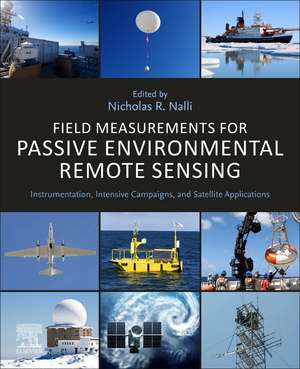
Field Measurements for Passive Environmental Remote Sensing: Instrumentation, Intensive Campaigns, and Satellite Applications
Editat de Nicholas R. Nallien Limba Engleză Paperback – 28 sep 2022
- Presents chapters organized according to subdiscipline, with each written by established experts in their relevant field
- Includes literature reviews, case studies and applications for each subdivision
- Features a synthesis of the suite of invaluable in situ measurements and techniques leveraged by the science of environmental remote sensing
Preț: 749.71 lei
Preț vechi: 974.93 lei
-23% Nou
Puncte Express: 1125
Preț estimativ în valută:
143.46€ • 150.16$ • 119.40£
143.46€ • 150.16$ • 119.40£
Carte tipărită la comandă
Livrare economică 24 martie-07 aprilie
Livrare express 22-28 februarie pentru 101.59 lei
Preluare comenzi: 021 569.72.76
Specificații
ISBN-13: 9780128239537
ISBN-10: 0128239530
Pagini: 458
Ilustrații: 300 illustrations (150 in full color)
Dimensiuni: 216 x 276 x 28 mm
Greutate: 1.04 kg
Editura: ELSEVIER SCIENCE
ISBN-10: 0128239530
Pagini: 458
Ilustrații: 300 illustrations (150 in full color)
Dimensiuni: 216 x 276 x 28 mm
Greutate: 1.04 kg
Editura: ELSEVIER SCIENCE
Public țintă
The principal readers of this book would include scientists at government agencies and labs (e.g., NOAA, NASA, NRL, EUMETSAT, JAXA, IMD, etc.), as well as professors/teachers at universities with departments in atmospheric, oceanic and remote sensing sciencesCuprins
1. Introduction: Field Measurements and Remote Sensing
Part I: Instrumentation
2. Balloon-Borne Radiosondes
3. Frost Point Hygrometers
4. Ozonesondes
5. Oceanographic buoys: providing ocean data to assess the accuracy of variables derived from satellite measurements
6. Surface-Based Thermal Infrared Spectrometers
7. Sun photometers
8. AirCore
Part II: Intensive Campaigns
9. High-Altitude Aircraft Radiometric Calibration-Validation Campaigns
10. Aircraft Dropsonde Campaigns
11. Ship-Based Cal/Val Campaigns
12. Land-Based Cal/Val Campaigns
13. Aircraft Vertical Profile Measurements for Evaluation of Satellite Retrievals of Long-Lived Trace Gases
14. Campaign Situational Awareness from Satellite Data
Part III: Satellite Applications
15. On-Orbit VIIRS Sensor Calibration and Validation in Reflective Solar Bands (RSB)
16. NOAA Products Validation System (NPROVS)
17. Satellite Microwave Sounder Product Retrieval Validation
18. Considerations for Satellite Infrared Sounder Applications
19. Sea Surface Temperature Validation and Blended Analysis
20. Satellite Ocean Color Validation
21. Land Surface Temperature Validation
22. Heterogeneity of Smoke from Fires: Evaluation of VIIRS Smoke Detection Using FIREX-AQ Field Campaign Data
23. Downburst Monitoring and Prediction Studies
