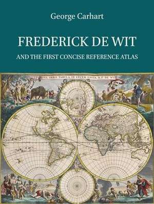
Frederick de Wit and the First Concise Reference Atlas: Explokart Studies in the History of Cartography, cartea 16
Autor George S. Carharten Limba Engleză Hardback – 21 feb 2016
De Amsterdamse onderneming van Frederick de Wit, genaamd 'De Witte Pascaert', bestond van 1654 tot 1710. De Wit handelde in allerlei soorten gedrukt werk en was een van de meest succesvolle uitgevers van kaarten en prenten in de tweede helft van de zeventiende eeuw.
De beschrijving van De Wits leven en werk wordt gevolgd door een cartobibliografie, die een grondige analyse en een datering van de atlassen en kaarten biedt die onder zijn naam werden uitgegeven.
Dr. George S. Carhart behaalde in 1998 een B.A. in geschiedenis aan de University of Southern Maine in de Verenigde Staten. Na zijn studie werkte hij als assistent-curator bij de Osher Map Library and Smith Center for Cartographic Education in Portland, Maine. In 2006 verliet hij dit instituut om zich meer te kunnen richten op zijn onderzoek, publicaties en lessen op het gebied van cartografische geschiedenis. In 2011 promoveerde hij aan de Universiteit van Passau in Duitsland op Frederick de Wit. Sindsdien heeft hij aan projecten voor verschillende universiteiten gewerkt, waaronder de Technische Unievrsiteit Dresden University en Trinity College Dublin.
Preț: 753.60 lei
Preț vechi: 919.02 lei
-18% Nou
Puncte Express: 1130
Preț estimativ în valută:
144.20€ • 150.56$ • 119.34£
144.20€ • 150.56$ • 119.34£
Carte indisponibilă temporar
Doresc să fiu notificat când acest titlu va fi disponibil:
Se trimite...
Preluare comenzi: 021 569.72.76
Specificații
ISBN-13: 9789004299030
ISBN-10: 9004299033
Dimensiuni: 240 x 315 x 41 mm
Greutate: 3.33 kg
Editura: Brill
Colecția Brill
Seria Explokart Studies in the History of Cartography
ISBN-10: 9004299033
Dimensiuni: 240 x 315 x 41 mm
Greutate: 3.33 kg
Editura: Brill
Colecția Brill
Seria Explokart Studies in the History of Cartography
Descriere
This book is about the life and work of Frederick de Wit (1629-1706), one of the most famous dealers of maps, prints and art during the Dutch Golden Age, and his contribution to the dissemination of the knowledge of cartography. The Amsterdam firm of Frederick de Wit operated under the name “De Witte Pascaert” (The White Chart) from 1654 to 1710. It offered all kinds of printing and was one of the most successful publishers of maps and prints in the second half of the seventeenth century. The description of De Wit’s life and work is followed by an in-depth analysis and dating of the atlases and maps issued under his name.
Cuprins
Acknowledgments
Introduction
1. Frederick de Wit’s biography and his business
1.1 How many ‘Frederick de Wits’
1.2 Johann Gottfried Gregorii (1685-1770)
1.3 Bagrow, Koeman, Van Eeghen and Werner
1.4 A new understanding of De Wit
Tracing Frederick de Wit’s origins
Father and Mother
Why has De Wit been considered to be Catholic?
Hendrick Fredericksz. de Wit’s social standing in Gouda
Education
1.5 De Wit moves to Amsterdam
Why Frederick Hendricksz changed his name to Frederick de Wit
De Wit’s early work
De Drie Crabben 1653-1655
De Witte Pascaert 1655-1710
The St. Lucas guild and De Wit’s membership
De Wit’s real estate ventures
De Wit’s marriage and children
De Wit’s social standing in Amsterdam
1.6 De Wit and the art and print trade
Engraver? Printer? Author? Publisher?
De Wit’s interaction with the engravers and printers in Amsterdam
De Wit’s business contacts outside the Netherlands
De Wit’s interest in current events or topics as shown by his topical prints and maps
De Wit’s trade in cartographic material and art prints from other publishers
1.7 De Wit’s death and Maria’s stewardship of the firm 1706-1710
1.8 1710 the firm is auctioned off
1.9 Conclusion
2. The first modern world atlas
2.1 Defining an atlas
The simple Concise Reference Atlas and complex Encyclopaedic Reference Atlas
The ‘Collector’s Composite Atlas’ and the ‘Map Sellers Composite Atlas’
2.2 Origins of the atlas
The early atlas
The Netherlands and the first modern Encyclopaedic Atlas
The production of a modern encyclopaedic atlas outside the Netherlands
2.3 Longevity of the first modern atlases
Gerard and Rumoldus Mercator
Cornelis Claesz., Jodocus and Henricus Hondius and Johannes Janssonius.
Competition from Willem Jansz. Blaeu
2.4 The Decline? or Success? of the Dutch hegemony of the map and atlas publishing market in the seventeenth and eighteenth century Europe
French control of the European commercial map and atlas market in the last half of the seventeenth century?
English and German expansion into the commercial map and atlas market of the seventeenth and eighteenth century?
2.5 Pocket atlases
2.6 Conclusion
3. Frederick de Wit’s new Concise Reference Atlas
3.1 A need for an inexpensive and small folio atlas
3.2 De Wit’s first atlases
3.3 Publisher’s or composite atlas
3.4 Who was first? Other contemporary atlas authors and publishers
Nicolaes Visscher
Danckerts
Janssonius Heirs
Nicolas Sanson
3.5 Conclusion
4. Today’s bibliographic methods collide with printing and publishing methods of the early modern world 1577-1800
4.1 Identifying and dating antiquarian maps
Modern Cartobibliographies
Understanding the limitations of the older cartobibliographies
4.2 Shop versus library binding and modern printing and binding practices
Atlas compilation and content
The time aspects of map compilation and intaglio or copper plate engraving
Time management of intaglio printing
Time to print the maps and text for one atlas
Shop binding
‘Sold separately’
4.3 Commercial interaction between the map makers of the seventeenth century
Map acquisition
Reprinting of old plates and edits made to them
The significance of having receiving a privilege to print maps
4.4 Conclusion
5. Dating de Wit’s maps and atlases
5.1 Methodology
5.2 Problems with the old cartobibliographies of De Wit’s maps
5.3 New dates for De Wit’s maps and atlases
De Wit’s 1654 sea atlas
De Wit’s first World atlas
De Wit’s Seventeen Provinces atlas
De Wit’s new maps
De Wit expands his small atlas
Janssonius and Blaeu maps as tools for dating De Wit’s atlases
1660 to 1686 and 1686 to 1721
New dates for De Wit’s atlases
Atlas dating through the printed map indexes
5.4 Deluxe maps on silk
5.5 Identifying loose sheet maps by the Janssonius and Blaeu firms that were bound in De Wit’s atlases
5.6 De Wit’s wall maps
De Wit’s elusive world and continental maps
When did De Wit first publish his continental wall maps: 1662 or 1672?
5.7 Special order topographic maps and plans produced by De Wit
5.8 De Wit’s city plans and views
5.9 Conclusion
6. De Wit’s legacy
6.1 Longevity of the De Wit name
De Wit’s charts, an exception to the rule
6.2 The use and abuse of his name
Copying in the Netherlands of De Wit’s work
Copying outside the Netherlands
6.3 The importance of De Wit’s cartographic works to the late seventeenth and eighteenth century scholarly world
6.4 Who owned De Wit’s atlases
6.5 Conclusion
7. The cartographic origins of De Wit’s maps
7.1 Map compilation in the sixteenth and seventeenth centuries
7.2 De Wit, cartographer or copyist
7.3 Source maps of a number of De Wit’s maps
7.4 Conclusion
8. Final Conclusion
The Atlases
Overview of the atlases published by De Wit
Cartobibliography
Cartobibliography of maps in De Wit’s atlases
Cataloguing code for maps in De Wit’s atlases
1. De Wit’s atlas maps
2. Plates purchased and edited by De Wit
3. Janssonius maps that De Wit used in his atlases
4. Blaeu maps that De Wit used in his atlases
5. Visscher maps that De Wit used in his atlases
6. Maps from other firms that De Wit used in his atlases
7. De Wit’s Charts
List of consulted Libraries
Acknowledgement of the illustrations
Samenvatting in het Nederlands
Bibliography
Index
Notă biografică
After a career in yacht, boat and historic building restoration and a stint in the army, Dr. Carhart began his second career in academia with a BA in history from the University of Southern Maine. The history of cartography has been a central point of his interests. After receiving his BA in 1998 he joined the staff at the Osher Map Library and Smith Center for Cartographic Education, working there as the assistant curator. After leaving the Osher Map Library in 2006 to complete his doctoral work he has continued to research, publish and teach in the field of cartographic history. Since receiving his Ph.D. from the University of Passau in 2011, he has worked on projects at several universities including Dresden University of Technology and Trinity College Dublin.
Recenzii
'The book is beautifully illustrated throughout with a plethora of color illustrations of maps, prints, archival records and portions of maps that are ably used to support the author’s main themes and thesis. [...] In sum, the book provides detailed support for its propositions and is an invaluable resource for academic researchers, map dealers, and map aficionados whom have a strong interest in the work of Frederick De Wit and 17th century Dutch cartography.'
Edward Kirsch, in: The Portolan Winter 2017, p. 78-79.
'The introductory chapters are followed by the exhaustive carto-bibliography of the maps and atlases, which is the principal part of the work. Carhart deserves all praise for this achievement: the bibliography is accurate, complete and compiled with great determination. The hundreds of colour pictures are sharp and many details are highlighted. Beautiful examples of the seventeenth-century Dutch art of engraving and typography can be admired!'
Marco van Egmond (Utrecht University Library), in: Imago Mundi 69:2 2017, p. 258-259.
http://dx.doi.org/10.1080/03085694.2017.1312126