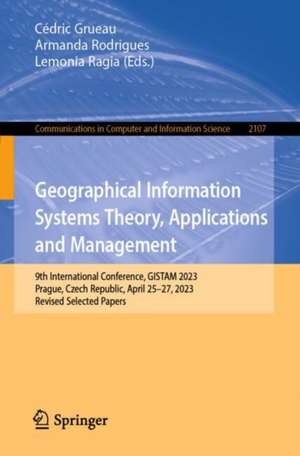
Geographical Information Systems Theory, Applications and Management: 9th International Conference, GISTAM 2023, Prague, Czech Republic, April 25–27, 2023, Revised Selected Papers: Communications in Computer and Information Science, cartea 2107
Editat de Cédric Grueau, Armanda Rodrigues, Lemonia Ragiaen Limba Engleză Paperback – mai 2024
The 6 full papers included in this book were carefully reviewed and selected from 37 submissions. They focus on challenges in geo-spatial data sensing, observation, representation, processing, visualization, sharing and managing, in all aspects concerning both information communication and technologies (ICT) as well as management information systems and knowledge-based systems.
Din seria Communications in Computer and Information Science
- 20%
 Preț: 325.48 lei
 - 20%
 Preț: 669.06 lei
 - 20%
 Preț: 324.64 lei
 - 20%
 Preț: 337.85 lei
 - 20%
 Preț: 656.19 lei
 - 20%
 Preț: 659.97 lei
 - 20%
 Preț: 333.88 lei
 - 20%
 Preț: 337.52 lei
 - 20%
 Preț: 656.36 lei
 - 20%
 Preț: 656.69 lei
 - 20%
 Preț: 659.31 lei
 -
 Preț: 392.60 lei
 - 20%
 Preț: 329.58 lei
 -
 Preț: 386.00 lei
 - 20%
 Preț: 336.02 lei
 - 20%
 Preț: 334.53 lei
 - 20%
 Preț: 331.74 lei
 - 20%
 Preț: 655.85 lei
 - 20%
 Preț: 338.49 lei
 - 20%
 Preț: 333.88 lei
 - 20%
 Preț: 334.53 lei
 - 20%
 Preț: 338.68 lei
 - 20%
 Preț: 666.58 lei
 - 20%
 Preț: 307.20 lei
 - 20%
 Preț: 336.02 lei
 - 20%
 Preț: 338.68 lei
 - 20%
 Preț: 330.24 lei
 - 20%
 Preț: 660.81 lei
 - 15%
 Preț: 648.42 lei
 - 20%
 Preț: 653.56 lei
 - 20%
 Preț: 332.06 lei
 - 20%
 Preț: 337.85 lei
 - 20%
 Preț: 1055.29 lei
 - 20%
 Preț: 836.50 lei
 - 20%
 Preț: 656.69 lei
 - 20%
 Preț: 1231.01 lei
 - 20%
 Preț: 331.25 lei
 - 20%
 Preț: 336.02 lei
 - 20%
 Preț: 323.00 lei
 - 20%
 Preț: 113.94 lei
 - 20%
 Preț: 336.21 lei
 -
 Preț: 387.75 lei
 - 20%
 Preț: 470.58 lei
 - 20%
 Preț: 750.86 lei
 - 20%
 Preț: 337.00 lei
 - 20%
 Preț: 327.95 lei
 - 20%
 Preț: 410.03 lei
 - 20%
 Preț: 335.36 lei
 - 20%
 Preț: 534.59 lei
 - 20%
 Preț: 673.02 lei
Preț: 641.20 lei
Preț vechi: 801.51 lei
-20% Nou
Puncte Express: 962
Preț estimativ în valută:
122.69€ • 128.10$ • 101.54£
122.69€ • 128.10$ • 101.54£
Carte tipărită la comandă
Livrare economică 04-18 aprilie
Preluare comenzi: 021 569.72.76
Specificații
ISBN-13: 9783031602764
ISBN-10: 3031602765
Ilustrații: IX, 115 p. 59 illus., 47 illus. in color.
Dimensiuni: 155 x 235 mm
Ediția:2024
Editura: Springer Nature Switzerland
Colecția Springer
Seria Communications in Computer and Information Science
Locul publicării:Cham, Switzerland
ISBN-10: 3031602765
Ilustrații: IX, 115 p. 59 illus., 47 illus. in color.
Dimensiuni: 155 x 235 mm
Ediția:2024
Editura: Springer Nature Switzerland
Colecția Springer
Seria Communications in Computer and Information Science
Locul publicării:Cham, Switzerland
Cuprins
.- U-Nets and MultispectralI mages for Detecting the Surface Water of Rivers via SAR Images.
.- A Combination of Geomatic Techniques for Modelling the Urban Environment in Virtual Reality.
.- Dynamic Real-time Spatio-Temporal Acquisition and Rendering in Adverse Environments.
.- Approaches for Addressing Spatial Connectivity of Final Harvests within Forest Harvest Scheduling Algorithms.
.- An Open-Source Model for Estimating the Need to Expansion in Local Charging Infrastructures.
.- Emergency Management and Response through 3D Maps and Novel Geo-Information Sources.
