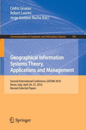
Geographical Information Systems Theory, Applications and Management: Second International Conference, GISTAM 2016, Rome, Italy, April 26-27, 2016, Revised Selected Papers: Communications in Computer and Information Science, cartea 741
Editat de Cédric Grueau, Robert Laurini, Jorge Gustavo Rochaen Limba Engleză Paperback – 9 iul 2017
Din seria Communications in Computer and Information Science
- 20%
 Preț: 325.48 lei
 - 20%
 Preț: 669.06 lei
 - 20%
 Preț: 324.64 lei
 - 20%
 Preț: 337.85 lei
 - 20%
 Preț: 656.19 lei
 - 20%
 Preț: 659.97 lei
 - 20%
 Preț: 333.88 lei
 - 20%
 Preț: 337.52 lei
 - 20%
 Preț: 656.36 lei
 - 20%
 Preț: 656.69 lei
 - 20%
 Preț: 659.31 lei
 -
 Preț: 392.60 lei
 - 20%
 Preț: 329.58 lei
 -
 Preț: 386.00 lei
 - 20%
 Preț: 336.02 lei
 - 20%
 Preț: 334.53 lei
 - 20%
 Preț: 331.74 lei
 - 20%
 Preț: 655.85 lei
 - 20%
 Preț: 338.49 lei
 - 20%
 Preț: 333.88 lei
 - 20%
 Preț: 334.53 lei
 - 20%
 Preț: 338.68 lei
 - 20%
 Preț: 666.58 lei
 - 20%
 Preț: 307.20 lei
 - 20%
 Preț: 336.02 lei
 - 20%
 Preț: 338.68 lei
 - 20%
 Preț: 330.24 lei
 - 20%
 Preț: 660.81 lei
 - 15%
 Preț: 648.42 lei
 - 20%
 Preț: 653.56 lei
 - 20%
 Preț: 332.06 lei
 - 20%
 Preț: 337.85 lei
 - 20%
 Preț: 1055.29 lei
 - 20%
 Preț: 836.50 lei
 - 20%
 Preț: 656.69 lei
 - 20%
 Preț: 1231.01 lei
 - 20%
 Preț: 331.25 lei
 - 20%
 Preț: 336.02 lei
 - 20%
 Preț: 323.00 lei
 - 20%
 Preț: 113.94 lei
 - 20%
 Preț: 336.21 lei
 -
 Preț: 387.75 lei
 - 20%
 Preț: 470.58 lei
 - 20%
 Preț: 750.86 lei
 - 20%
 Preț: 337.00 lei
 - 20%
 Preț: 327.95 lei
 - 20%
 Preț: 410.03 lei
 - 20%
 Preț: 335.36 lei
 - 20%
 Preț: 534.59 lei
 - 20%
 Preț: 673.02 lei
Preț: 327.29 lei
Preț vechi: 409.11 lei
-20% Nou
Puncte Express: 491
Preț estimativ în valută:
62.66€ • 65.38$ • 52.52£
62.66€ • 65.38$ • 52.52£
Carte tipărită la comandă
Livrare economică 13-27 martie
Preluare comenzi: 021 569.72.76
Specificații
ISBN-13: 9783319626178
ISBN-10: 3319626175
Pagini: 171
Ilustrații: IX, 181 p. 88 illus.
Dimensiuni: 155 x 235 mm
Greutate: 0.28 kg
Ediția:1st ed. 2017
Editura: Springer International Publishing
Colecția Springer
Seria Communications in Computer and Information Science
Locul publicării:Cham, Switzerland
ISBN-10: 3319626175
Pagini: 171
Ilustrații: IX, 181 p. 88 illus.
Dimensiuni: 155 x 235 mm
Greutate: 0.28 kg
Ediția:1st ed. 2017
Editura: Springer International Publishing
Colecția Springer
Seria Communications in Computer and Information Science
Locul publicării:Cham, Switzerland
Cuprins
Fast Displacements Detection Techniques Considering Mass-Market GPS L1 Receivers.- Integrating a Metadata Editor with Hyperbolic Tree to Improve Data Access in Spatial Data Infrastructures.- CIAO-WPS - Utilizing Semantic Web (Web 3.0) Techniques to Assist in the Automatic Orchestration of Geospatial Processes And Datasets.- Investigation of Geospatially Enabled, Social Media Generated Structure Occupancy Curves in Commercial Structures.- Event Categorization and Key Prospect Identification from Storylines.- Automated Walkable Area Segmentation from Aerial Images for Evacuation Simulation.- Information System for Automated Multicriterial Analytical Control of Geomagnetic Field and Space Weather Parameters.- SWRL Rule Development to Automate Spatial Transactions in Government.- A Spatial Ontology for Architectural Heritage Information.- The Software Design of an Intelligent Water Pump.
Caracteristici
Includes supplementary material: sn.pub/extras
