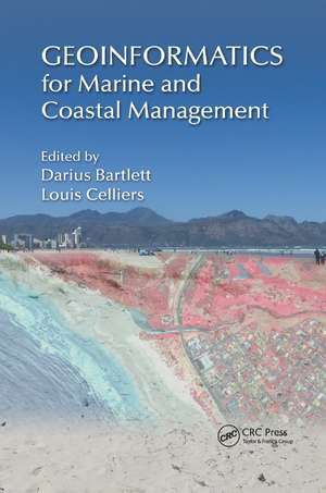
Geoinformatics for Marine and Coastal Management
Editat de Darius Bartlett, Louis Celliersen Limba Engleză Paperback – 12 dec 2019
Preț: 506.48 lei
Preț vechi: 595.85 lei
-15% Nou
Puncte Express: 760
Preț estimativ în valută:
96.93€ • 105.25$ • 81.42£
96.93€ • 105.25$ • 81.42£
Carte tipărită la comandă
Livrare economică 22 aprilie-06 mai
Preluare comenzi: 021 569.72.76
Specificații
ISBN-13: 9780367873684
ISBN-10: 0367873680
Pagini: 444
Dimensiuni: 156 x 234 x 23 mm
Greutate: 0.62 kg
Ediția:1
Editura: CRC Press
Colecția CRC Press
ISBN-10: 0367873680
Pagini: 444
Dimensiuni: 156 x 234 x 23 mm
Greutate: 0.62 kg
Ediția:1
Editura: CRC Press
Colecția CRC Press
Public țintă
Professional Practice & DevelopmentCuprins
Foreword. Preface. Editors. Contributors. Geoinformatics for Applied Coastal and Marine Management. Mapping the Seabed. A GIS-Based Application of Drainage Basin Analysis and Geomorphometry in the Submarine Environment: The Gollum Canyon System, Northeast Atlantic. Recent Developments in Remote Sensing for Coastal and Marine Applications. Current and Future Information and Communication Technology (ICT) Trends in Coastal and Marine Management. Ontologies and Their Contribution to Marine and Coastal Geoinformatics Interoperability. Applied Marine Management with Volunteered Geographic Information. Geoinformatic Applications in Marine Management. Navigating a Sea of Data: Geoinformatics for Law Enforcement at Sea. Geospatial Technologies and Indigenous Knowledge Systems. Spatial Information and Ecosystem-Based Management in the Marine Arctic. Geospatial Technologies for Siting Coastal and Marine Renewable Infrastructures. Geoinformatics for Fisheries Management. Geoinformatics in Hydrography and Marine Navigation. The Use of Geoinformatics by the Irish Naval Service in Maritime Emergency and Security Response. Spatial Analysis for Coastal Vulnerability Assessment. Index.
Notă biografică
Darius Bartlett is an earth scientist and geomorphologist by training, has been teaching and researching at the interface between GIS and coastal zone science and management in the Department of Geography at the University College Cork in Ireland for over a quarter-century, and is a past director of the department’s MSc in GIS and remote sensing and the MSc in applied coastal and marine management taught programs. As a corresponding member of the Commission on Coastal Systems of the International Geographical Union, he helped establish the CoastGIS Biennial Symposium Series, in partnership with Ron Furness (then at the Australian Hydrographic Office and chair of the International Cartographic Association’s Commission on Coastal Mapping), and hosted the first meeting as a collaboration between the two organisations in Cork in 1995 (the 12th meeting in the series was held in Cape Town in April 2015). He is the co-editor of Marine and Coastal Geographical Information Systems (with Dawn Wright, Taylor & Francis, 2000) and GIS for Coastal Zone Management (with Jennifer Smith, CRC Press, 2005).
Louis Celliers is employed by the CSIR in a dual role as a principal researcher in, and heads up the Coastal Systems Research Group of the Natural Resources and the Environment Business Unit. He completed his graduate (BSc Agric) and postgraduate studies (MSc Agric) at the University of Pretoria in 1998, followed by his PhD in marine ecology at the University of Natal, South Africa in 2001. The responsibilities of his portfolio include the integration of coastal and marine science with management of the coastal area by the three spheres of government in South Africa. His research interests and profes- sional development strongly favour an approach that guides, integrates and translates good science to the benefit of society through the maintenance of natural systems. His main research interests, and focus of his published work, are in the area
Louis Celliers is employed by the CSIR in a dual role as a principal researcher in, and heads up the Coastal Systems Research Group of the Natural Resources and the Environment Business Unit. He completed his graduate (BSc Agric) and postgraduate studies (MSc Agric) at the University of Pretoria in 1998, followed by his PhD in marine ecology at the University of Natal, South Africa in 2001. The responsibilities of his portfolio include the integration of coastal and marine science with management of the coastal area by the three spheres of government in South Africa. His research interests and profes- sional development strongly favour an approach that guides, integrates and translates good science to the benefit of society through the maintenance of natural systems. His main research interests, and focus of his published work, are in the area
Recenzii
"Particular strength of this volume is the ability to demonstrate how the new data and technologies serve the governance and decision-making. As such the book becomes a revealing journey on the boundaries – between land and sea, information technologies and management, remote sensing and crowdsourcing, and still remains relevant to practical needs of fisheries, energy, emergency rescue, law enforcement, hydrography, or vulnerability assessment – serving the overall goal of advancing ecosystem-based management approach."
—Andrus Meiner, European Environment Agency, Copenhagen, Denmark
"This book is an excellent vision into the geotemporal nature and challenge of marine and coastal systems. The variety of technical, scientific, and management issues are confronted in Geographical Information Science terms and illuminated by instructive examples. And, rather than a litany of individual cases, the chapters portray the integrative character of the marine and coastal environment and the opportunities to apply innovative approaches as well as to use the products of our increasing database in this mileau."
— Norbert P. Psuty, Rutgers University, Sandy Hook, New Jersey, USA
"This book is a must read for students who want an overview of the range of issues to be considered in coastal management and how geoinformatic tools contribute to such management. The book is also very relevant for those active in the field who require to be updated on the latest developments and trends in relation to how we manage our coasts and oceans."
— Ned Dwyer, EurOcean - the European Centre for Information on Marine Science and Technology, Lisbon, Portugal
"Geoinformatics for Marine and Coastal Management presents an insightful and skilful interweaving of the old with the new, of the familiar with the frontier (e.g., GIS expanded to ICT and geoinformatics). There is also a fluid interweaving of academic, government, NGO, and industry perspectives. The
Descriere
This book provides a timely and valuable assessment of the current state of the art geoinformatics tools and methods for the management of marine systems. This book focuses on the cutting-edge coverage of a wide spectrum of activities and topics such as GIS-based application of drainage basin analysis, contribution of ontology to marine manageme
