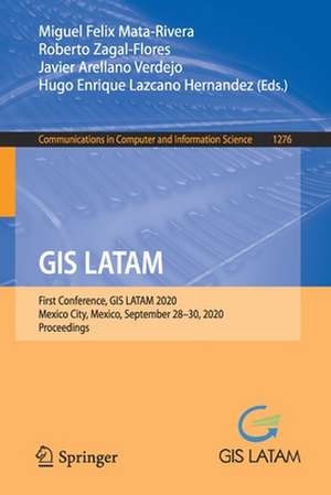
GIS LATAM: First Conference, GIS LATAM 2020, Mexico City, Mexico, September 28–30, 2020, Proceedings: Communications in Computer and Information Science, cartea 1276
Editat de Miguel Felix Mata-Rivera, Roberto Zagal-Flores, Javier Arellano Verdejo, Hugo Enrique Lazcano Hernandezen Limba Engleză Paperback – 21 sep 2020
The 9 full papers and 2 short papers were thoroughly reviewed and selected from 29 submissions. The papers are focused on the GIS applications in data analytics in spheres of health, environment, government, public, and education.
Din seria Communications in Computer and Information Science
- 20%
 Preț: 325.48 lei
 - 20%
 Preț: 669.06 lei
 - 20%
 Preț: 324.64 lei
 - 20%
 Preț: 337.85 lei
 - 20%
 Preț: 656.19 lei
 - 20%
 Preț: 659.97 lei
 - 20%
 Preț: 333.88 lei
 - 20%
 Preț: 337.52 lei
 - 20%
 Preț: 656.36 lei
 - 20%
 Preț: 656.69 lei
 - 20%
 Preț: 659.31 lei
 -
 Preț: 392.60 lei
 - 20%
 Preț: 329.58 lei
 -
 Preț: 386.00 lei
 - 20%
 Preț: 336.02 lei
 - 20%
 Preț: 334.53 lei
 - 20%
 Preț: 331.74 lei
 - 20%
 Preț: 655.85 lei
 - 20%
 Preț: 338.49 lei
 - 20%
 Preț: 333.88 lei
 - 20%
 Preț: 334.53 lei
 - 20%
 Preț: 338.68 lei
 - 20%
 Preț: 666.58 lei
 - 20%
 Preț: 307.21 lei
 - 20%
 Preț: 336.02 lei
 - 20%
 Preț: 338.68 lei
 - 20%
 Preț: 330.24 lei
 - 20%
 Preț: 660.81 lei
 - 15%
 Preț: 648.42 lei
 - 20%
 Preț: 653.56 lei
 - 20%
 Preț: 332.06 lei
 - 20%
 Preț: 337.85 lei
 - 20%
 Preț: 1055.29 lei
 - 20%
 Preț: 836.50 lei
 - 20%
 Preț: 656.69 lei
 - 20%
 Preț: 1231.01 lei
 - 20%
 Preț: 331.25 lei
 - 20%
 Preț: 336.02 lei
 - 20%
 Preț: 323.00 lei
 - 20%
 Preț: 113.94 lei
 - 20%
 Preț: 336.21 lei
 -
 Preț: 387.75 lei
 - 20%
 Preț: 470.59 lei
 - 20%
 Preț: 750.86 lei
 - 20%
 Preț: 337.00 lei
 - 20%
 Preț: 327.95 lei
 - 20%
 Preț: 410.03 lei
 - 20%
 Preț: 335.36 lei
 - 20%
 Preț: 534.59 lei
 - 20%
 Preț: 673.02 lei
Preț: 326.28 lei
Preț vechi: 407.85 lei
-20% Nou
Puncte Express: 489
Preț estimativ în valută:
62.44€ • 64.95$ • 51.55£
62.44€ • 64.95$ • 51.55£
Carte tipărită la comandă
Livrare economică 15-29 aprilie
Preluare comenzi: 021 569.72.76
Specificații
ISBN-13: 9783030598716
ISBN-10: 3030598713
Pagini: 161
Ilustrații: X, 161 p. 87 illus., 74 illus. in color.
Dimensiuni: 155 x 235 mm
Greutate: 0.25 kg
Ediția:1st ed. 2020
Editura: Springer International Publishing
Colecția Springer
Seria Communications in Computer and Information Science
Locul publicării:Cham, Switzerland
Cuprins
Vulnerability assessing contagion risk of Covid-19 using Geographic Information Systems (GIS) and Multi-Criteria Decision Analysis (MCDA): Case study Chetumal, México.- Land subsidence in Villahermosa Tabasco Mexico, using Radar Interferometry.- A proposal for semantic integration of crime data in Mexico City.- Crowdsourcing for Sargassum monitoring along of the Quintana Roo beaches.- The Air Quality and the relationship with the community birds from the Sierra de Guadalupe.- Swift UI and their integration to Mapkit technology as a framework for representing spatial information in mobile applications.- Forecasting the influx of people on Metrobus line 1 using a fractal analysis.- Mapping biogas from municipal waste, as potential clean energy areas in central Mexico, using Geographic Information Systems.- Geographic Information Systems for Forest Species Distribution and Habitat Suitability.- Index of Coastal Urban Resilience (ICURHF) when copingwith Hurricanes and Floods in the City of Chetumal, in the south east of Mexico.- Grouping mixed documents: Mexico job offers case study.
