Cantitate/Preț
Produs

Global Navigation Satellite Systems: Signal, Theory & Applications

Autor Gustaf Kron
en Limba Engleză Hardback – 16 feb 2017
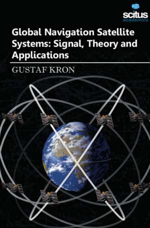
A satellite navigation is a system of satellites that provide autonomous geospatial positioning with global coverage. It allows small electronic receivers to determine their location to high precision (within a few meters) using time signals transmitted along a line of sight by radio from satellites. The signals also allow the electronic receivers to calculate the current local time to high precision, which allows time synchronization. A satellite navigation system with global coverage may be termed a Global Navigation Satellite System (GNSS). GNSS is a satellite system that is used to pinpoint the geographic location of a user's receiver anywhere in the world. GNSS receivers, using the GPS, GLONASS, Galileo or Beidou system, are used in many applications. Automobiles can be equipped with GNSS receivers at the factory or as aftermarket equipment. Units often display moving maps and information about location, speed, direction, and nearby streets and points of interest. Air navigation systems usually have a moving map display and are often connected to the autopilot for en-route navigation. Boats and ships can use GNSS to navigate all of the world's lakes, seas and oceans. Maritime GNSS units include functions useful on water, such as "man overboard" (MOB) functions that allow instantly marking the location where a person has fallen overboard, which simplifies rescue efforts. Heavy equipment can use GNSS in construction, mining and precision agriculture. The blades and buckets of construction equipment are controlled automatically in GNSS-based machine guidance systems. Agricultural equipment may use GNSS to steer automatically, or as a visual aid displayed on a screen for the driver. Hikers, climbers, and even ordinary pedestrians in urban or rural environments can use GNSS to determine their position, with or without reference to separate maps. Spacecraft are beginning to use GNSS as a navigational tool. The addition of a GNSS receiver to a spacecraft allows precise orbit determination without ground tracking. This, in turn, enables autonomous spacecraft navigation, formation flying, and autonomous rendezvous. GNSS plays a key role in high precision navigation, positioning, timing, and scientific questions related to precise positioning. This is an extremely precise, continuous, all-weather, and real-time technique. The book entitled Global Navigation Satellite Systems: Signal, Theory and Applications is intended to presenting recent results and developments in GNSS theory, system, signal, receiver, method, and errors sources, such as multipath effects and atmospheric delays. This book is of a valuable tool for GNSS designers, engineers, and scientists, along with the user market.
Citește tot Restrânge

Preț: 90681 lei

Preț vechi: 110587 lei
-18% Nou

Puncte Express: 1360

Preț estimativ în valută:
17353 18251$ 14499£

Carte indisponibilă temporar

Doresc să fiu notificat când acest titlu va fi disponibil:

Preluare comenzi: 021 569.72.76

Specificații

ISBN-13: 9781681174129
ISBN-10: 168117412X
Pagini: 330
Dimensiuni: 155 x 230 mm
Greutate: 0 kg
Editura: Scitus Academics LLC
Colecția Scitus Academics LLC