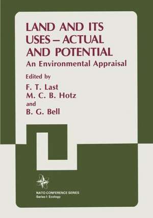
Land and its Uses — Actual and Potential: An Environmental Appraisal: Nato Conference Series, cartea 10
Autor F. T. Last, M. C. B. Hotz, B. G. Bellen Limba Engleză Paperback – oct 2011
Din seria Nato Conference Series
- 5%
 Preț: 389.56 lei
 - 15%
 Preț: 705.99 lei
 - 15%
 Preț: 661.32 lei
 -
 Preț: 389.49 lei
 -
 Preț: 412.95 lei
 - 18%
 Preț: 1241.42 lei
 -
 Preț: 389.70 lei
 -
 Preț: 409.69 lei
 - 20%
 Preț: 585.72 lei
 -
 Preț: 412.57 lei
 -
 Preț: 396.78 lei
 -
 Preț: 399.12 lei
 -
 Preț: 397.97 lei
 -
 Preț: 396.62 lei
 -
 Preț: 390.08 lei
 - 5%
 Preț: 378.07 lei
 - 18%
 Preț: 1235.57 lei
 - 15%
 Preț: 495.26 lei
 -
 Preț: 392.37 lei
 -
 Preț: 413.15 lei
 -
 Preț: 404.67 lei
 -
 Preț: 396.40 lei
 - 15%
 Preț: 662.16 lei
 - 5%
 Preț: 722.69 lei
 - 15%
 Preț: 666.41 lei
 -
 Preț: 382.75 lei
 - 18%
 Preț: 822.01 lei
 -
 Preț: 401.57 lei
 -
 Preț: 403.91 lei
 -
 Preț: 404.67 lei
 -
 Preț: 403.15 lei
 -
 Preț: 411.42 lei
 -
 Preț: 440.71 lei
 -
 Preț: 408.63 lei
 - 15%
 Preț: 647.27 lei
 -
 Preț: 393.74 lei
 -
 Preț: 392.97 lei
 - 18%
 Preț: 1234.62 lei
 -
 Preț: 412.95 lei
 -
 Preț: 390.46 lei
 -
 Preț: 405.66 lei
 - 15%
 Preț: 667.54 lei
 - 18%
 Preț: 1242.03 lei
 - 18%
 Preț: 1225.62 lei
 - 15%
 Preț: 679.00 lei
 -
 Preț: 401.03 lei
 -
 Preț: 399.12 lei
 -
 Preț: 413.15 lei
Preț: 415.29 lei
Nou
Puncte Express: 623
Preț estimativ în valută:
79.47€ • 82.47$ • 66.43£
79.47€ • 82.47$ • 66.43£
Carte tipărită la comandă
Livrare economică 17-31 martie
Preluare comenzi: 021 569.72.76
Specificații
ISBN-13: 9781461292784
ISBN-10: 1461292786
Pagini: 616
Ilustrații: 610 p.
Dimensiuni: 178 x 254 x 32 mm
Greutate: 1.06 kg
Ediția:Softcover reprint of the original 1st ed. 1986
Editura: Springer Us
Colecția Springer
Seriile Nato Conference Series, I Ecology
Locul publicării:New York, NY, United States
ISBN-10: 1461292786
Pagini: 616
Ilustrații: 610 p.
Dimensiuni: 178 x 254 x 32 mm
Greutate: 1.06 kg
Ediția:Softcover reprint of the original 1st ed. 1986
Editura: Springer Us
Colecția Springer
Seriile Nato Conference Series, I Ecology
Locul publicării:New York, NY, United States
Public țintă
ResearchCuprins
A. Identification of Ecological Factors Characterising the Range of Terrestrial Habitats.- i Urban.- 1 Planning and the Physical Environment.- 2 Planned Urban Unit Development: A Case Study Louvain-La-Neuve.- 3 Fragmentation of Land-Rural and Urban: A Major Problem of South European Mediterrean Countries.- Commentary: Urban Planning.- ii Rural.- a Geology.- 4 Geology and Land-Use: The Production of ‘Environmentally’ Orientated Maps for Decision-Makers.- Commentary: Geology.- b Soil Resources.- 5 The Formation and Properties of Soils.- 6 Classification and Maps of Soils and their Interpretation for Planners.- 7 Soil Requirements for Forestry.- 8 Tropical Forest Soils.- 9 Principal Features of the Formation of Hill Land Soils, their Management and Capability in Cool, Moist, Temperate Climates.- 10 Soils in Arid Areas: Management and Characteristics.- Commentary: Soils.- c Water Resources.- 11 Assessment and Management of Water Resources.- 12 Some examples of Land and Water Use Planning in British Columbia, Canada.- 13 Water in Arid Areas - Basic Facts and Examples of Environmental Implications, Supply and Conservation.- 14 Biological Aspects of Freshwater Resources.- Commentary: Water Resources.- d Conservation/Landscape.- 15 Rationales for Conservation.- 16 Conservation Planning in a Checkerboard World: The Problem of Size of Natural Areas.- 17 Impacts of Changing Land-use particularly in Central Europe.- 18 Nature and Landscape Planning in a Rapidly Changing Region.- 19 Towards Better Land Use - The Role of Geographers.- 20 Landscape Ecology as the Scientific Basis for Holistic Land Appraisal, Planning and Management.- Commentary: Conservation/Landscape.- B Land Classification.- 21 Monitoring, Optimizing and Predicting Impacts from Multi-source Spatial Data.- 22Land Classification in Relation to Physical Planning.- 23 Land Classification Systems in Practical Planning: A Norwegian Perspective.- 24 The Canada Land Inventory.- 25 An Ecological Classification of Land - Its Application to Planning in the Highland Region, Scotland.- 26 Orientations of Land Use Maps.- Commentary: Land Classification.- C Remote Sensing.- 27 Ecological Land Survey as Basis for Land Resource Planning and Management in Canada.- 28 Measuring the Standing Crop of Intertidal Seaweeds by Remote Sensing.- 29 Remote Sensing and Other Methods for Collecting Data.- 30 Numerical Picture Treatment of Remote Sensing Imaging Systems for the Evaluation of Oil Spills.- Commentary: Remote Sensing.- D Case Studies.- 31 The National Environmental Survey of the Netherlands: A Case Study.- 32 The Zuiderzee Polders in the Netherlands: Economic and Environmental Assessments During their Early Stages of Planning.- 33 Development of the Markerwaard Area: A Study in Conflict.- 34 Nepal: Its Land and Its Uses.- 35 Rural Land Use Information Systems: A Pilot Project in Fife, Scotland.- 36 Land Use - Actual and Potential in Central Scotland: A Tour to Pose the Problems.- Commentary: Case Studies.- Epilogue.- Contributors and Participants.


