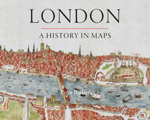
London: A History in Maps
Autor Peter Barberen Limba Engleză Hardback – 14 sep 2012
Over the past two thousand years London has developed from a small town, fitting snugly within its walls, into one of the world’s largest and most dynamic cities. This beautifully illustrated book charts that growth and the city’s transformation through hundreds of maps culled from the collection of the British Library’s Map Library.
These visual records range from sweeping images of the entire city to nuanced studies of its elements and neighborhoods. Including official documents, individual endeavors, hand-drawn renditions, and technologically advanced replicas, these maps represent a variety of perspectives. Utilitarian maps show the city as it is and serve to elucidate its inner workings, while carefully wrought plans show the city as it was envisioned—whether those plans were executed or not.
The maps and panoramas collected here are more than topographical records. They all convey unique insight into the concerns, assumptions, ambitions, and prejudices of Londoners at the time the maps were created. In addition to offering readers a tour of London past and present, this book reveals the inside story of the creation, growth, and change of one of the world’s greatest cities.
Preț: 378.97 lei
Nou
Puncte Express: 568
Preț estimativ în valută:
72.53€ • 75.44$ • 60.78£
72.53€ • 75.44$ • 60.78£
Carte disponibilă
Livrare economică 20 februarie-06 martie
Preluare comenzi: 021 569.72.76
Specificații
ISBN-13: 9780712358798
ISBN-10: 071235879X
Pagini: 380
Ilustrații: 400 color plates
Dimensiuni: 314 x 246 x 38 mm
Greutate: 2.5 kg
Ediția:New.
Editura: British Library
Colecția British Library
ISBN-10: 071235879X
Pagini: 380
Ilustrații: 400 color plates
Dimensiuni: 314 x 246 x 38 mm
Greutate: 2.5 kg
Ediția:New.
Editura: British Library
Colecția British Library
Notă biografică
Peter Barber is head of map collections at the British Library.
Cuprins
Editorial
London: A History in Maps
Section One: The Walled City 50–1066
1.1 Within the Walls
1.2 A Renaissance Vision
1.3 London from Bankside
1.4 The First Maps
1.5 The London Reality
Section Two: London Reborn
2.1 Building the City
2.2 The City and Westminster
2.3 Profiting from Development
2.4 The Coming of the West End
2.5 London Life
Section Three: 'Sweet, Salutarie Air': London's Countryside
3.1 London's Villages
3.2 From Noble Mansion to Gentleman's Villa
3.3 'Sweet, Salutarie Air'
Section Four: Out of Sight: The East End and Docklands
4.1 London's Workshop
4.2 The Coming of the Docks
Section Five: The Age of Improvement
5.1 The Demands of Commerce
5.2 Regency Grandeur
Section Six: The Mean Streets of Victorian London
6.1 Unbridled Growth
6.2 Hard Times
6.3 The Coming of the Railways
6.4 Sewage and London-wide Government
6.5 Open Spaces, Health and Social Harmony
6.6 New Roads for Old
6.7 Stanfords for Maps
Section Seven: Metroland
7.1 Different Londons
7.2 Be a Sport . . .
7.3 Imperial Grandeur
7.4 Getting Around
7.5 A to Z
7.6 Destruction from the Air
Section Eight: Maps in Modern London
8.1 Convulsions
8.2 London Resurgent
8.3 London Present and Future
Select Reading List on Historic Maps of London
Index of People
General Index
Recenzii
“[E]ndlessly absorbing. . . . [A] skillful balance between the city’s shape-shifting actuality and the various fantasies, cherished by everybody from Christopher Wren to the Luftwaffe, of what the place, with a few crucial tweaks, might become.”
“With each page, we witness London’s horizontal and vertical expansion. The collected work of London’s cartographers shows urban mass as a living entity, pushing forever outward. In its entirety, Mr. Barber’s book captures this energy and sense of organic growth. . . . This is a coffee table book that deserves to be read and studied. . . . [A] beautiful and engaging book.”
“Highly recommended.”
“Creatively designed and copiously illustrated, this beautiful and informative coffee table publication replicates an exhibition that was displayed at the British Library from November 2006 to March 2007. . . . This handsome publication will be a delightful and useful resource for a variety of audiences, including the general public; map collectors and bibliophiles; local and urban historians; and scholars interested in historical geography, urban geography and planning, and the history of cartography.”
"The entire volume exceeds the author’s expressed aspirations to present an honest and inclusive representation of London. I particularly appreciated the author’s perspectives on the history of mapping, which includes analysis and documentation of the highly selective nature of maps and mapping throughout history. The analysis of the motives of cartographers and publishers in particular is outstanding, being something few other books of this type include and a worthwhile addition to any publication discussing the history of cartography."
