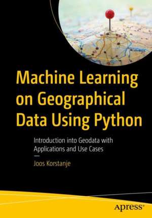
Machine Learning on Geographical Data Using Python: Introduction into Geodata with Applications and Use Cases
Autor Joos Korstanjeen Limba Engleză Paperback – 21 iul 2022
Get up and running with the basics of geographic information systems (GIS), geospatial analysis, and machine learning on spatial data in Python.
This book starts with an introduction to geodata and covers topics such as GIS and common tools, standard formats of geographical data, and an overview of Python tools for geodata. Specifics and difficulties one may encounter when using geographical data are discussed: from coordinate systems and map projections to different geodata formats and types such as points, lines, polygons, and rasters. Analytics operations typically applied to geodata are explained such as clipping, intersecting, buffering, merging, dissolving, and erasing, with implementations in Python. Use cases and examples are included. The book also focuses on applying more advanced machine learning approaches to geographical data and presents interpolation, classification, regression, and clustering via examples and use cases.
This book is your go-to resource for machine learning on geodata. It presents the basics of working with spatial data and advanced applications. Examples are presented using code (accessible at github.com/Apress/machine-learning-geographic-data-python) and facilitate learning by application.
What You Will Learn
- Understand the fundamental concepts of working with geodata
- Work with multiple geographical data types and file formats in Python
- Create maps in Python
- Apply machine learning on geographical data
Readers with a basic understanding of machine learning who wish to extend their skill set to analysis of and machine learning on spatial data while remaining in a common data science Python environment
Preț: 264.29 lei
Preț vechi: 330.35 lei
-20% Nou
Puncte Express: 396
Preț estimativ în valută:
50.59€ • 54.97$ • 42.52£
50.59€ • 54.97$ • 42.52£
Carte disponibilă
Livrare economică 31 martie-14 aprilie
Livrare express 14-20 martie pentru 110.70 lei
Preluare comenzi: 021 569.72.76
Specificații
ISBN-13: 9781484282861
ISBN-10: 1484282868
Pagini: 312
Ilustrații: XV, 312 p. 227 illus., 123 illus. in color.
Dimensiuni: 178 x 254 x 22 mm
Greutate: 0.57 kg
Ediția:1st ed.
Editura: Apress
Colecția Apress
Locul publicării:Berkeley, CA, United States
ISBN-10: 1484282868
Pagini: 312
Ilustrații: XV, 312 p. 227 illus., 123 illus. in color.
Dimensiuni: 178 x 254 x 22 mm
Greutate: 0.57 kg
Ediția:1st ed.
Editura: Apress
Colecția Apress
Locul publicării:Berkeley, CA, United States
Cuprins
Chapter 1: Introduction to Geodata.- Chapter 2: Coordinate Systems and Projections.-
Chapter 3: Geodata Data Types: Points, Lines, Polygons, Raster.- Chapter 4: Creating Maps.- Chapter 5: Basic Operations 1: Clipping and Intersecting in Python.- Chapter 6: Basic Operations 2: Buffering in Python.- Chapter 7: Basic Operations 3: Merge and Dissolve in Python.- Chapter 8: Basic Operations 4: Erase in Python.- Chapter 9: Machine Learning: Interpolation.- Chapter 10: Machine Learning: Classification.- Chapter 11: Machine Learning: Regression.- Chapter 12: Machine Learning: Clustering.- Chapter 13: Conclusion.
Notă biografică
Joos Korstanje is a data scientist, with over five years of industry experience in developing machine learning tools. He has a double MSc in Applied Data Science and in Environmental Science and has extensive experience working with geodata use cases. He currently works at Disneyland Paris where he develops machine learning for a variety of tools. His experience in writing and teaching have motivated him to write this book on machine learning for geodata with Python.
Textul de pe ultima copertă
Get up and running with the basics of geographic information systems (GIS), geospatial analysis, and machine learning on spatial data in Python.
This book starts with an introduction to geodata and covers topics such as GIS and common tools, standard formats of geographical data, and an overview of Python tools for geodata. Specifics and difficulties one may encounter when using geographical data are discussed: from coordinate systems and map projections to different geodata formats and types such as points, lines, polygons, and rasters. Analytics operations typically applied to geodata are explained such as clipping, intersecting, buffering, merging, dissolving, and erasing, with implementations in Python. Use cases and examples are included. The book also focuses on applying more advanced machine learning approaches to geographical data and presents interpolation, classification, regression, and clustering via examples and use cases.
This book is your go-to resource for machine learning on geodata. It presents the basics of working with spatial data and advanced applications. Examples are presented using code and facilitate learning by application.
What You Will Learn
- Understand the fundamental concepts of working with geodata
- Work with multiple geographical data types and file formats in Python
- Create maps in Python
- Apply machine learning on geographical data
Caracteristici
Provides a comprehensive introduction to working with geodata in Python Presents ML approaches—such as interpolation, classification, and clustering—to geographical data in Python Starts with basic operations, topics increase in complexity, and covers advanced use cases
