Cantitate/Preț
Produs

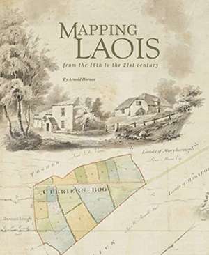
Mapping Laois: From the 16th to the 21st Century

Autor Arnold Horner
en Limba Engleză Hardback – 27 aug 2019
The author reviews and contextualizes the extraordinarily rich diversity of manuscripts and printed maps that record the changing political, economic, and social circumstances of an Irish county over nearly five centuries. The flavor of these varied, informative and often colorful maps is captured in over 400 illustrations, among which are reproductions of six early county maps and a unique assemblage of images from the Ordnance Survey fair plans' of c. 1838-40. With a map record that stretches back more than 450 years, County Laois (formerly Leix and Laoighis, and between 1556 and 1920 officially known as Queen's County) has a distinguished place in the history of cartography in Ireland. This book explores that record, from the first map of c. 1560, covering the eastern part of the county, through to the present century.
Citește tot Restrânge

Preț: 24020 lei

Nou

Puncte Express: 360

Preț estimativ în valută:
4597 4823$ 3814£

Carte indisponibilă temporar

Doresc să fiu notificat când acest titlu va fi disponibil:

Preluare comenzi: 021 569.72.76

Specificații

ISBN-13: 9781999790967
ISBN-10: 1999790960
Pagini: 388
Dimensiuni: 218 x 269 x 38 mm
Greutate: 1.34 kg
Editura: Carnelian Heart Publishing Ltd