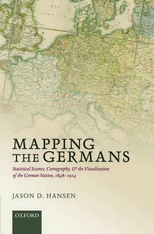
Mapping the Germans: Statistical Science, Cartography, and the Visualization of the German Nation, 1848-1914: Oxford Studies in Modern European History
Autor Jason D. Hansenen Limba Engleză Hardback – 22 ian 2015
Din seria Oxford Studies in Modern European History
- 30%
 Preț: 673.53 lei
 - 13%
 Preț: 278.29 lei
 -
 Preț: 222.12 lei
 - 26%
 Preț: 601.69 lei
 - 6%
 Preț: 234.19 lei
 - 16%
 Preț: 707.37 lei
 - 25%
 Preț: 522.10 lei
 - 17%
 Preț: 582.53 lei
 - 17%
 Preț: 583.54 lei
 - 16%
 Preț: 584.33 lei
 - 25%
 Preț: 582.12 lei
 - 30%
 Preț: 623.22 lei
 - 30%
 Preț: 486.56 lei
 - 14%
 Preț: 321.01 lei
 -
 Preț: 341.60 lei
 - 27%
 Preț: 832.43 lei
 -
 Preț: 309.69 lei
 - 30%
 Preț: 729.14 lei
 - 25%
 Preț: 877.94 lei
 - 12%
 Preț: 351.71 lei
 - 14%
 Preț: 297.87 lei
 - 14%
 Preț: 295.23 lei
 - 13%
 Preț: 240.04 lei
 - 30%
 Preț: 613.37 lei
 - 27%
 Preț: 662.35 lei
 - 17%
 Preț: 582.46 lei
 - 17%
 Preț: 581.77 lei
 - 16%
 Preț: 584.42 lei
Preț: 671.46 lei
Preț vechi: 964.57 lei
-30% Nou
Puncte Express: 1007
Preț estimativ în valută:
128.50€ • 133.66$ • 106.08£
128.50€ • 133.66$ • 106.08£
Carte tipărită la comandă
Livrare economică 02-08 aprilie
Preluare comenzi: 021 569.72.76
Specificații
ISBN-13: 9780198714392
ISBN-10: 0198714394
Pagini: 224
Ilustrații: 17 black and white images, colour map section
Dimensiuni: 163 x 241 x 19 mm
Greutate: 0.52 kg
Editura: OUP OXFORD
Colecția OUP Oxford
Seria Oxford Studies in Modern European History
Locul publicării:Oxford, United Kingdom
ISBN-10: 0198714394
Pagini: 224
Ilustrații: 17 black and white images, colour map section
Dimensiuni: 163 x 241 x 19 mm
Greutate: 0.52 kg
Editura: OUP OXFORD
Colecția OUP Oxford
Seria Oxford Studies in Modern European History
Locul publicării:Oxford, United Kingdom
Recenzii
Hansen's book shows that mapping nationality is inherently prone to bias, that statistics can be easily tweaked, and maps can be manipulated for propaganda.
by highlighting the relation between statistics and visualization using a fitting and prominent example, Hansen provides an important contribution to ongoing methodical debates amongst historians. Understanding categorizations and the methodical basics of statistics and cartography is an essential condition for a critical assessment of maps as a medium.
Mapping the Germans is a significant addition to research on several topics, especially the role of maps in constructing modern imaginaries.
Hansen provides an excellent layered account of maps, statistics, and nationalism over a crucial half century of German history.
Hansen's monograph would make for an excellent addition to an upper-level undergraduate or, especially, graduate seminar on social studies of science or spatial history. I can only hope that this book is a harbinger of more SSS-like studies of scientific institutions, a field from which historians have a lot to learn.
Notă biografică
Jason Hansen specializes in the study of modern Germanyand is currently working on a new project which examines the impact of the development of the internet and digitalization on the future of Holocaust memory. Dr Hansen has been the recipient of awards from the Council of European Studies and the German Academic Exchange Service (DAAD).


