Mapping Wonderlands: Illustrated Cartography of Arizona, 1912–1962
Autor Dori Griffinen Limba Engleză Hardback – 2 mai 2013
Though tourism now plays a recognized role in historical research and regional studies, the study of popular touristic images remains sidelined by chronological histories and objective statistics. Further, Arizona remains underexplored as an early twentieth-century tourism destination when compared with nearby California and New Mexico. With the notable exception of the Grand Canyon, little has been written about tourism in the early days of Arizona’s statehood.
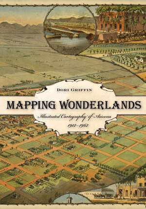
Mapping Wonderlands fills part of this gap in existing regional studies by looking at early popular pictorial maps of Arizona. These cartographic representations of the state utilize formal mapmaking conventions to create a place-based state history. They introduce illustrations, unique naming conventions, and written narratives to create carefully visualized landscapes that emphasize the touristic aspects of Arizona.
Analyzing the visual culture of tourism in illuminating detail, this book documents how Arizona came to be identified as an appealing tourism destination. Providing a historically situated analysis, Dori Griffin draws on samples from a comprehensive collection of materials generated to promote tourism during Arizona’s first half-century of statehood. She investigates the relationship between natural and constructed landscapes, visual culture, and narratives of place. Featuring sixty-six examples of these aesthetically appealing maps, the book details how such maps offered tourists and other users a cohesive and storied image of the state. Using historical documentation and rhetorical analysis, this book combines visual design and historical narrative to reveal how early-twentieth-century mapmakers and map users collaborated to imagine Arizona as a tourist’s paradise.
Preț: 382.33 lei
Preț vechi: 512.65 lei
-25% Nou
Puncte Express: 573
Preț estimativ în valută:
73.17€ • 79.45$ • 61.46£
73.17€ • 79.45$ • 61.46£
Carte indisponibilă temporar
Doresc să fiu notificat când acest titlu va fi disponibil:
Se trimite...
Preluare comenzi: 021 569.72.76
Specificații
ISBN-13: 9780816509324
ISBN-10: 0816509328
Pagini: 232
Ilustrații: 69 photos
Dimensiuni: 178 x 254 x 25 mm
Greutate: 0.68 kg
Ediția:First Edition
Editura: University of Arizona Press
Colecția University of Arizona Press
ISBN-10: 0816509328
Pagini: 232
Ilustrații: 69 photos
Dimensiuni: 178 x 254 x 25 mm
Greutate: 0.68 kg
Ediția:First Edition
Editura: University of Arizona Press
Colecția University of Arizona Press
Notă biografică
Dori Griffin, a former Arizona Humanities Council Road Scholar, is an assistant professor of art and design at the University of Southern Mississippi.
Cuprins
List of Illustrations
Acknowledgments
Introduction
1. Writing the Wonderlands of Arizona
2. Contextualizing Arizona’s Cartographic Illustrations, 1912–1962
3. Adopted Identities: Map-makers, Map Users, and Illustrated Roles
4. Rewriting Time: Illustrated Cartography and Arizona’s Temporal Landscape
5. Crowded Spaces: “How We Filled in the Map”
6. Cartographic Narratives of Place: Writing Stories onto Arizona Landscapes
7. Cartographic Narratives of Cultural Exoticism: Stories with Local Color
Conclusion: Rereading Arizona as a Wonderland
Appendix: Popular Cartographers of Arizona, A Biographical Catalogue
Notes
Index
Recenzii
"This fine book has important things to say about how the way Arizona told its story in the past impacts the way Arizonans, and the rest of the world, perceive the state today."—Helene Woodhams, Southwest Books of the Year
"Historical geographers who are interested in the roles that maps—as both representations and practices—play in the unfolding of place identities over time will find Mapping Wonderland a rich and useful extension of previous work."—Journal of Historical Geography
“Rich in content and beautifully illustrated, Mapping Wonderlands makes a major contribution to our understanding about the role of mapmaking in advertising and promotion.”—Richard Francaviglia, author of Over the Range: A History of the Promontory Summit Route of the Pacific Railroad
“This is an imaginative study, using the visual culture of tourism to explore the identity of Arizona, one that has broad implications for our understanding of the Southwest. Griffin has much to say about cultural memory and the touristic experience.”—Betsy Fahlman, author of Pennsylvania Modern: Charles Demuth of Lancaster
“Authoritative and well-researched. . . . A comprehensive study of a largely overlooked subject.”—Journal of Arizona History
Descriere
Mapping Wonderlands explores popular, illustrated maps of Arizona as a tourism destination, investigating the relationship between landscapes, visual culture, and narratives of place. These aesthetically appealing maps offer tourists an Arizona landscape at once historical and imaginary—just as their makers intended.