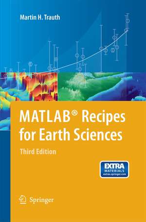
MATLAB® Recipes for Earth Sciences
Autor Martin Trauth Ilustrat de E. Sillmann Contribuţii de R. Gebbers, N. Marwanen Limba Engleză Paperback – 29 noi 2014
Preț: 530.03 lei
Preț vechi: 623.56 lei
-15% Nou
Puncte Express: 795
Preț estimativ în valută:
101.42€ • 108.45$ • 84.56£
101.42€ • 108.45$ • 84.56£
Carte tipărită la comandă
Livrare economică 18 aprilie-02 mai
Preluare comenzi: 021 569.72.76
Specificații
ISBN-13: 9783642447167
ISBN-10: 3642447163
Pagini: 352
Ilustrații: XI, 336 p.
Dimensiuni: 155 x 235 x 18 mm
Greutate: 0.49 kg
Ediția:3rd ed. 2010
Editura: Springer Berlin, Heidelberg
Colecția Springer
Locul publicării:Berlin, Heidelberg, Germany
ISBN-10: 3642447163
Pagini: 352
Ilustrații: XI, 336 p.
Dimensiuni: 155 x 235 x 18 mm
Greutate: 0.49 kg
Ediția:3rd ed. 2010
Editura: Springer Berlin, Heidelberg
Colecția Springer
Locul publicării:Berlin, Heidelberg, Germany
Public țintă
ResearchCuprins
Data Analysis in Earth Sciences.- to MATLAB.- Univariate Statistics.- Bivariate Statistics.- Time-Series Analysis.- Signal Processing.- Spatial Data.- Image Processing.- Multivariate Statistics.- Statistics on Directional Data.
Recenzii
From the reviews of the third edition:
“The book introduces methods of data analysis in geosciences using MATLAB. … If you are tied to MATLAB, I don’t think you will be disappointed. If you have some familiarity with python then you will also be able to glean allot from the content. … The mathematical element flows nicely with the subject matter and I suspect that even an individual without a mathematics background could gain an appreciation for the math based on the context … .” (Amazon.com, February, 2013)
“The book introduces methods of data analysis in geosciences using MATLAB. … If you are tied to MATLAB, I don’t think you will be disappointed. If you have some familiarity with python then you will also be able to glean allot from the content. … The mathematical element flows nicely with the subject matter and I suspect that even an individual without a mathematics background could gain an appreciation for the math based on the context … .” (Amazon.com, February, 2013)
Notă biografică
MATLAB® is used for a wide range of applications in geosciences, such as image processing in remote sensing, the generation and processing of digital elevation models, and the analysis of time series. This book introduces methods of data analysis in geosciences using MATLAB, such as basic statistics for univariate, bivariate and multivariate datasets, jackknife and bootstrap resampling schemes, processing of digital elevation models, gridding and contouring, geostatistics and kriging, processing and georeferencing of satellite images, digitizing from the screen, linear and nonlinear time-series analysis, and the application of linear time-invariant and adaptive filters. The revised and updated Third Edition includes ten new sections and has greatly expanded on most chapters from the previous edition, including a step by step discussion of all methods before demonstrating the methods with MATLAB functions. New sections include: Data Storage and Handling, Data Structures and Classes of Objects, Generating M-Files to Regenerate Graphs, Publishing M-Files, Distribution Fitting, Nonlinear and Weighted Regression, Color-Intensity Transects of Varved Sediments, and Grain Size Analysis from Microscope Images. The text includes numerous examples demonstrating how MATLAB can be used on data sets from earth sciences. All MATLAB recipes can be easily modified in order to analyse the reader's own data sets.
Textul de pe ultima copertă
MATLAB® is used for a wide range of applications in geosciences, such as image processing in remote sensing, the generation and processing of digital elevation models, and the analysis of time series. This book introduces methods of data analysis in geosciences using MATLAB, such as basic statistics for univariate, bivariate and multivariate datasets, jackknife and bootstrap resampling schemes, processing of digital elevation models, gridding and contouring, geostatistics and kriging, processing and georeferencing of satellite images, digitizing from the screen, linear and nonlinear time-series analysis, and the application of linear time-invariant and adaptive filters. The revised and updated Third Edition includes ten new sections and has greatly expanded on most chapters from the previous edition, including a step by step discussion of all methods before demonstrating the methods with MATLAB functions. New sections include: Data Storage and Handling, Data Structures and Classes of Objects, Generating M-Files to Regenerate Graphs, Publishing M-Files, Distribution Fitting, Nonlinear and Weighted Regression, Color-Intensity Transects of Varved Sediments, and Grain Size Analysis from Microscope Images. The text includes numerous examples demonstrating how MATLAB can be used on data sets from earth sciences. All MATLAB recipes can be easily modified in order to analyse the reader's own data sets. The online files accompanying the book contain exemplary data sets and a digital version of the MATLAB recipes.
Caracteristici
Contains 10 new sections and has greatly expanded on most chapters from the previous edition Contains exercises and fully worked-out solutions Many detailed illustrations Includes supplementary material: sn.pub/extras
