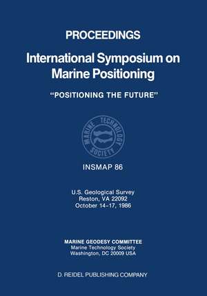
Proceedings International Symposium on Marine Positioning: U.S. Geological Survey Reston, VA 22092 October 14–17,1986
Muneendra Kumar, G.A. Maulen Limba Engleză Paperback – 27 sep 2011
Preț: 406.25 lei
Nou
Puncte Express: 609
Preț estimativ în valută:
77.73€ • 81.16$ • 64.34£
77.73€ • 81.16$ • 64.34£
Carte tipărită la comandă
Livrare economică 04-18 aprilie
Preluare comenzi: 021 569.72.76
Specificații
ISBN-13: 9789401082266
ISBN-10: 940108226X
Pagini: 492
Ilustrații: 488 p.
Dimensiuni: 178 x 254 x 26 mm
Greutate: 0.84 kg
Ediția:Softcover reprint of the original 1st ed. 1987
Editura: SPRINGER NETHERLANDS
Colecția Springer
Locul publicării:Dordrecht, Netherlands
ISBN-10: 940108226X
Pagini: 492
Ilustrații: 488 p.
Dimensiuni: 178 x 254 x 26 mm
Greutate: 0.84 kg
Ediția:Softcover reprint of the original 1st ed. 1987
Editura: SPRINGER NETHERLANDS
Colecția Springer
Locul publicării:Dordrecht, Netherlands
Public țintă
ResearchCuprins
Keynote Speech.- Session 1. Instrumentation in Marine Environment I.- Sea Beam Mapping Systems.- STARFIX: A New High-Precision Satellite Positioning System.- The Hydrorange Acoustic System for Seismic Streamer Tracking for INSMAP 86.- New Technology and Proven Techniques Combine to Provide Dynamic Precise Positioning.- Session 2. Instrumentation in Marine Environment II.- Lasers and Nearshore Positioning.- Polarimetric Radar for Accurate Navigation.- Japanese Geodetic Satellite for Expansion of Marine Control.- Evaluation of a Large Ship GPS System: Direct Computation and Dynamic Differential.- Optimum Utilization of Positioning Data in SDS III.- Session 3. GPS in Marine Positioning I.- GPS Marine Kinematic Positioning--Accuracy and Reliability.- Demonstration of the Combined Use of GPS Pseudorange and Doppler Measurements for Improved Dynamic Positioning.- Accurate Positioning of Marine Vessels Using GPS.- Evaluation and Correction of Loran-C Positions in Comparison with GPS Data.- GPS-Aided Inertial Positioning in Irregular Ocean Gravity Fields.- Session 4. GPS in Marine Positioning II.- Precise GPS-Aided Marine Positioning Developments and Results.- A Dual-Band Interferometric GPS Marine Navigation System.- Codeless GPS Positioning.- Decimeter GPS Positioning for Surface Element of Sea Floor Geodesy System.- Performance Appraisal of an ARGO Calibration System Using GPS.- Session 5. Marine Mapping and Charting I.- NAVGRAV, A Comprehensive Combined Navigation and Gravimetry Experiment on the North Sea; Objectives and First Experiences.- Mapping Nuclear Craters on Enewetak Atoll, Marshall Islands.- Sea Floor Mapping Using Gloria Digital Techniques.- Horizontal Datum Anomalies on Nautical Charts: A Solution.- Afternoon Banquet.- The Role of GPS in Naval Oceanography.- Session 6: Marine Mapping and Charting II.- The Canadian Hydrographic Service Experiment in Electronic Chart Distribution.- The MAPGEN Cartographic System.- Continental Margin Mapping Project and Cartographic Management Information System for the U.S. Exclusive Economic Zone.- Predictive Loran-C Positioning in the Marine Environment Using Area Modeling for Real Time Propagation Corrections.- Session 7: Positioning in Oceanography.- The RAFOS Navigation System.- Integrating Marine Navigational Systems in Post Cruise Processing.- A New Sound Velocity Measurement System.- Evolution of Position-Locating System on Data Buoys.- Seafloor Benchmark Positioning System Experiment Interim Report.- Session 8: Calibration and Intercomparison.- Calibration of a Range to Range Loran Chain with the Use of Global Positioning System.- Current Issues in Expressing Uncertainty of Position in GPS Navigation.- Computing the Heading Effect at M.F. and L.F. Position Fixing.- The Use of Calibrated and Monitored Loran as a Means for Precision Vessel Location.- Accuracy of Multiple Lines of Position for Hydrography.- Session 9: Applications/Requirements.- Monumenting Marine Control.- Navigation for Surveys of Trans-Pacific Fiber-Optic Cables.- Detailed Structural Mapping of an Ocean Rift Using Acoustic-Transponder Positioning: Problems of Net Maintenance (1981–86) and New Experiments Possible with Long-Life Transponders.- High Accuracy Marine Positioning for Dredging Surveys at the Port of Hamburg.- Position Changes in Marine Areas.- Workshop.- I. Potential, Problems, and Projected Directions in the Oceanographic Applications of Sea Level Measurements from Satellite Altimetry.- II. Precise Marine Positioning for Geodesy/Geophysics.- III. GPS Applications in Oceanography.- IV. Instrumentation.- V.Positioning in Marine Mapping and Charting.- List of Registered Participants.
Recenzii
` This is a valuable reference for any organization engaged in marine surveying or exploration. '
Geophysics
` The public availability of these summarized proceedings in a book form is specially welcome; it brings a wealth of useful information out of the realm of `obscure literature'. The book is a must for all of us concerned with geodesy and geophysics of the wet 71% of our planet. '
P. Vanïcek in Pageoph, vol.132, no.3, 1990
