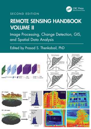
Remote Sensing Handbook, Volume II: Image Processing, Change Detection, GIS, and Spatial Data Analysis: Remote Sensing Handbook
Editat de Prasad S. Thenkabailen Limba Engleză Hardback – 29 noi 2024
Features
- Provides the most up-to-date comprehensive coverage of digital image processing.
- Highlights object-based image analysis (OBIA) and pixel-based classification methods and techniques of digital image processing.
- Demonstrates practical examples of image processing for a myriad of applications such as land use/land cover, croplands, and urban.
- Establishes image processing using different types of remote sensing data that includes multispectral, radar, LiDAR, thermal, and hyperspectral.
- Highlights change detection, geoprocessing, and GIScience.
Preț: 1044.05 lei
Preț vechi: 1147.30 lei
-9% Nou
Puncte Express: 1566
Preț estimativ în valută:
199.79€ • 213.63$ • 166.57£
199.79€ • 213.63$ • 166.57£
Carte tipărită la comandă
Livrare economică 17 aprilie-01 mai
Preluare comenzi: 021 569.72.76
Specificații
ISBN-13: 9781032890975
ISBN-10: 1032890975
Pagini: 506
Ilustrații: 432
Dimensiuni: 178 x 254 mm
Greutate: 1.1 kg
Ediția:2
Editura: CRC Press
Colecția CRC Press
Seria Remote Sensing Handbook
ISBN-10: 1032890975
Pagini: 506
Ilustrații: 432
Dimensiuni: 178 x 254 mm
Greutate: 1.1 kg
Ediția:2
Editura: CRC Press
Colecția CRC Press
Seria Remote Sensing Handbook
Public țintă
Postgraduate, Professional Reference, and Undergraduate AdvancedCuprins
Part I: Image Processing Methods and Approaches. 1. Digital Image Processing: A Review of the Fundamental Methods and Techniques. 2. Image Classification Methods in Land Cover and Land Use and Cropland Studies. 3. Urban Image Classification: Per-pixel Classifiers, Sub-pixel Analysis, Object-based Image Analysis, and Geospatial Methods. 4. Hyperspectral Image Processing: Methods and Approaches. 5. Collaborative Representation for Hyperspectral Image Classification and Detection. 6. Thermal Infrared Remote Sensing: Principles and Theoretical Background. 7. Remote Sensing Image Segmentation: Methods, Approaches, and Advances. 8. Object Based Image Analysis: Evolution, History, State-of-the-Art and Future Vision. 9. Geospatial Data Integration in OBIA- implications of Accuracy and Validity. 10. Image Segmentation Algorithms for Land Categorization. 11. LiDAR Data Processing and Applications. Part II: Change Detection. 12. Forest Clear-Cutting Detection in Subtropical Regions with Time Series Remotely Sensed Data. Part III: Integrating Geographic Information Systems (GIS) and Remote Sensing in Spatial Modeling Framework for Decision Support. 13. Geoprocessing, Workflows, and Provenance. 14. Toward Democratization of Geographic Information: GIS, Remote Sensing, and GNSS Applications in Everyday Life. 15. Frontiers of GIScience: Evolution, State-of-Art, and Future Pathways. 16. Object-Based Regionalization for Policy-Oriented Partitioning of Space. Part IV: Summary and Synthesis of Volume II. 17. Remote Sensing Handbook, Volume II: Image Processing, Change Detection, GIS and Spatial Data Analysis.
Notă biografică
Dr. Prasad S. Thenkabail, Senior Scientist (ST), United States Geological Survey (USGS), is a world-recognized expert in remote sensing science with major contributions in the field for nearly 40 years. He has made the list of the world’s top 1% of scientists across 22 scientific fields and 176 sub-fields. Dr. Thenkabail has conducted pioneering research in hyperspectral remote sensing of vegetation, global croplands, and their water use for food security. He obtained his PhD from the Ohio State University in 1992 and has 168 peer-reviewed publications including 15 books, including this six-volume set, and over 15 major data releases such as the Landsat-derived global cropland extent product @ 30m and Landsat-derived rainfed and irrigated cropland area product @ 30 m (LGRIP30). He was recognized as a Fellow of the American Society of Photogrammetry and Remote Sensing (ASPRS) in 2023. His scientific papers have won several awards for demonstrating world-class, highest-quality research. He was a Landsat Science Team Member (2007-2011).
Descriere
Volume II of the Remote Sensing Handbook, Second Edition, is focused on digital image processing including image classification methods in land cover and land use. It discusses object-based segmentation and pixel-based image processing algorithms, change detection techniques, and image classification for a wide array of applications.


