Cantitate/Preț
Produs

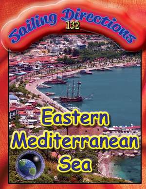
Sailing Directions 132 Eastern Mediterranean

Autor N. G. A
en Limba Engleză Paperback
EDITION 14 current 2016 PUB.132 SAILING DIRECTIONS (ENROUTE) EASTERN MEDITERRANEAN Prepared and published by the NATIONAL GEOSPATIAL-INTELLIGENCE AGENCY Libya Egypt Israel, Lebanon, and Syria Cyprus Turkey-South Coast-Kassab Bay to Alobi Burnu Rodhos (Rhodes), Nisos Karpathos, and Kriti (Crete) Greece-West Coast and Dhiorix Korinthou (Corinth Canal) Greece-West Coast and Albania-Nisos Oxia to Kep I Kefali Albania, Montenegro, and Croatia-Kep I Kefali to Rt Bat Croatia and Bosnia-Herzegovina-Rt Bat to Rt Movar and Off-lying Islands Croatia-Rt Movar to Rt Marlera Greece-Akra Tainaron to Akra Skillaion Greece-Saronikos Kolpos Greece-Kikladhes Nisoi Greece-Channels West of Nisos Evvoia Greece-Nisoi Vorioi Sporadhes and Pagasitikos Kolpos Greece-Thermaikos Kolpos to Alexandroupolis Greece-Dhodhekanisos and the Southwest Coast of Turkey Turkey-West Coast-Samos Strait to Izmir The Dardanelles Approach and the Adjacent Coast and Islands SAILING DIRECTIONS are all available at Amazon as paperback and kindle editions. SAILING DIRECTIONS are prepared and published by the NATIONAL GEOSPATIAL-INTELLIGENCE AGENCY (NGA). UNITED STATES OF AMERICA. SAILING DIRECTIONS, covering the harbors, coasts, and waters of the world, provide information that cannot be shown graphically on nautical charts and is not readily available elsewhere. Sailing Directions include detailed coastal and port approach information which supplements the largest scale chart. PLANNING GUIDES are; SAILING DIRECTIONS (PLANNING GUIDES) include relevant physical, political, industrial, navigational and regulatory information about the countries adjacent to a particular ocean basin in a single volume 102 INTERNATIONAL CODE OF SIGNALS 120 PACIFIC OCEAN & SOUTHEAST ASIA 140 NORTH ATLANTIC OCEAN & ADJACENTSEAS 160 SOUTH ATLANTIC OCEAN &INDIAN OCEAN 180 ARCTIC OCEAN 200 ANTARCTICA ENROUTE GUIDES; 102 INTERNATIONAL CODE OF SIGNALS 120 PACIFIC OCEAN & SOUTHEAST ASIA 123 SOUTHWEST AFRICA 124 EAST COAST OF SOUTH AMERICA 125 WEST COAST OF SOUTH AMERICA 126 PACIFIC ISLANDS 127 EAST COAST OF AUSTRALIA & NEW ZEALAND 131 WESTERN MEDITERRANEAN 132 EASTERN MEDITERRANEAN 140 NORTH ATLANTIC OCEAN & ADJACENTSEAS 141 SCOTLAND 142 IRELAND AND THE WEST COAST OF ENGLAND 143 WEST COAST OF EUROPE & NORTHWEST AFRICA 145 NOVA SCOTIA & THE ST LAWRENCE 146 NEWFOUNDLAND, LABRADOR & HUDSON BAY 147 CARIBBEAN SEA VOLUME 1 148 CARIBBEAN SEA VOLUME 2 150 WORLD PORT INDEX 151 DISTANCE BETWEEN PORTS 153 WEST COASTS OF MEXICO & CENTRAL AMERICA 154 BRITISH COLUMBIA 155 EAST RUSSIA 157 KOREA & CHINA 158 JAPAN 1 159 JAPAN 2 160 SOUTH ATLANTIC OCEAN &INDIAN OCEAN 161 SOUTH CHINA SEA & THAILAND 162 PHILLIPINE ISLANDS 163 BORNEO, JAWA, SULAWESI, & NUSA TENGGARA 171 EAST AFRICA & THE SOUTH INDIAN OCEAN 172 RED SEA & PERSIAN GULF 173 INDIA & BAY OF BENGAL 174 STRAIT OF MALACCA & SUMATERA 175 NORTH, WEST & SOUTH COASTS OF AUSTRALIA 180 ARCTIC OCEAN 181 GREENLAND & ICELAND 182 NORTH & WEST COASTS OF NORWAY 183 NORTH COAST OF RUSSIA 191 ENGLISH CHANNEL 192 NORTH SEA 193 SKAGERRAK & KATTEGAT 194 BALTIC SEA (SOUTHERN PART) 195 GULF OF FINLAND & GULF OF BOTHNIA 200 ANTARCTICA
Citește tot Restrânge

Preț: 14640 lei

Nou

Puncte Express: 220

Preț estimativ în valută:
2801 2958$ 2331£

Carte indisponibilă temporar

Doresc să fiu notificat când acest titlu va fi disponibil:

Preluare comenzi: 021 569.72.76

Specificații

ISBN-13: 9781463669799
ISBN-10: 1463669798
Pagini: 300
Dimensiuni: 216 x 279 x 16 mm
Greutate: 0.68 kg
Editura: CreateSpace Independent Publishing Platform