Cantitate/Preț
Produs

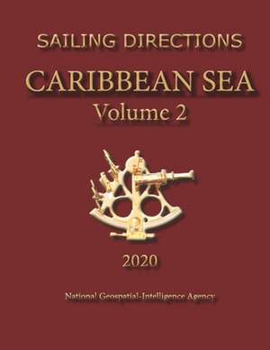
Sailing Directions Caribbean Sea Volume 2

Autor National Geospatial-Intelligence Agency
en Limba Engleză Paperback
Edition 16 for 2016. Included in the book is a code to download an app. The app has links to thousands of useful pieces of information. All the weather, the winds, the formalities and regulations, to blogs and photos, things to do, events, anchorages, costs, marinas, google earth, camping, walking, flights, ferries, boatyards, repairs, currency, addresses, communications, snorkelling, fishing workshop, diving, flora, the animals, online charts, updates, the parks, local food, the restaurants, hotels and accommodation, Wikipedia, Noonsite, sailing guides online, diesel engine troubleshooting & repair etc.etc. Also included is a wiki editable document. Experienced seamen can leave information, comments, observations, photos, links to videos, blogs, and useful websites. Use the QR code scanner on your phone or tablet. It is all free. Sailing Directions are THE official document of the U.S.published by the National Geospatial- Intelligence Agency. Sailing Directions, covering the harbors, coasts, and waters of the world, provide information that cannot be shown graphically on nautical charts and is not readily available elsewhere. Sailing Directions include detailed coastal and port approach information which supplements the largest scale chart.All geographical features have GPS coordinates for emergency navigation. CARIBBEAN SEA VOLUME 2 Trinidad and Tobago and the Coast of Venezuela-The Gulf of Paria and the Rio Orinoco Aruba, Bonaire, Curacao, and the Coast of Venezuela-Punta Penas to Cabo San Roman, with Off-lying Islands and Dangers Golfo de Venezuela and Lago de Maracaibo Coasts of Colombia and Panama-Punta Gallinas to and including the Panama Canal Coasts of Panama, Costa Rica, and Nicaragua-The Panama Canal to Cabo Gras a Dios Coasts of Honduras, Guatemala, Belize, and Mexico-Cabo Gracias a Dios to Cabo Catoche Coast of Mexico-Cabo Catoche to the Rio Grande . REFERENCE BOOKS SAILING DIRECTIONS are prepared and published by the NATIONAL GEOSPATIAL-INTELLIGENCE AGENCY (NGA). UNITED STATES OF AMERICA. SAILING DIRECTIONS, covering the harbors, coasts, and waters of the world, provide information that cannot be shown graphically on nautical charts and is not readily available elsewhere. Sailing Directions include detailed coastal and port approach information which supplements the largest scale chart.
Citește tot Restrânge

Preț: 14267 lei

Nou

Puncte Express: 214

Preț estimativ în valută:
2731 2814$ 2305£

Carte indisponibilă temporar

Doresc să fiu notificat când acest titlu va fi disponibil:

Preluare comenzi: 021 569.72.76

Specificații

ISBN-13: 9781463543945
ISBN-10: 1463543948
Pagini: 206
Dimensiuni: 216 x 279 x 11 mm
Greutate: 0.53 kg
Editura: CreateSpace Independent Publishing Platform