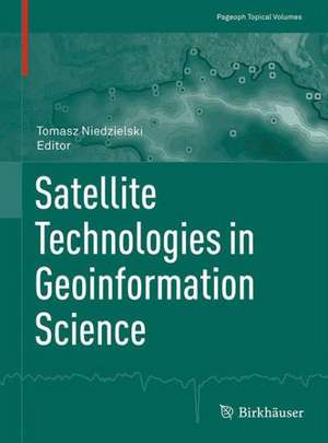
Satellite Technologies in Geoinformation Science: Pageoph Topical Volumes
Editat de Tomasz Niedzielskien Limba Engleză Paperback – 15 aug 2014
The volume addresses the interests of scientists and practitioners whose work is related to processing remote sensing data using geoinformation methods. Postgraduate students of geography, geodesy, cartography and geophysics – as well as students of the broader geosciences – will also find the book to be a valuable resource, as it brings together numerous satellite and airborne technologies with geospatial processing methods, presents case studies and examines most applications in the context of basic geophysical principles.
Din seria Pageoph Topical Volumes
-
 Preț: 300.85 lei
 -
 Preț: 386.19 lei
 -
 Preț: 303.07 lei
 -
 Preț: 306.14 lei
 - 15%
 Preț: 720.73 lei
 -
 Preț: 397.38 lei
 -
 Preț: 314.52 lei
 - 15%
 Preț: 641.71 lei
 -
 Preț: 221.70 lei
 -
 Preț: 328.35 lei
 - 15%
 Preț: 726.94 lei
 -
 Preț: 308.55 lei
 -
 Preț: 320.20 lei
 -
 Preț: 384.70 lei
 -
 Preț: 301.10 lei
 -
 Preț: 298.66 lei
 -
 Preț: 299.34 lei
 -
 Preț: 324.18 lei
 -
 Preț: 392.75 lei
 -
 Preț: 312.97 lei
 -
 Preț: 307.88 lei
 -
 Preț: 387.96 lei
 -
 Preț: 405.06 lei
 -
 Preț: 386.00 lei
 -
 Preț: 396.40 lei
 -
 Preț: 404.29 lei
 -
 Preț: 391.99 lei
 -
 Preț: 351.49 lei
 - 18%
 Preț: 1106.46 lei
 -
 Preț: 393.52 lei
 - 20%
 Preț: 568.74 lei
 -
 Preț: 388.72 lei
 -
 Preț: 380.07 lei
 - 15%
 Preț: 660.83 lei
 -
 Preț: 396.40 lei
 -
 Preț: 397.38 lei
 -
 Preț: 409.30 lei
 -
 Preț: 399.29 lei
 -
 Preț: 495.62 lei
 -
 Preț: 385.25 lei
 -
 Preț: 394.29 lei
 - 15%
 Preț: 647.27 lei
 -
 Preț: 400.47 lei
 -
 Preț: 395.25 lei
 - 15%
 Preț: 657.08 lei
 -
 Preț: 400.26 lei
 -
 Preț: 352.80 lei
 -
 Preț: 384.48 lei
 -
 Preț: 401.42 lei
Preț: 386.00 lei
Nou
Puncte Express: 579
Preț estimativ în valută:
73.86€ • 80.48$ • 62.24£
73.86€ • 80.48$ • 62.24£
Carte tipărită la comandă
Livrare economică 19-25 aprilie
Preluare comenzi: 021 569.72.76
Specificații
ISBN-13: 9783034808491
ISBN-10: 3034808496
Pagini: 309
Ilustrații: VI, 310 p.
Dimensiuni: 193 x 260 x 20 mm
Greutate: 0.64 kg
Ediția:2015
Editura: Springer
Colecția Birkhäuser
Seria Pageoph Topical Volumes
Locul publicării:Basel, Switzerland
ISBN-10: 3034808496
Pagini: 309
Ilustrații: VI, 310 p.
Dimensiuni: 193 x 260 x 20 mm
Greutate: 0.64 kg
Ediția:2015
Editura: Springer
Colecția Birkhäuser
Seria Pageoph Topical Volumes
Locul publicării:Basel, Switzerland
Public țintă
ResearchCuprins
Satellite Technologies in Geoinformation Science: Introduction.- Global, Regional and National Geodetic Reference Frames for Geodesy and Geodynamics.- Modelling the Velocity Field in a Regular Grid in the Area of Poland on the Basis of the Velocities of European Permanent Stations.- LiDAR and 2D Electrical Resistivity Tomography as a Supplement of Geomorphological Investigations in Urban Areas: a Case Study from the City of Wrocław (SW Poland).- Aerial Orthophoto and Airborne Laser Scanning as Monitoring Tools for Land Cover Dynamics: A Case Study from the Milicz Forest District (Poland).- Quantitative and Qualitative Assessment of Soil Erosion Risk in Małopolska (Poland), Supported by an Object-Based Analysis of High-Resolution Satellite Images.- Assessment of the Accuracy of SRTM C- and X-Band High Mountain Elevation Data: a Case Study of the Polish Tatra Mountains.- Land Surface Temperature Patterns in the Urban Agglomeration of Krakow (Poland) Derived from Landsat-7/ETM+ Data.- Remote Sensing Data in Wind Velocity Field Modelling: a Case Study from the Sudetes (SW Poland).- Determination of Ventilation Channels In Urban Area: A Case Study of Wrocław (Poland).- Geospatial Investigation into Groundwater Pollution and Water Quality Supported by Satellite Data: A Case Study from the Evros River (Eastern Mediterranean).- Application of Integrated GNSS/Hydroacoustic Measurements and GIS Geodatabase Models for Bottom Analysis of Lake Hancza: the Deepest Inland Reservoir in Poland.- Biogeography of the Oceans: a Review of Development of Knowledge of Currents, Fronts and Regional Boundaries from Sailing Ships in the Sixteenth Century to Satellite Remote Sensing.- Use of Remotely-Derived Bathymetry for Modelling Biomass in Marine Environments.- Prototypes of Orthoimage Maps as Tools for Geophysical Application.- Towards a More Realistic Depiction of the Earth’s Surface on Maps.- Satellite-Based Technologies in Use for Extreme Nocturnal Mountain Rescue Operations: a Synergetic Approach Applying Geophysical Principles.
Notă biografică
Tomasz Niedzielski is professor at the Faculty of Earth Science and Environmental Management of the University of Wrocław, Poland.
Textul de pe ultima copertă
This topical volume covers a wide range of multidisciplinary topics, the common theme of which is processing of remotely-acquired spatial data using geo information methods. Satellite or airborne technologies and geo information itself provide powerful tools for solving numerous scientific problems in the geosciences, as they utilize geophysical principles and offer geophysicists new data and methods. Accordingly, this topical volume focuses on six key topics, presenting research applications of satellite or airborne technologies in geodynamics, geomorphology, meteorology and climatology, hydrology and limnology, oceanography and cartography. These applications make use of numerous remote sensing or observational platforms, including: Light Detection and Ranging (LiDAR), Airborne Laser Scanning (ALS), Rapid Eye, Shuttle Radar Topography Mission (SRTM), Landsat-7, Enhanced Thematic Mapper Plus (ETM+), Moderate-resolution Imaging Spectroradiometer (MODIS), Global Navigation SatelliteSystem (GNSS), Satellite Laser Ranging (SLR), Lunar Laser Ranging (LLR), Doppler Orbitography and Radio positioning Integrated by Satellite (DORIS), as well as several altimetric and gravimetric satellite missions. The remotely-sensed data are processed using various geo information techniques, e.g. spatial interpolation and modeling, object-based image analysis, statistical and geo statistical inference and visualization.
The volume addresses the interests of scientists and practitioners whose work is related to processing remote sensing data using geoinformation methods. Postgraduate students of geography, geodesy, cartography and geophysics – as well as students of the broader geosciences – will also find the book to be a valuable resource, as it brings together numerous satellite and airborne technologies with geospatial processing methods, presents case studies and examines most applications in the context of basic geophysical principles.
The volume addresses the interests of scientists and practitioners whose work is related to processing remote sensing data using geoinformation methods. Postgraduate students of geography, geodesy, cartography and geophysics – as well as students of the broader geosciences – will also find the book to be a valuable resource, as it brings together numerous satellite and airborne technologies with geospatial processing methods, presents case studies and examines most applications in the context of basic geophysical principles.
Caracteristici
Brings together satellite and airborne technologies with geospatial processing methods Presents case studies examining most applications in the context of basic geophysical principles Addresses scientists and practitioners in the field of processing remote sensing data using geo information methods Valuable resource for postgraduate students of geography, geodesy, cartography and geophysics
