Cantitate/Preț
Produs

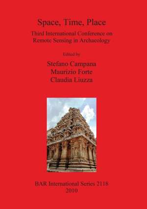
Space, Time, Place Bar Is2118: Bar S, cartea 2118

Autor Stefano Campana, Maurizio Forte, Claudia Liuzza
en Limba Engleză Paperback – 30 noi 2010
Proceedings of the Third International Conference on Remote Sensing in Archaeology held in Tiruchirappalli, Tamil Nadu, India, in August 2009. Contents: 1) Identifying, Mapping and Managing the Unmanageable: the implications of long term multi-sensor research into the archaeology of the Vale of Pickering, Yorkshire, England (D. Powlesland); 2) Pushing the envelope for satellite archaeology in Egypt: Quickbird feature detection, predictive site modeling, and thermal site signatures (S. Parcak); 3) High-resolution, multi-spectral satellite imagery and extensive archaeological prospection: A case study from Apulia, Italy and Kazanlak, Bulgaria (A. Sobotova and S.A. Ross); 4)Archaeological Remote Sensing Approach in Honduras. A Project for Cultural Heritage and Human Habitats Protection (J.G. Rejas et al.); 5) Integrating Sar Data and Hyperspectral Analysis for the Archaeological Survey of the Segeda City, Spain (J.G. Rejas et al.); 6) Wavelet based feature extraction and classification using Differential evolution (R.A. Alagu Raja et al.); 7) Remote Sensing of Ancient Maya Land Use Features at Caracol, Belize Related to Rainforest Canopy Structure (J.F. Weishampel et al.); 8) A Study for Analyzing the Impact of Wavelet Scaling on Satellite Data Classification (R.A. Alagu Raja et al.); 9) Western Han Landscape and Remote Sensing Applications at Xi'an (China) (M. Forte); 10) Terrestrial Remote Sensing in Archaeology (M. K. Tiwari); 11) Ground-Based Icing Condition Remote Sensing System Definition (M. K. Tiwari); 12) The Role of Aerial Photographs for Interpreting Iron Age Communities in Eastern Scotland (A. Brend); 13) Historic aerial photography for archaeology and heritage management (D. Cowley and L. Ferguson); 14 Towards an improved archaeological record through the use of airborne laser scanning (O. Risb); 15) LiDAR surveys of ancient landscapes in SW Germany: Assessment of archaeological features under forests and attempts for automatic pattern recognition (B. Sittler and J. Heinzel); 16) Application of multispectral remote sensing imagery in detection of enclosure walls of ancient settlements in South India (M.B. Rajani and S. Settar); 17) Interpreting Aerial Imagery - developing best practice (R. Palmer and D. Cowley); 18) Worldview: the importance of diversity in human (spatial) thinking (J. Van der Elst); 19) To reconcile water and fire? Some discourse issues on the interpretation of aerial images (W. Raczkowski); 20) Geomatics techniques for the 3D documentation and visualization of archaeological building (S. Campana et al.); 21) Digital Videography: Recording, Preserving, and Disseminating Archaeological Data (M.K. Tiwaria); 22) Digital Photo Documentation of murals at Brihadisvara Temple, Tanjavur: A tool for Art Historians (P.S. Sriraman); 23) The importance of precision in georeferencing demonstrated in the case study of archaeological GIS of Chitradurga, Karnataka (N.S. Nalinia and M.B. Rajani); 24) Semi-Automated Data Capture and Image Processing: new routes to interactive 3D models (K. Galor and D.H. Sanders); 25) CENOBIUM - Putting together the Romanesque Cloister Capitals of the Mediterranean Region (M. Dellepiane et al.); 26) The Virtual Museum of the Western Han Dynasty: 3D Documentation and Interpretation (M. Forte et al); 27) The 'Cultural Heritage Map of Apulia' Project (A. Buglione et al); 28) Remote Sensing and GIS Application in the Management and Conservation of Heritage properties at Agra (D. Dayalan); 29) Digital Documentation of Buddhist Sites in Tamil Nadu (D. Dayalan); 30) Conservation and Environmental Issues of Taj Mahal (D. Dayalan); 31) Use of Re-projected Photos in the Conservation of the Order's Castle in Cesis (Latvia) (A. Lapins); 32) Damage documentation in shore temple Mahabalipuram India (A. Padma); 33) Rethinking Cultural Heritage: The Interface between Cultural and Natural Heritage in Protected Areas - multi media project (N. McClean); 34) Culture of Excavation and Sculptural Geometry of the Ground (C. Pozzi); 34) A Forgotten Heritage: Impact Assessment Studies at Prehistoric Sites in Tamil Nadu (S. Pappu); 35) Heritage Management on Mattancherry Palace, Kochi, Kerala (India) - a case study (K.K. Ramamurthy and K.P. Mohandas); 36) Pattanam Excavations and Explorations 2007 & 2008: An Overview (P.J. Cherian); 37) Resolution Invariant Content Based Retrieval of Artistic Images (S. Bama et al.); 38) Socio-economic impact assessment as a strategic management tool for heritage sites (J. Kaminski); 39) Geospatial database of Ahichchatra using Geoinformatics (A. Tare et al.); 40) Geoarchaeology of Central West Coast of India (B.R. Manjunatha); 41) Detection and Excavation of Remains of Underground Burial by Geophysics and Remote Sensing Methods (J. Peng et al.); 42) Reconstruction possibilities of the ancient Roman villas - based on air photographs, geodesical and geophysical surveys (A. Firnigl); 43) Application of Integrated Digital Technologies in the Study of Settlement archaeology of Kausambi Region (S.S. Rai); 44) Investigating Megalithic Astronomy: the role of remote sensing (S.M. Menon and M.N. Vahia); 45) Chronological Aspects of Functioning of the Set of North Indian Early Mediaeval Epigraphic Sources (A.A. Stolyarov); 46) The Archaeology of Ritual Spaces: Satellite Images and Early Chalukyan Temples (H.P. Ray); 47) Recent Applications of Archaeological Remote Sensing in Cambodia: An Overview (D. Evans); 48) Archaeology and landscape features in Magnetometer Data (M. Posselt and I. Heske); 49) Digital Historical atlas of South India (F. Borne et al); 50) Documentation and visualization of archaeological data (A. Pillai et al.); 51) Mapping Archaeological Sites of Tamil Nadu (K. Rajan); 52) An "Encyclopedia of Archaeological Heritage"? The Encyclopedia of Life as a model for digital cultural atlases (S.A. Ross); 53) Computer tools for creation of electronic atlases of the historical monuments state (S.B. Shchigorets et al.); 54) Dynamical mapp
Citește tot Restrânge

Din seria Bar S

Preț: 103493 lei

Preț vechi: 113729 lei
-9% Nou

Puncte Express: 1552

Preț estimativ în valută:
19808 20645$ 16490£

Carte tipărită la comandă

Livrare economică 06-20 ianuarie 25

Preluare comenzi: 021 569.72.76

Specificații

ISBN-13: 9781407306599
ISBN-10: 1407306596
Pagini: 426
Greutate: 1.46 kg
Ediția:New.
Editura: British Archaeological Association
Seria Bar S