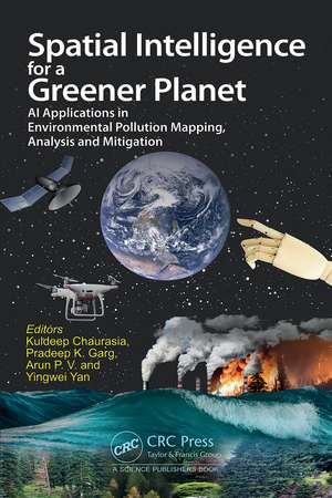
Spatial Intelligence for a Greener Planet: AI Applications in Environmental Pollution Mapping, Analysis and Mitigation
Editat de Kuldeep Chaurasia, Pradeep Kumar Garg, Arun P V, Yingewi Yanen Limba Engleză Hardback – 26 dec 2024
Preț: 798.23 lei
Preț vechi: 877.18 lei
-9% Nou
Puncte Express: 1197
Preț estimativ în valută:
152.76€ • 158.58$ • 127.38£
152.76€ • 158.58$ • 127.38£
Carte tipărită la comandă
Livrare economică 24 martie-07 aprilie
Preluare comenzi: 021 569.72.76
Specificații
ISBN-13: 9781032699981
ISBN-10: 1032699981
Pagini: 182
Ilustrații: 51
Dimensiuni: 156 x 234 mm
Greutate: 0.5 kg
Ediția:1
Editura: CRC Press
Colecția CRC Press
ISBN-10: 1032699981
Pagini: 182
Ilustrații: 51
Dimensiuni: 156 x 234 mm
Greutate: 0.5 kg
Ediția:1
Editura: CRC Press
Colecția CRC Press
Public țintă
Academic, Postgraduate, and Professional ReferenceCuprins
Preface. Acknowledgement. Geospatial Approaches for Environmental Pollution Mapping, Analysis and Mitigation. AI-Driven Approaches for Pollution Mapping and Mitigation. Groundwater Quality and Human Health Risk Assessment in India: Leveraging GeoAI for Environmental Monitoring. An Integrated Stratagem for Soil Pollution Assessment Utilizing Geospatial Tools and Machine Learning Approach. Statistical Approach to Evaluate Spatio-Temporal Relationship of Crop Residue Burning and Land Surface Temperature Over a Decade: Case Study of Punjab. Land Resource Mapping Framework for Delhi City using Urban Sprawl Modelling Methods. Environmental Intelligence: Mapping the Transforming Landscape through Artificial Intelligence and Satellite Data. Exploring the Integration of Machine Learning for Environmental Pollution and Flood Risk Assessment: A Comprehensive Review. Geo-AI for Urban Planning. Spectral Unmixing for Pollution Assessment in Water Bodies. Assessing the Trend of Carbon Storage Changes from 1990 to 2020 Based on Land Use Changes: A Comparative Study between Hong Kong and Shenzhen. Harnessing AI in Decision Support Systems for Comprehensive Pollution Management. Index. About the Editors.
Notă biografică
Dr. Kuldeep Chaurasia is an Associate Professor at School of Computer Science Engineering and Technology at Bennett University, Greater Noida, India. He earned his Ph.D. in Geomatics from Indian Institute of Technology Roorkee, and made significant contributions as a Research Scientist at the National Remote Sensing Centre, ISRO, Govt. of India, while working on various national projects. His expertise spans machine learning, deep learning in the geospatial domain, flood mapping, spatial data management, computer networks, and geo-blockchain. Dr. Chaurasia has published over 40 research papers in prestigious international journals and conferences, achieving significant breakthroughs and earning widespread respect in the academic community.
Prof. Pradeep K. Garg serves as a Professor in the Geomatics Engineering Group, Civil Engineering Department, IIT Roorkee. He earned his B.Tech and M.Tech from the University of Roorkee, and Ph.D. from the University of Bristol, UK. He has held key positions, including Head of Civil Engineering at IIT Roorkee and Vice Chancellor of Uttarakhand Technical University. Prof. Garg has published over 300 technical papers, authored several textbooks, and supervised numerous theses, significantly contributing to geospatial research and education.
Dr. Arun P. V. is an Assistant Professor in CSE and Institute Research Coordinator at the Indian Institute of Information Technology, Sri City, Chittoor. His research interests include deep learning, computer vision, explainable image and signal processing, remote sensing, and precision agriculture. He completed his Ph.D. at IIT Bombay, and postdoc at Ben-Gurion University, Israel. He served as a Research Scientist/Assoc Vice-president at Huawei R&D. He has published around 20 high-impact SCI-indexed journals, with about 300 citations. He leads projects funded by DST, ISRO, and other organizations, and consults for industries. He has reviewed top journals, and collaborated with various national and international agencies.
Dr. Yingwei Yan is a GIScientist working on volunteered geographic information, social sensing, and GIS educational research. He is the Director of Taught Graduate/Continuing Education and Training programmes in Applied GIS, and a member of the GIS Unit of the Department of Geography, National University of Singapore (NUS). He obtained his Ph.D. from the Department of Geography, NUS. He is also the Co-chair of the ISPRS Technical Commission Working Group on Human Behaviour and Spatial Interactions.
Descriere
With rapid advancements in AI, this book reveals how AI can be a powerful tool in reducing pollution and fostering sustainability. It highlights the integration of geospatial techniques with AI for enhancing capabilities in mapping, analysis, and mitigation of environmental pollution.
