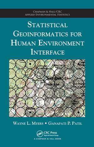
Statistical Geoinformatics for Human Environment Interface: Chapman & Hall/CRC Applied Environmental Statistics
Autor Wayne L. Myers, Ganapati P. Patilen Limba Engleză Hardback – 27 iul 2012
The first approach localizes thematic targets by treating space as a pattern of vicinities, with the pattern being a square grid and the placement of vicinities centrically referenced. The second approach explores human/environment interface as an abstraction through indicators, neutralizing the common conundrum of how to reconcile disparate spatial structures such as points, lines, and polygons. These paired paradigms enable:
- The capacity to cope with complexity
- Systematic surveillance
- Visualization and communication
- Preliminary prioritization
- Coupling of GIS and statistical software
- Avenues for automation
Din seria Chapman & Hall/CRC Applied Environmental Statistics
- 8%
 Preț: 439.04 lei
 - 9%
 Preț: 620.58 lei
 - 16%
 Preț: 242.08 lei
 -
 Preț: 446.96 lei
 -
 Preț: 435.98 lei
 -
 Preț: 360.52 lei
 - 11%
 Preț: 319.26 lei
 - 18%
 Preț: 1009.91 lei
 - 12%
 Preț: 325.34 lei
 - 12%
 Preț: 312.43 lei
 -
 Preț: 402.30 lei
 -
 Preț: 436.15 lei
 - 15%
 Preț: 595.12 lei
 - 12%
 Preț: 301.69 lei
 - 15%
 Preț: 604.75 lei
 - 12%
 Preț: 305.29 lei
 - 9%
 Preț: 832.08 lei
Preț: 492.52 lei
Preț vechi: 658.82 lei
-25% Nou
Puncte Express: 739
Preț estimativ în valută:
94.25€ • 102.35$ • 79.17£
94.25€ • 102.35$ • 79.17£
Comandă specială
Livrare economică 01-15 aprilie
Doresc să fiu notificat când acest titlu va fi disponibil:
Se trimite...
Preluare comenzi: 021 569.72.76
Specificații
ISBN-13: 9781420082876
ISBN-10: 1420082876
Pagini: 223
Ilustrații: 50 b/w images
Dimensiuni: 156 x 234 x 18 mm
Greutate: 0.52 kg
Ediția:1
Editura: CRC Press
Colecția Chapman and Hall/CRC
Seria Chapman & Hall/CRC Applied Environmental Statistics
ISBN-10: 1420082876
Pagini: 223
Ilustrații: 50 b/w images
Dimensiuni: 156 x 234 x 18 mm
Greutate: 0.52 kg
Ediția:1
Editura: CRC Press
Colecția Chapman and Hall/CRC
Seria Chapman & Hall/CRC Applied Environmental Statistics
Public țintă
ProfessionalCuprins
Statistical Geoinformatics of Human Linkage with Environment. Localizing Fixed-Form Features. Precedence and Patterns of Propensity. Raster-Referenced Cellular Codings and Map Modeling. Similar Settings as Clustered Components. Intensity Images and Map Multimodels. High Spots, Hot Spots, and Scan Statistics. Shape, Support, and Partial Polygons. Semisynchronous Signals and Variant Vicinities. Auto-Association: Local Likeness and Distance Decline. Regression Relations for Spatial Stations. Spatial Stations as Surface Samples. Shifting Spatial Structure. Synthesis and Synopsis with Allegheny Application. Index.
Notă biografică
Wayne L. Myers is Professor Emeritus of Forest Biometrics at the Pennsylvania State University. He is a Certified Forester of the Society of American Foresters, an Emeritus Member of the American Society of Photogrammetry and Remote Sensing, and a 40-year member of the American Statistical Association. Dr. Myers specializes in landscape analysis using GIS and remote sensing in conjunction with multivariate approaches to analysis and prioritization.
Ganapati P. Patil is Director of the Center for Statistical Ecology and Environmental Statistics and Distinguished Professor Emeritus of Mathematical and Environmental Statistics at the Pennsylvania State University. He is a fellow of the American Statistical Association, American Association of Advancement of Science, Institute of Mathematical Statistics, International Statistical Institute, Royal Statistical Society, International Association for Ecology, International Indian Statistical Association, Indian National Institute of Ecology, and Indian Society for Medical Statistics. Dr. Patil has served on panels for numerous international organizations, including the United Nations Environment Programme, U.S. National Science Foundation, U.S. Environmental Protection Agency, U.S. Forest Service, and U.S. National Marine Fisheries Service. He has authored/coauthored more than 300 research papers and more than 30 cross-disciplinary volumes.
Ganapati P. Patil is Director of the Center for Statistical Ecology and Environmental Statistics and Distinguished Professor Emeritus of Mathematical and Environmental Statistics at the Pennsylvania State University. He is a fellow of the American Statistical Association, American Association of Advancement of Science, Institute of Mathematical Statistics, International Statistical Institute, Royal Statistical Society, International Association for Ecology, International Indian Statistical Association, Indian National Institute of Ecology, and Indian Society for Medical Statistics. Dr. Patil has served on panels for numerous international organizations, including the United Nations Environment Programme, U.S. National Science Foundation, U.S. Environmental Protection Agency, U.S. Forest Service, and U.S. National Marine Fisheries Service. He has authored/coauthored more than 300 research papers and more than 30 cross-disciplinary volumes.
Recenzii
"… a refreshingly different approach to geospatial analysis, which has the potential to unify the disparate worlds of raster and vector GIS and to provide an integrated treatment of space and time. Readers accustomed to more traditional approaches to geoinformatics may find the book particularly thought provoking."
—Sally E. Goldin, Photogrammetric Engineering and Remote Sensing, December 2013
—Sally E. Goldin, Photogrammetric Engineering and Remote Sensing, December 2013
Descriere
Illustrating the interdisciplinary nature of geoinformatics, this book presents two paradigms (localization and multiple indicators) for the spatial analysis of human influences and environmental resources. The first approach localizes thematic targets by treating space as a pattern of vicinities, with the pattern being a square grid and the placement of vicinities centrically referenced. The second approach explores human/environment interface as an abstraction through indicators, neutralizing the common conundrum of how to reconcile disparate spatial structures such as points, lines, and polygons.
