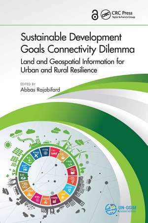
Sustainable Development Goals Connectivity Dilemma: Land and Geospatial Information for Urban and Rural Resilience
Editat de Abbas Rajabifarden Limba Engleză Paperback – 14 oct 2024
Large-scale migration from rural to urban areas, and between countries, affects sustainable development at local, national, and regional levels. To strengthen urban and rural resilience to global challenges, Sustainable Development Goals Connectivity Dilemma: Land and Geospatial Information for Urban and Rural Resilience, brings together leading international geospatial experts to analyze the role of land and geospatial data infrastructures and services for achieving the United Nations' Sustainable Development Goals (SDGs). While the goals outlined in the 2030 Agenda have been longstanding aspirations worldwide, the complexity and connectivity between social, economic, environmental, and governance challenges are changing with large-scale urbanization and population growth. Structured in 5 parts, the themes and objectives of the book are in line with the critical challenges, gaps, and opportunities raised at all UN-GGIM events and UN-GGIM Academic Network forums. Through the different perspectives of scholars, industry actors, and policy-makers, this book provides interdisciplinary analysis and multisectoral expertise on the interconnection between the SDGs, geospatial information, and urban and rural resilience.
Sustainable Development Goals Connectivity Dilemma: Land and Geospatial Information for Urban and Rural Resilience is an essential reference for researchers, industry professionals, and postgraduate students in fields such as geomatics, land administration, urban planning, GIS, and sustainable development. It will also prove a vital resource for environmental protection specialists, government practitioners, UN-GGIM delegates, and geospatial and land administration agencies.
Features:
- Introduces a holistic and new approach to sustainable development
- Brings together social, economic, and environmental dimensions of sustainability
- Highlights the significance and the role of geospatial information in sustainable development
- Examines urban and rural interdependencies in the context of strengthening resilience
- Written by experts with diverse academic and professional backgrounds who examine connectivity and develop strategic pathways
Preț: 317.38 lei
Preț vechi: 351.60 lei
-10% Nou
Puncte Express: 476
Preț estimativ în valută:
60.73€ • 64.94$ • 50.64£
60.73€ • 64.94$ • 50.64£
Carte tipărită la comandă
Livrare economică 17 aprilie-01 mai
Preluare comenzi: 021 569.72.76
Specificații
ISBN-13: 9781032920931
ISBN-10: 1032920939
Pagini: 374
Ilustrații: 66
Dimensiuni: 156 x 234 mm
Greutate: 0.69 kg
Ediția:1
Editura: CRC Press
Colecția CRC Press
Locul publicării:Boca Raton, United States
ISBN-10: 1032920939
Pagini: 374
Ilustrații: 66
Dimensiuni: 156 x 234 mm
Greutate: 0.69 kg
Ediția:1
Editura: CRC Press
Colecția CRC Press
Locul publicării:Boca Raton, United States
Public țintă
AcademicCuprins
Introduction. SDGs Roadmap: Setting the Scene. Spatial Enablement for Sustainable Development. Geospatial Information Enhancing SDG Connectivity. Links between Urban and Rural Resilience for Sustainability. Legal, Policies and Institutional Components. Technical and Enabling Tools. Way Forward and Future Direction.
Notă biografică
Prof Abbas Rajabifard is the Head of Department of Infrastructure Engineering at The University of Melbourne and the Chair UN-GGIM Academic Network. He is also Director of the Centre for Spatial Data Infrastructures & Land Administration (CSDILA).Prof Rajabifard is a member of Academic Board. He was President of the GSDI Association (2009-2012), Vice Chair of Working Group 3 of the United Nations supported Permanent Committee on GIS Infrastructure for Asia and the Pacific (PCGIAP), is a member of ICA-Spatial Data Standard Commission, and is a member of Victorian Spatial Council. He has been an Executive Board member and national representative to the PCGIAP (1994-1998), member of International Steering Committee for Global Mapping Project (1997-2001) and a member of the UN-ESCAP Group of Experts to develop Guidelines on GIS Standardisation for Asia-Pacific (1995). Prof Rajabifard has active research in the areas of SDI, Land Administration and land management, spatial enablement, spatial enabled government and societies, disaster management, 3D platforms and virtual jurisdictions.
Descriere
To strengthen urban and rural resilience to global challenges, this book brings together global leading geospatial experts, industry actors, and policy-makers to analyse the role of geospatial data infrastructures and services for achieving the United Nations' Sustainable Development Goals and providing interdisciplinary and multisectoral analysis.
