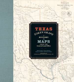
Texas Takes Shape: A History in Maps from the General Land Office
Autor Mark Lambert, James Harkins, Brian A. Stauffer, Patrick Walshen Limba Engleză Hardback – iul 2025
The Texas General Land Office’s map collection contains over 45,000 maps, some dating from the sixteenth century, making it one of the most important cartographic archives in Texas. As products and agents of history drawn by cartographers with motives and means as diverse as the places they document, maps provide a unique perspective on geopolitical, cultural, and economic processes. The maps of the GLO offer key insights into Texas’s sprawling history. They speak to issues of changing borders, social and political upheaval, and questions of sovereignty and power.
Texas Takes Shape offers an illuminating selection from the GLO archive: over one hundred maps that tell—and sometimes obscure—the stories of European colonization, Spanish and Mexican rule, the Republic of Texas, and the modern US state. There are maps here of every scale, from the hemispheric visions of European explorers to individual survey plats. Accompanying essays offer fascinating lessons on topics ranging from Indigenous cartography to military and railroad mapmaking and frontier surveys. Artful and informative, Texas Takes Shape examines a unique place through the eyes and imaginations of those who sought to govern it, profit from it, understand it, and call it home.
Preț: 333.70 lei
Nou
Puncte Express: 501
Preț estimativ în valută:
63.85€ • 66.86$ • 52.96£
63.85€ • 66.86$ • 52.96£
Carte nepublicată încă
Doresc să fiu notificat când acest titlu va fi disponibil:
Se trimite...
Preluare comenzi: 021 569.72.76
Specificații
ISBN-13: 9781477330920
ISBN-10: 1477330925
Pagini: 360
Dimensiuni: 279 x 305 mm
Greutate: 0.45 kg
Editura: University of Texas Press
Colecția University of Texas Press
ISBN-10: 1477330925
Pagini: 360
Dimensiuni: 279 x 305 mm
Greutate: 0.45 kg
Editura: University of Texas Press
Colecția University of Texas Press
Notă biografică
Mark Lambert is the Senior Deputy Director for Heritage at the Texas General Land Office. James Harkins is the Deputy Director of Archives and Records. Brian A. Stauffer is the Director of Public Services and the author of Victory on Earth or in Heaven: Mexico’s Religionero Rebellion. Patrick Walsh is a research specialist.
Cuprins
- List of Maps
- Foreword by Dawn Buckingham
- Preface
- Introduction
- Part I. Defining Texas
- Chapter 1. Mapping the New World: An Age of Discovery
- Beyond the Neatline—Uncovering the Base Layer: Indigenous Cartography in North America
- Chapter 2. Competing Empires: Maps as Knowledge and Power, 1671–1830
- Beyond the Neatline—Compasses and Crucifixes: Priests and Friars in the Mapping of Spanish North America
- Chapter 3. Mapping Mexico: Uneven Geography
- Beyond the Neatline—From the “Dead Desert” to the “Wonderland of Agriculture and Opportunity”: Mapping the Nueces Strip 000:
- Chapter 4. The Lone Star Rises: Maps of the Republic of Texas, 1835–1846
- Beyond the Neatline—”A continued succession of abrupt sinuousities”: The Joint Boundary Commission and the Republic of Texas, 1838–1841
- Chapter 5. “The Republic of Texas is no more”: The Lone Star State Takes Shape
- Beyond the Neatline—The Art and Cartography of Eltea Armstrong
- Part II. Developing Texas
- Chapter 6. Contested Frontier: Pathfinders, Soldiers, and Military Maps
- Beyond the Neatline—Land for Military Service: Bounty, Donation, and Confederate Scrip
- Chapter 7. Connecting a Continent: Texas Land and the Expanding American Railroad System
- Beyond the Neatline—Frontier Surveying in Texas
- Chapter 8. All Boundaries Are Local: GLO County Maps
- Beyond the Neatline—Drawing Conclusions: Manuscript Cartouches in the GLO
- Chapter 9. The Growth and Urbanization of Texas: City Maps at the GLO
- Beyond the Neatline—”Complete Success” to Obsolescence: The Photographic Bureau of the GLO, 1861–1874
- Conclusions. Texas History on the Digital Frontier: Improving Access through Preservation
- Acknowledgments
- Notes
- Index
- About the Authors
Recenzii
Texas Takes Shape is a beautifully illustrated and designed book of the most comprehensive map collection relating to Texas. Texas is unique in the Union in that it retained ownership of its public land, and this book makes clear that the creative and judicious use of that land is, in many ways, the creation story of present-day Texas.
Texas Takes Shape is an astoundingly beautiful work of visual history. Surveying the Texas past through more than a hundred historical maps, this collection offers readers a remarkable new window into how individuals and empires have imagined, explored, and fought over the lands that became Texas. For anyone interested in understanding how maps have literally shaped the modern landscape of Texas, this is an absolute must-read.
Texas Takes Shape is both a guide to the extensive and ever-increasing map collection of the Texas General Land Office and a remarkable study of maps of Texas and the Southwest. This handsome and colorful volume is a pleasure for the eye of the book collector but also a treat for the reader who wants to understand how maps framed understandings of the state and the region over several centuries.
Descriere
A comprehensive volume on historical mapping in Texas.
