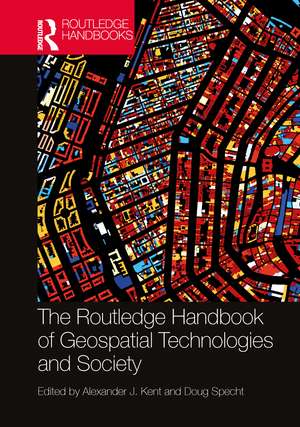
The Routledge Handbook of Geospatial Technologies and Society
Editat de Alexander J. Kent, Doug Spechten Limba Engleză Hardback – 17 aug 2023
The ability of geospatial data to transform knowledge in contemporary and future societies forms an important theme running throughout the entire volume. Contributors reflect on the changing role of geospatial technologies in society and highlight new applications that represent transformative directions in society and point towards new horizons. Furthermore, they encourage dialogue across disciplines to bring new theoretical perspectives on geospatial technologies, from neurology to heritage studies.
The international contributions from leading scholars and influential practitioners that constitute the Handbook provide a wealth of critical examples of these technologies as agents of change in societies around the globe. The book will appeal to advanced undergraduates and practitioners interested or engaged in their application worldwide.
Preț: 1147.08 lei
Preț vechi: 1845.14 lei
-38% Nou
Puncte Express: 1721
Preț estimativ în valută:
219.50€ • 226.44$ • 183.17£
219.50€ • 226.44$ • 183.17£
Carte tipărită la comandă
Livrare economică 26 martie-09 aprilie
Preluare comenzi: 021 569.72.76
Specificații
ISBN-13: 9780367428877
ISBN-10: 0367428873
Pagini: 694
Ilustrații: 564
Dimensiuni: 174 x 246 mm
Greutate: 1.62 kg
Ediția:1
Editura: Taylor & Francis
Colecția Routledge
Locul publicării:Oxford, United Kingdom
ISBN-10: 0367428873
Pagini: 694
Ilustrații: 564
Dimensiuni: 174 x 246 mm
Greutate: 1.62 kg
Ediția:1
Editura: Taylor & Francis
Colecția Routledge
Locul publicării:Oxford, United Kingdom
Public țintă
Postgraduate and Undergraduate AdvancedCuprins
Introduction Part I: Origins and Perspectives of Geospatial Technologies 1. Latitude, Longitude, and Geospatial Technologies to 1884 2. The Photo-mechanical Era of Cartography: A Recollection 3. The Roots of GIS 4. Positivism, Power, and Critical GIS 5. Geospatial Standards: An Example from Agriculture 6. Technology, Aesthetics, and Affordances 7. Race and Mapping 8. Feminist Geography and Geospatial Technologies 9. Mapping the Subaltern 10. Geospatial Technologies and Rural and Indigenous Spatial Knowledges 11. Social Constructivism and Geospatial Technologies: Neogeography, Big Data, and Deep Maps Part II: Understanding Geospatial Technologies 12. Mobile Mapping 13. Airborne and Ground-based Laser Scanning 14. Drones and Unmanned Aerial Vehicles (UAVs) 15. Airborne Photogrammetric Mapping 16. Digital Elevation Models (DEMs) 17. Extended Realities (XR) 18. Free and Open-Source Software for Geospatial Applications (FOSS4G) 19. APIs, Coding and Language for Geospatial Technologies 20. Spatial Analysis and Modelling 21. The Geovisualisation of Big Data 22. Machine Learning and Geospatial Technologies 23. Artificial Intelligence for Geospatial Applications Part III: Applications of Geospatial Technologies 24. Location Matters: Trends in Location-Based Services 25. Mapping Buildings and Cities 26. Underground Mapping 27. Geospatial Technology and Food Security: Forging a Four-Dimensional Partnership 28. The Past, Present and Future of Technologies for Improved Water Management 29. Ocean Mapping: Taxonomies of the Fluid Geospatial 30. Geospatial Technologies in Transport: Shaping and Recording Everyday Lived Experiences 31. Geospatial Technologies in Electrical Systems 32. Geospatial Technologies and Public Health 33. Applications of GIScience to Disease Mapping: A COVID-19 Case Study 34. Geosurveillance and Society 35. Geospatial Technology and Journalism in a Post-truth World 36. Advancing Sustainability Research through Geospatial Technology and Social Media 37. Crisis and Hazard Mapping 38. Humanitarian Relief and Geospatial Technologies 39. Geospatial Technology and the Sustainable Development Goals (SDGs) 40. Maps of Time 41 Geospatial Technologies in Archaeology 42. Mapping Planetary Bodies Part IV: New Ontologies and Strategies for Geospatial Technologies 43. Toward the Democratization of Geospatial Data: Evaluating Data Decisioning Practices 44. Developing Geospatial Strategies 45. Map Thinking Across the Life Sciences 46. Spatial Anthropology: Understanding Deep Mapping as a Form of Visual Ethnography 47. The Quantum Turn for Geospatial Technologies and Society 48. The Locus Charter: Towards Ethical Principles and Practice for Location Data Services
Notă biografică
Alexander J. Kent is Honorary Reader in Cartography and Geographic Information Science at Canterbury Christ Church University, UK, and leads the Coastal Connections project for World Monuments Fund and English Heritage.
Doug Specht is a Chartered Geographer and a Reader in the School of Media and Communication at the University of Westminster, UK.
Doug Specht is a Chartered Geographer and a Reader in the School of Media and Communication at the University of Westminster, UK.
Descriere
This book provides a relevant and comprehensive reference point for research and practice in this dynamic field. It offers detailed explanations of geospatial technologies, provides critical reviews and appraisals of their application in society within international and multi-disciplinary contexts as agents of change.
