The Use of Remote Sensing in the Modeling of Forest Productivity: Forestry Sciences, cartea 50
Autor Gholz Editat de Henry L. Gholz, Haruhisa Shimodaen Limba Engleză Hardback – 31 dec 1996
Din seria Forestry Sciences
- 18%
 Preț: 958.56 lei
 -
 Preț: 388.13 lei
 - 15%
 Preț: 644.18 lei
 - 18%
 Preț: 1848.16 lei
 - 18%
 Preț: 2105.44 lei
 -
 Preț: 390.25 lei
 - 18%
 Preț: 950.33 lei
 -
 Preț: 390.84 lei
 - 18%
 Preț: 1226.73 lei
 -
 Preț: 383.50 lei
 - 18%
 Preț: 950.33 lei
 - 18%
 Preț: 1234.77 lei
 - 15%
 Preț: 637.28 lei
 -
 Preț: 387.58 lei
 -
 Preț: 385.62 lei
 - 18%
 Preț: 952.72 lei
 - 18%
 Preț: 1219.63 lei
 - 18%
 Preț: 1229.73 lei
 - 15%
 Preț: 647.59 lei
 - 18%
 Preț: 949.73 lei
 - 18%
 Preț: 946.10 lei
 - 18%
 Preț: 2762.55 lei
 - 15%
 Preț: 644.95 lei
 - 18%
 Preț: 1840.26 lei
 - 18%
 Preț: 1228.15 lei
 - 18%
 Preț: 1236.69 lei
 - 15%
 Preț: 639.73 lei
 - 18%
 Preț: 1847.21 lei
Preț: 588.97 lei
Preț vechi: 692.91 lei
-15% Nou
Puncte Express: 883
Preț estimativ în valută:
112.70€ • 117.97$ • 93.80£
112.70€ • 117.97$ • 93.80£
Carte tipărită la comandă
Livrare economică 31 martie-14 aprilie
Preluare comenzi: 021 569.72.76
Specificații
ISBN-13: 9780792342786
ISBN-10: 079234278X
Pagini: 323
Dimensiuni: 165 x 244 x 20 mm
Greutate: 0.71 kg
Editura: Kluwer Academic Publishers
Seria Forestry Sciences
ISBN-10: 079234278X
Pagini: 323
Dimensiuni: 165 x 244 x 20 mm
Greutate: 0.71 kg
Editura: Kluwer Academic Publishers
Seria Forestry Sciences
Recenzii
`The approaches discussed in the book are not limited to forests only they can easily be utilized in evaluation of other types of ecosystems. This is why the book will certainly be highly valuable for a wide range of scientists and land managers.' Biologia Plantarum, 40:4 (1997/8)
Cuprins
Preface. Section One: Stand-Level Analyses. 1. Assessing Leaf Area and Canopy Biochemistry of Florida Pine Plantations Using Remote Sensing; H.L. Gholz, et al. 2. Modeling Radiative Transfer Through Forest Canopies: Implications for Canopy Photosynthesis and Remote Sensing; T. Nilson, J. Ross. 3. Estimating Forest Canopy Characteristics as Inputs for Models of Forest Carbon Exchange by High Spectral Resolution Remote Sensing; M.E. Martin, J.D. Aber. Section Two: Landscape/Regional-Level Analyses. 4. Detecting Structural and Growth Changes in Woodlands and Forests: The Challenge for Remote Sensing and the Role of Geometric-Optical Modeling; D.L.B. Jupp, J. Walker. 5. Integrating Remotely Sensed Spatial Heterogeneity with a Three-Dimensional Forest Succession Model; J.F. Weishampel, et al. 6. Combining Remote Sensing and Forest Ecosystem Modeling: An Example Using the Regional HydroEcological Simulation System (RHESSys); J.C. Coughlan, J.L. Dungan. 7. Forest Vegetation Classification and Biomass Estimation Based on Landsat TM Data in a Mountainous Region of West Japan; N.J. Lee, K. Nakane. 8. Forest Structure and Productivity Along the Oregon Transect; D.L. Peterson. 9. Use of Remote Sensing to Model Land Use Effects on Carbon Flux in Forests of the Pacific Northwest, USA; D.O. Wallin, et al. Section Three: Global-Level Analyses. 10. Global Biospheric Monitoring with Remote Sensing; S.N. Goward, D.G. Dye. 11. Energy Conversion and Use in Forests: An Analysis of Forest Production in Terms of Radiation Utilisation Efficiency (epsilon); J.J. Landsberg, et al. Color Plates. Index.
Textul de pe ultima copertă
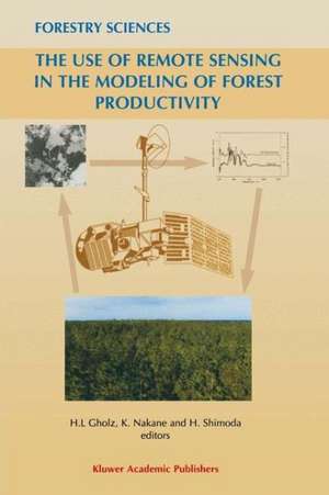
This book explores how remote sensing and computer modeling can be combined to estimate changes in the carbon storage, or productivity, of forests - from the level of the leaf to the level of the globe. Land managers, researchers, policy makers and students will all find stimulating discussions among an international set of experts at the cutting edge of the interface between science, technology and management.
