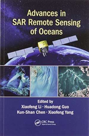
Advances in SAR Remote Sensing of Oceans
Editat de Xiaofeng Li, Huadong Guo, Kun-Shan Chen, Xiaofeng Yangen Limba Engleză Paperback – 30 iun 2020
Written by leading experts in the field, and divided into four sections, the book presents the basic principles of radar backscattering from the ocean surface; introduces the recent progresses in SAR remote sensing of dynamic coastal environment and management; discusses the state-of-the-art methods to monitor parameters or phenomena related to the dynamic ocean environment; and deals specifically with new techniques and findings of marine atmospheric boundary layer observations.
Advances in SAR Remote Sensing of Oceans is a very comprehensive and up-to-date reference intended for use by graduate students, researchers, practitioners, and R&D engineers working in the vibrant field of oceans, interested to understand how SAR remote sensing can support oceanography research and applications.
| Toate formatele și edițiile | Preț | Express |
|---|---|---|
| Paperback (1) | 316.96 lei 6-8 săpt. | |
| CRC Press – 30 iun 2020 | 316.96 lei 6-8 săpt. | |
| Hardback (1) | 1334.28 lei 6-8 săpt. | |
| CRC Press – 21 noi 2018 | 1334.28 lei 6-8 săpt. |
Preț: 316.96 lei
Preț vechi: 374.00 lei
-15% Nou
Puncte Express: 475
Preț estimativ în valută:
60.66€ • 65.87$ • 50.95£
60.66€ • 65.87$ • 50.95£
Carte tipărită la comandă
Livrare economică 22 aprilie-06 mai
Preluare comenzi: 021 569.72.76
Specificații
ISBN-13: 9780367570842
ISBN-10: 036757084X
Pagini: 362
Dimensiuni: 156 x 234 mm
Greutate: 0.67 kg
Ediția:1
Editura: CRC Press
Colecția CRC Press
Locul publicării:Boca Raton, United States
ISBN-10: 036757084X
Pagini: 362
Dimensiuni: 156 x 234 mm
Greutate: 0.67 kg
Ediția:1
Editura: CRC Press
Colecția CRC Press
Locul publicării:Boca Raton, United States
Public țintă
Academic and Professional Practice & DevelopmentCuprins
Section I Background Chapter 1 Introduction to Synthetic Aperture Radar Chapter 2 Radar Scattering of Ocean Surfaces with Anisotropic Ocean Spectrum Using NMM3D Simulations Chapter 3 Sensitivity Analysis of Bistatic Scattering from Sea Surface at L-band Section II Coast Zone and Man-Made Object Detection Chapter 4 Oil Fields Observation Using Polarimetric SAR Chapter 5 Oil Spills Detection and Classification with Fully and Compact Polarimetric SAR Chapter 6 Ocean Surface Pollutant Monitoring and Trajectory Simulation Chapter 7 Exposed Intertidal Flats Monitoring by Polarimetric SAR Chapter 8 SAR Detection of Ocean Bottom Topography Chapter 9 Ship Characterization and Analyses in Sentinel-1 Imagery Based on a Large and Open Dataset Section III Ocean Environment Monitoring Chapter 10 SAR Remote Sensing of Internal Solitary Waves in the Ocean Chapter 11 Joint Retrieval of Directional Ocean Wave Spectra from SAR and RAR Chapter 12 Mediterranean Eddy Statistics Based on Multiple SAR Imagery Chapter 13 Mode-2 Internal Solitary Waves in the Ocean Section IV Marine Atmospheric Boundary Layer Observations Chapter 14 Oceanographic Aspect of Tropical Cyclone Wind and Wave Remote Sensing Chapter 15 Application of SAR-Derived Sea Surface Winds in Data Assimilation Chapter 16 The Effect of Rain on Radar Backscattering from the Ocean
Notă biografică
Xiaofeng Li received his Ph.D. degree in physical oceanography from North Carolina State University, Raleigh in 1997. Since 1997, he has been with the National Environmental Satellite, Data, and Information Service (NESDIS), National Oceanic Atmospheric Administration (NOAA), College Park, MD. He is involved in developing many operational satellite ocean remote sensing products at NESDIS. He is the author of more than 100 peer-reviewed publications. Dr. Li currently serves as the Associate Editor of the International Journal of Remote Sensing and Remote Sensing and the Senior Associate Editor for Remote Sensing. He is also an Editorial Board Member of the International Journal of Digital Earth. He was appointed as an “Overseas Expert” by the Chinese Academy of Sciences in 2014 and won the NOAA/NESDIS Center for Satellite Applications and Research’s Individual Award for Science and the Len Curtis Award from the Remote Sensing and Photogrammetry Society in 2015.
Guo Huadong is an Academician of the Chinese Academy of Sciences, foreign member of Russian Academy of Sciences, and a Fellow of the Academy of Sciences for the Developing World (TWAS). He presently serves as President of the International Society for Digital Earth (ISDE), Scientific Committee Member of the Integrated Research on Disaster Risk (IRDR) programme, President of the Expert Committee of the IRDR China National Committee, President of the ICSU Committee on Data for Science and Technology (CODATA), and Editor-in-Chief of the International Journal of Digital Earth (IJDE). Prof. Guo has focused his research on remote sensing science and applications over the past 30 years and has published more than 300 papers and 15 books, and is the principal awardee of 13 national and CAS prizes.
Kun-Shan Chen received his Ph.D. degree in electrical engineering from the University of Texas at Arlington in 1990. From 1992 to 2014, he was with the faculty of National Central University, Taoyuan, Taiwan, where he held a Distinguished Chair Professorship from 2008 to 2014. He joined the Institute of Remote Sensing and Digital Earth, Chinese Academy of Sciences, in 2014, where he is National Distinguished professor. He has authored or co-authored over 130 referred journal papers, contributed eight book chapters, and authored two books. He has been an Associate Editor of the IEEE Transactions On Geoscience and Remote Sensing since 2000, and IEEE JSTARS since 2008. He was the Founding Deputy Editor-in-Chief of the IEEE Journal Of Selected Topics In Applied Earth Observations And Remote Sensing from 2008 to 2010. He has been a member of the Editorial Board of the Proceedings of The IEEE since 2014.
Xiaofeng Yang received his Ph.D. degree in cartography and geographic information systems from the Institute of Remote Sensing Applications (IRSA), Chinese Academy of Sciences (CAS), Beijing, in 2010. From 2009 to 2010, he was a Visiting Research Scientist with the Department of Atmospheric and Oceanic Science, University of Maryland, College Park. From 2010 to 2012, he was an Assistant Professor with IRSA, CAS. From 2013 to 2015, he was an Associate Professor with the Institute of Remote Sensing and Digital Earth, CAS. He is currently a Full Professor with the State Key Laboratory of Remote Sensing Science, RADI, CAS.
Descriere
SAR remote sensing for ocean and coast monitoring has become a very popular area of geoscience and remote sensing research in recent years. This book is focused on ocean dynamical studies of sea surface phenomena, air-sea interactions, anthropogenic object detection and radar imaging mechanisms.
