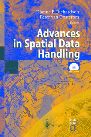
Advances in Spatial Data Handling: 10th International Symposium on Spatial Data Handling
Editat de Dianne Richardson, Peter van Oosteromen Limba Engleză Paperback – 13 noi 2012
| Toate formatele și edițiile | Preț | Express |
|---|---|---|
| Paperback (1) | 1285.45 lei 6-8 săpt. | |
| Springer Berlin, Heidelberg – 13 noi 2012 | 1285.45 lei 6-8 săpt. | |
| Hardback (1) | 1291.89 lei 6-8 săpt. | |
| Springer Berlin, Heidelberg – 8 iul 2002 | 1291.89 lei 6-8 săpt. |
Preț: 1285.45 lei
Preț vechi: 1606.82 lei
-20% Nou
Puncte Express: 1928
Preț estimativ în valută:
245.97€ • 256.31$ • 203.66£
245.97€ • 256.31$ • 203.66£
Carte tipărită la comandă
Livrare economică 03-17 aprilie
Preluare comenzi: 021 569.72.76
Specificații
ISBN-13: 9783642628597
ISBN-10: 3642628591
Pagini: 576
Ilustrații: XII, 562 p.
Dimensiuni: 155 x 235 x 30 mm
Greutate: 0.8 kg
Ediția:Softcover reprint of the original 1st ed. 2002
Editura: Springer Berlin, Heidelberg
Colecția Springer
Locul publicării:Berlin, Heidelberg, Germany
ISBN-10: 3642628591
Pagini: 576
Ilustrații: XII, 562 p.
Dimensiuni: 155 x 235 x 30 mm
Greutate: 0.8 kg
Ediția:Softcover reprint of the original 1st ed. 2002
Editura: Springer Berlin, Heidelberg
Colecția Springer
Locul publicării:Berlin, Heidelberg, Germany
Public țintă
ResearchCuprins
A Decision Tree for Multi-Layered Spatial Data.- Computational and Visual Support for Geographical Knowledge Construction: Filling in the Gaps Between Exploration and Explanation.- Polygonization of Point Clusters through Cluster Boundary Extraction for Geographical Data Mining.- The Impact of Filtering on Spatial Continuous Queries.- An Object Model for Geologic Map Information.- Indexing and Browsing Digital Maps with Intelligent Thumbnails.- Modelling and Manipulating Multiple Representations of Spatial Data.- Terrain Modelling Based on Contours and Slopes.- Siting Observers on Terrain.- An Agent-Based Framework for Polygonal Subdivision Generalisation.- Template Matching in Support of Generalisation of Rural Buildings.- Minimising Positional Errors in Line Simplification Using Adaptive Tolerance Values.- A New Merging Process for Data Integration Based on the Discrete Fréchet Distance.- Above-Ground Biomass Estimation of Successional and Mature Forests Using TM Images in the Amazon Basin.- Grid Computing for Real Time Distributed Collaborative Geoprocessing.- The Balance Between Geometry and Topology.- STOQL: An ODMG-Based Spatio-Temporal Object Model and Query Language.- A Semantics for Version Queries in GIS Databases.- A Differential Spatio-temporal Model: Primitives and Operators.- A QTM-based Algorithm for Generation of the Voronoi Diagram on a Sphere.- The Dimensional Model: A Framework to Distinguish Spatial Relationships.- A Quantitative Description of Spatial Configurations.- Implementing Topological Predicates for Complex Regions.- Route Specifications with a Linear Dual Graph.- Projecting a Regular Grid onto a Sphere or Ellipsoid.- Creating Spatial Information: Commissioning the UK Land Cover Map 2000.- A Methodology for Updating Geographic DatabasesUsing Map Versions.- Revealing Uncertainty in Maps of Glacial Lake Algonquin.- Spatio-Temporal Methods to Reduce Data Uncertainty in Restricted Movement on a Road Network.- Quantifying Uncertainty of Digital Elevation Models Derived from Topographic Maps.- Detecting Building Alignments for Generalisation Purposes.- Temporal GIS and Statistical Modelling of Personal Lifelines.- Urban Simulation Using Neural Networks and Cellular Automata for Land Use Planning.- Creation of the Anamorphoses-Based 3D-Pyramidal Block-Diagrams.- Schematic Networks: An Algorithm and its Implementation.- Developing Lightweight, Data-Driven Exploratory Geo-visualisation Tools for the Web.- GAP-Tree Extensions Based on Skeletons.- Improving Automated Generalisation for On-Demand Web Mapping by Multiscale Databases.- Map Samples to Help GI Users Specify their Needs.- Representation of Map Objects with Semi-Structured Data Models.
Caracteristici
The book brings together the science community that works in the area Geographic Information Systems and Remote Sensing
