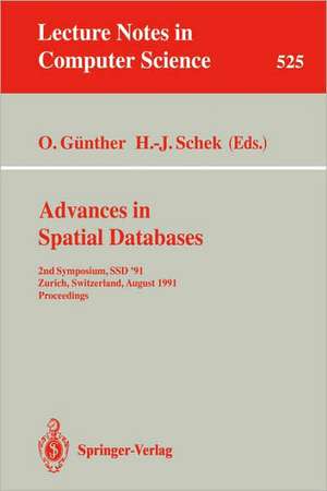
Advances in Spatial Databases: 2nd Symposium, SSD '91, Zurich, Switzerland, August 28-30, 1991. Proceedings: Lecture Notes in Computer Science, cartea 525
Editat de Oliver Günther, Hans-Jörg Scheken Limba Engleză Paperback – 14 aug 1991
Din seria Lecture Notes in Computer Science
- 20%
 Preț: 1061.55 lei
 - 20%
 Preț: 307.71 lei
 - 20%
 Preț: 438.69 lei
 - 20%
 Preț: 645.28 lei
 -
 Preț: 410.88 lei
 - 15%
 Preț: 580.46 lei
 - 17%
 Preț: 427.22 lei
 - 20%
 Preț: 596.46 lei
 -
 Preț: 449.57 lei
 - 20%
 Preț: 353.50 lei
 - 20%
 Preț: 1414.79 lei
 - 20%
 Preț: 309.90 lei
 - 20%
 Preț: 583.40 lei
 - 20%
 Preț: 1075.26 lei
 - 20%
 Preț: 310.26 lei
 - 20%
 Preț: 655.02 lei
 - 20%
 Preț: 580.93 lei
 - 20%
 Preț: 340.32 lei
 - 18%
 Preț: 938.83 lei
 - 20%
 Preț: 591.51 lei
 - 15%
 Preț: 438.59 lei
 - 20%
 Preț: 337.00 lei
 -
 Preț: 389.48 lei
 - 20%
 Preț: 607.39 lei
 - 20%
 Preț: 1024.44 lei
 - 20%
 Preț: 579.30 lei
 - 20%
 Preț: 763.23 lei
 - 20%
 Preț: 453.32 lei
 - 20%
 Preț: 575.48 lei
 - 20%
 Preț: 585.88 lei
 - 20%
 Preț: 825.93 lei
 - 20%
 Preț: 763.23 lei
 - 17%
 Preț: 360.19 lei
 - 20%
 Preț: 1183.14 lei
 - 20%
 Preț: 340.32 lei
 - 20%
 Preț: 504.57 lei
 - 20%
 Preț: 369.12 lei
 - 20%
 Preț: 583.40 lei
 - 20%
 Preț: 343.62 lei
 - 20%
 Preț: 350.21 lei
 - 20%
 Preț: 764.89 lei
 - 20%
 Preț: 583.40 lei
 - 20%
 Preț: 649.49 lei
 - 20%
 Preț: 341.95 lei
 - 20%
 Preț: 238.01 lei
 - 20%
 Preț: 538.29 lei
Preț: 341.95 lei
Preț vechi: 427.44 lei
-20% Nou
Puncte Express: 513
Preț estimativ în valută:
65.43€ • 68.32$ • 54.15£
65.43€ • 68.32$ • 54.15£
Carte tipărită la comandă
Livrare economică 04-18 aprilie
Preluare comenzi: 021 569.72.76
Specificații
ISBN-13: 9783540544142
ISBN-10: 3540544143
Pagini: 488
Ilustrații: XII, 476 p.
Dimensiuni: 216 x 279 x 26 mm
Greutate: 0.68 kg
Ediția:1991
Editura: Springer Berlin, Heidelberg
Colecția Springer
Seria Lecture Notes in Computer Science
Locul publicării:Berlin, Heidelberg, Germany
ISBN-10: 3540544143
Pagini: 488
Ilustrații: XII, 476 p.
Dimensiuni: 216 x 279 x 26 mm
Greutate: 0.68 kg
Ediția:1991
Editura: Springer Berlin, Heidelberg
Colecția Springer
Seria Lecture Notes in Computer Science
Locul publicării:Berlin, Heidelberg, Germany
Public țintă
ResearchCuprins
Geometric algorithms and their complexity.- The combination of spatial access methods and computational geometry in geographic database systems.- FI-Quadtree: a new data structure for content-oriented retrieval and fuzzy search.- The importance of metaknowledge for environmental information systems.- An extended object-oriented data model for large image bases.- On the integration of GIS and remotely sensed data: Towards an integrated system to handle the large volume of spatial data.- Towards a toolbox for geographic user interfaces.- The management of the ambiguities in a graphical query language for geographical information systems.- Geo-SAL: A query language for spatial data analysis.- Reasoning about binary topological relations.- Topological constraints: A representational framework for approximate spatial and temporal reasoning.- Grow and post index trees: Role, techniques and future potential.- The spatial locality and a spatial indexing method by dynamic clustering in hypermap system.- Properties of geographic data: Requirements for spatial access methods.- Efficient processing of spatial queries in line segment databases.- The performance of object decomposition techniques for spatial query processing.- Performance comparison of segment access methods implemented on top of the buddy-tree.- Extending a DBMS with spatial operations.- The use of a complex object language in geographic data management.- Motion in a geographical database system.- A spatial index for convex simplicial complexes in d dimensions.- An algorithm for computing the overlay of k-dimensional spaces.- Encoding and manipulating pictorial data with S+-trees.- Exploiting extensible DBMS in integrated geographic information systems.- Storage management in geographic information systems.- Pannel:Why does GIS industry ignore university research?.
