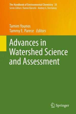
Advances in Watershed Science and Assessment: The Handbook of Environmental Chemistry, cartea 33
Editat de Tamim Younos, Tammy E. Pareceen Limba Engleză Hardback – 4 mar 2015
This book will be of interest to graduate students and researchers involved in watershed science and environmental studies. Equally, it will serve as a valuable guide to experts in government agencies who are concerned with water-availability and water-quality issues, and engineers and other professionals involved in the design of land- and water-monitoring systems.
| Toate formatele și edițiile | Preț | Express |
|---|---|---|
| Paperback (1) | 945.30 lei 6-8 săpt. | |
| Springer International Publishing – 6 oct 2016 | 945.30 lei 6-8 săpt. | |
| Hardback (1) | 951.47 lei 6-8 săpt. | |
| Springer International Publishing – 4 mar 2015 | 951.47 lei 6-8 săpt. |
Din seria The Handbook of Environmental Chemistry
- 18%
 Preț: 1819.46 lei
 - 18%
 Preț: 1827.32 lei
 - 18%
 Preț: 2102.76 lei
 - 18%
 Preț: 2089.35 lei
 - 18%
 Preț: 2481.57 lei
 - 18%
 Preț: 1223.43 lei
 - 5%
 Preț: 1419.56 lei
 - 15%
 Preț: 639.41 lei
 -
 Preț: 392.97 lei
 - 5%
 Preț: 366.56 lei
 - 18%
 Preț: 1826.69 lei
 - 15%
 Preț: 640.71 lei
 - 18%
 Preț: 728.91 lei
 - 5%
 Preț: 1424.89 lei
 - 18%
 Preț: 1225.94 lei
 -
 Preț: 386.00 lei
 - 18%
 Preț: 732.70 lei
 - 15%
 Preț: 641.53 lei
 - 5%
 Preț: 1416.81 lei
 - 15%
 Preț: 644.82 lei
 - 5%
 Preț: 1421.76 lei
 -
 Preț: 386.39 lei
 -
 Preț: 389.49 lei
 - 5%
 Preț: 719.02 lei
 - 5%
 Preț: 714.63 lei
 - 18%
 Preț: 1215.22 lei
 -
 Preț: 392.97 lei
 - 18%
 Preț: 1832.08 lei
 - 15%
 Preț: 639.73 lei
 - 5%
 Preț: 1925.56 lei
 -
 Preț: 381.98 lei
 - 5%
 Preț: 363.97 lei
 -
 Preț: 386.00 lei
 - 5%
 Preț: 1423.39 lei
 - 15%
 Preț: 643.16 lei
 -
 Preț: 383.12 lei
 - 15%
 Preț: 642.51 lei
 - 5%
 Preț: 716.09 lei
 - 5%
 Preț: 1407.87 lei
 - 18%
 Preț: 1231.01 lei
Preț: 951.47 lei
Preț vechi: 1160.32 lei
-18% Nou
Puncte Express: 1427
Preț estimativ în valută:
182.08€ • 197.72$ • 152.95£
182.08€ • 197.72$ • 152.95£
Carte tipărită la comandă
Livrare economică 23 aprilie-07 mai
Preluare comenzi: 021 569.72.76
Specificații
ISBN-13: 9783319142111
ISBN-10: 3319142119
Pagini: 312
Ilustrații: XX, 292 p. 98 illus., 77 illus. in color.
Dimensiuni: 155 x 235 x 27 mm
Greutate: 0.62 kg
Ediția:2015
Editura: Springer International Publishing
Colecția Springer
Seria The Handbook of Environmental Chemistry
Locul publicării:Cham, Switzerland
ISBN-10: 3319142119
Pagini: 312
Ilustrații: XX, 292 p. 98 illus., 77 illus. in color.
Dimensiuni: 155 x 235 x 27 mm
Greutate: 0.62 kg
Ediția:2015
Editura: Springer International Publishing
Colecția Springer
Seria The Handbook of Environmental Chemistry
Locul publicării:Cham, Switzerland
Public țintă
ResearchCuprins
Land Use/Land Cover Monitoring and Geospatial Technologies: An Overview.- Using Remote Sensing to Map and Monitor Water Resources in Arid and Semi-Arid Regions.- Imaging Spectrometry of Inland Water Quality in Italy Using MIVIS: An Overview.- Using Remote Sensing to Assess the Impact of Human Activities on Water Quality: Case Study of Lake Taihu, China.- Remote Sensing for Regional Lake Water Quality Assessment: Capabilities and Limitations of Current and Upcoming Satellite Systems.- Interactive Geospatial Analysis Tool for Estimating Watershed-Scale Consumptive Use: Potomac River Basin Case Study.- Advances in Water Sensor Technologies and Real-Time Water Monitoring.- Instrumenting Caves to Collect Hydrologic and Geochemical Data: Case Study from James Cave, Virginia.- Principles for the Development of Contemporary Bioassessment Indices for Freshwater Ecosystems.- Microbial Source Tracking – Advances in Research and a Guide to Application.
Caracteristici
Elaborates on advanced methods of land and water monitoring in aquatic ecosystems Will contribute to the development of improved watershed models Written by respected experts in their fields Includes supplementary material: sn.pub/extras


