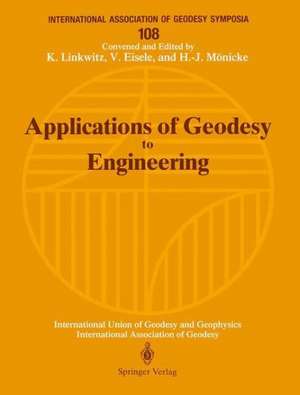
Applications of Geodesy to Engineering: Symposium No. 108, Stuttgart, Germany, May 13–17, 1991: International Association of Geodesy Symposia, cartea 108
Editat de Klaus Linkwitz, Viktor Eisele, Hans-Joachim Mönickeen Limba Engleză Paperback – 29 oct 1993
Din seria International Association of Geodesy Symposia
- 15%
 Preț: 660.49 lei
 - 18%
 Preț: 956.81 lei
 - 18%
 Preț: 958.38 lei
 -
 Preț: 440.22 lei
 -
 Preț: 430.59 lei
 -
 Preț: 435.38 lei
 -
 Preț: 405.28 lei
 - 15%
 Preț: 662.62 lei
 - 15%
 Preț: 641.38 lei
 - 15%
 Preț: 642.03 lei
 - 15%
 Preț: 640.55 lei
 - 15%
 Preț: 666.89 lei
 - 18%
 Preț: 975.29 lei
 - 15%
 Preț: 655.45 lei
 - 15%
 Preț: 644.18 lei
 - 15%
 Preț: 666.24 lei
 - 15%
 Preț: 679.00 lei
 - 15%
 Preț: 662.30 lei
 - 20%
 Preț: 579.46 lei
 - 20%
 Preț: 566.39 lei
 - 24%
 Preț: 1640.04 lei
 - 18%
 Preț: 1228.62 lei
 - 18%
 Preț: 957.62 lei
 - 20%
 Preț: 571.23 lei
 - 18%
 Preț: 1221.69 lei
 - 18%
 Preț: 1234.94 lei
 - 24%
 Preț: 1074.62 lei
 - 24%
 Preț: 1633.19 lei
 - 24%
 Preț: 1199.25 lei
 - 24%
 Preț: 1080.15 lei
 - 24%
 Preț: 1549.43 lei
 - 18%
 Preț: 1232.89 lei
 - 18%
 Preț: 1280.86 lei
 - 24%
 Preț: 1069.44 lei
 - 18%
 Preț: 1238.56 lei
 - 24%
 Preț: 1142.96 lei
Preț: 661.14 lei
Preț vechi: 777.82 lei
-15% Nou
Puncte Express: 992
Preț estimativ în valută:
126.53€ • 131.61$ • 104.45£
126.53€ • 131.61$ • 104.45£
Carte tipărită la comandă
Livrare economică 12-26 aprilie
Preluare comenzi: 021 569.72.76
Specificații
ISBN-13: 9783540562337
ISBN-10: 3540562338
Pagini: 444
Ilustrații: IX, 431 p. 34 illus.
Dimensiuni: 210 x 277 x 23 mm
Greutate: 0.99 kg
Editura: Springer Berlin, Heidelberg
Colecția Springer
Seria International Association of Geodesy Symposia
Locul publicării:Berlin, Heidelberg, Germany
ISBN-10: 3540562338
Pagini: 444
Ilustrații: IX, 431 p. 34 illus.
Dimensiuni: 210 x 277 x 23 mm
Greutate: 0.99 kg
Editura: Springer Berlin, Heidelberg
Colecția Springer
Seria International Association of Geodesy Symposia
Locul publicării:Berlin, Heidelberg, Germany
Public țintă
ResearchCuprins
and Programme.- Theoretical Aspects.- Engineering Networks in a Threedimensional Reference Frame.- Tidal Corrections in Geodetic Height Determination.- Transferring the Bearing Using a Strapdown Inertial Measurement Unit.- GPS as a Tool for Engineering Applications of Geodesy.- Formfinding of Lightweight Surface Structures by Geodetic Methods.- Risk Analysis of Local Heterogeneous Networks.- The Estimation of Rigid-Body-Movements Around a 3D-Axis.- Three-Dimensional Kinematic Network for Deformation Measurements.- New Models of the Deformation Analysis (not included).- Modelling Rigid Body Motion from Kinematic Measurements (not included).- Techniques of Measurements.- Robot Techniques and their Impact on Surveying Systems.- A Unified Alignment Model for Rotating Machinery.- Measurements of High-Frequency Oscillations by Optoelectronic and Inertial Sensors in a Hybrid Measurement System.- Concept for a New Monitoring System for the Arch Dam Esch/Sauer.- System of Survey, Analysis and Interpretation of Rocky Block Deformations in the Mountains.- Setting Up a Levelling Network for the Detection of Reliable Subsidences.- Techniques of Data Processing and Computing.- Recent Developments with Respect to the Automated Processing and Analysis of Engineering Survey Data.- Computer Solution of Systems of Linear Equations in Engineering Geodesy.- Theoretical Foundations of Technology by Using the System Analogous Stereo Plotter and Personal Computers.- Earthwork Volume Determination by Terrestrial Photogrammetry.- Precise Levelling Network Adjustment in Mining Subsidence Regions.- Data Base Systems for Applications in Engineering (not included).- Reports About Selected Executed Projects.- Applied Geodesy for Particle Accelerators.- Geodetic Works for Large Structures in Venezuela.- A Digital Urban Space Model for Urban Planning and Management.- Geodetic Survey for Long Undersea Tunnel Construction.- Control Surveys During the Construction of the Channel Tunnel.- Height Transfer Across the Storebælt (Eastern Channel) Using Geometric Levelling, Trigonometric Heighting and Astronomic Methods in Combination with GPS (GPS Levelling).- Engineering Surveys for Construction of the Ems Tunnel.- Special Tasks, i.e. Realtime Positioning and Navigation, Industrial Measurements, Image Processing.- Application of Network Adjustment Techniques in Engineering.- Current Work on the Methods of Industrial Measurements Carried Out at the Institute of Geodesy and Cartography in Warsaw.- High-Precision Real-Time Differential Positioning Using Low-Cost GPS Receivers.- High Accuracy Edge Matching with an Extension of the MPGC-Matching Algorithm.- Simultaneous Adjustment for a Self-Calibration of a CCD Camera in a 2-D Field.- Chains of Elongated Figures as Control Networks in Mines and Tunnels.- Robot Vision Based on an Exact Solution of the Threedimensional Resection-Intersection.- Special Measurement Methods to Determination of the Dynamic Parameters in Bridge Systems.- Instrumentation for Bridge Tests.- The Role of the Geodesist in Collaboration with Civil and Mechanical Engineers, Technical Designers and Architects.- Contributions of the Surveyor to Improve Infrastructure in Developing Countries.- The Polynominal Approximation in Design of Rectification of the Roadway Overhead Crane.- State of the Art and Development of Engineering Geodesy and Activities of the FIG Commission 6.- Geodätische Vermessungen bei Montage, Stapellauf, und Betrieb von Schiffen und Meeres-Bohrinseln (not included).- Appendix — List of Participants.- Author Index.
