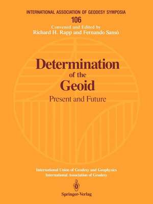
Determination of the Geoid: Present and Future: International Association of Geodesy Symposia, cartea 106
Editat de Richard H. Rapp, Fernando Sansòen Limba Engleză Paperback – 14 aug 1991
Din seria International Association of Geodesy Symposia
- 15%
 Preț: 660.49 lei
 - 18%
 Preț: 956.81 lei
 - 18%
 Preț: 958.38 lei
 -
 Preț: 440.22 lei
 -
 Preț: 430.59 lei
 -
 Preț: 435.38 lei
 -
 Preț: 405.28 lei
 - 15%
 Preț: 662.62 lei
 - 15%
 Preț: 641.38 lei
 - 15%
 Preț: 642.03 lei
 - 15%
 Preț: 640.55 lei
 - 18%
 Preț: 975.29 lei
 - 15%
 Preț: 661.14 lei
 - 15%
 Preț: 655.45 lei
 - 15%
 Preț: 644.18 lei
 - 15%
 Preț: 666.24 lei
 - 15%
 Preț: 679.00 lei
 - 15%
 Preț: 662.30 lei
 - 20%
 Preț: 579.46 lei
 - 20%
 Preț: 566.39 lei
 - 24%
 Preț: 1640.04 lei
 - 18%
 Preț: 1228.62 lei
 - 18%
 Preț: 957.62 lei
 - 20%
 Preț: 571.23 lei
 - 18%
 Preț: 1221.69 lei
 - 18%
 Preț: 1234.94 lei
 - 24%
 Preț: 1074.62 lei
 - 24%
 Preț: 1633.19 lei
 - 24%
 Preț: 1199.25 lei
 - 24%
 Preț: 1080.15 lei
 - 24%
 Preț: 1549.43 lei
 - 18%
 Preț: 1232.89 lei
 - 18%
 Preț: 1280.86 lei
 - 24%
 Preț: 1069.44 lei
 - 18%
 Preț: 1238.56 lei
 - 24%
 Preț: 1142.96 lei
Preț: 666.89 lei
Preț vechi: 784.57 lei
-15% Nou
Puncte Express: 1000
Preț estimativ în valută:
127.62€ • 138.58$ • 107.20£
127.62€ • 138.58$ • 107.20£
Carte tipărită la comandă
Livrare economică 22 aprilie-06 mai
Preluare comenzi: 021 569.72.76
Specificații
ISBN-13: 9780387974705
ISBN-10: 0387974709
Pagini: 500
Ilustrații: XI, 500 p. 16 illus.
Dimensiuni: 210 x 279 x 26 mm
Greutate: 1.15 kg
Ediția:Softcover reprint of the original 1st ed. 1991
Editura: Springer
Colecția Springer
Seria International Association of Geodesy Symposia
Locul publicării:New York, NY, United States
ISBN-10: 0387974709
Pagini: 500
Ilustrații: XI, 500 p. 16 illus.
Dimensiuni: 210 x 279 x 26 mm
Greutate: 1.15 kg
Ediția:Softcover reprint of the original 1st ed. 1991
Editura: Springer
Colecția Springer
Seria International Association of Geodesy Symposia
Locul publicării:New York, NY, United States
Public țintă
ResearchCuprins
Welcome Address.- Global Geopotential Models: Present and Future.- OSU89A/B Potential Coefficient Models.- The Aliasing Effect in Coefficients Estimation.- Grim-4: A New Global Earth Gravity Model (Status Report).- Geoid Recovery at 0.5 Degree Resolution from Global Satellite Gradiometry Data Sets.- Compact Approximation of the Geoid Height on the Base of Modified High Resolution Global Geopotential Models.- An Improved Method to the Earth’s Potential Coefficients Estimation.- The Role of Topography in Geoid Computations: The Marine Geoid.- Review of Geoid Prediction Methods in Mountainous Regions.- Estimation of the Gravity Field and Sea Surface Heights from Heterogeneous Data in the Central Mediterranean.- Altimetry Based Geoid Determination at the German Processing and Archiving Facility Within the ERS-1 Project.- The Determination of Oceanic Geoid Using Modified Hotine Integral.- A Strategy for Gross-Error Detection in Satellite Altimeter Data Applied in the Baltic-Sea Area for Enhanced Geoid and Gravity Determination.- Altimetry Rank Deficiency in Crossover Adjustment.- Practical Considerations in the Use of FFT Methods for Computing Terrain Effects.- Regularization by Digital Topography and by Estimating Crustal Parameters from Gravity Field Data: Example of Switzerland.- The Geoid and GPS.- Estimation of the Disturbing Potential Components and Comparison with GPS and Astrogeodetic Data.- GPS Control of the 1989 Gravimetric Quasigeoid for the Federal Republic of Germany.- Orthometric Heights Using GPS in Canada.- Determination of the Regional Geoid from Simulated GPS Measurements by the Aristoteles Solid-Earth Satellite.- Gravimetric and Astrogeodetic Measurements at GPS Locations in Karakorum.- GPS and Spirit Leveling Measurements in NE Italy.- State ofComputation of National or Regional Geoids.- Comparison of Geopotential Models in the Region of Hungary.- Test Computations for a Local Quasigeoid in Hungary Using FFT.- Derivation of the Most Reliable Geoid in the Area of Japan and Some Comments on the Variability of Sea Surface Topography.- ITALGEO ’90: Progress Report June ’90.- New Gravimetric Geoid for Canada: the “UNB ’90” Solution.- The Swiss Geoid Computation: A Status Report.- Estimation Models of Geoid in Nigeria Using Doppler Satellite Observations.- A New High-Resolution Geoid of the Nordic Area.- Geoid Evaluation in Australia: Status and Problems.- Free-Air Gravity Anomalies in Kenya.- Efforts Towards a Preliminary Gravimetric Geoid Computations in Poland Area.- The Gravimetric Geoid in Spain: First Results.- Finland: National Report.- Possible Improvements of the Existing European Geoid.- Theoretical Improvements in the Determination of the Geoid.- Nonspherical Boundary Value Problem by Pseudodifferential Operators.- A Global Geoid Computation by a Solution of the Bipotential Equation.- The Geoid and Its Computation from the Gravimetric Boundary Value Problem.- Some Integral Formulas for a Non-Spherical Earth.- Coerciveness and Geometry in the Linear Gravimetric Boundary Value Problem: Reduced Version.- Holes in Boundary and Out-of-Boundary Data.- The Boundary Equation Approach to the Geoid.- The Geoid, Green’s Functions and the Gravimetric Boundary Value Problem for the Spheroid Earth.- Correlation of Strain Representations of the Potential Anomalies with the Geoid.- On the Joint Use of Seismic and Gradiometric Data in Identifying Density Anomalies.- Software and Data Improvement for Geoid Computations.- A New Direct Solution of the Transformation Problem of Cartesian into EllipsoidalCoordinates.- Stokes Formula Using Fast Fourier Techniques.- Simulation of Regional Gravity Field Recovery from Satellite Gravity Gradiometer Data Using Collocation and FFT.- The GEMT1 Variance-Covariance Matrix: Its Characteristics and Applications in Geoid Computations.- Some Accuracy Estimates of Local Geoids.- Numerical Behaviour of Covariance Matrices and Their Influence on Iterative Solution Techniques.- Fast Collocation.- Poster Session.- GEOMED: An International Project for the Determination of the Geoid in the Mediterranean.- Preprocessing of Altimetric and Gravimetric Data in the Mediterranean Area.- Data Collection, Data Validation and Statistics of Geophysically Relevant Data.- GEOMED: Gravimetry Data Validation: Status Report.- Analysis of GEOSAT Altimeter Data.- Use of Point Masses on Optimized Positions for the Approximation of the Gravity Field.- List of Participants.- Author Index.


