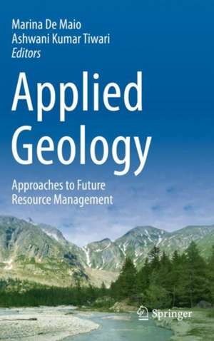
Applied Geology: Approaches to Future Resource Management
Editat de Marina De Maio, Ashwani Kumar Tiwarien Limba Engleză Paperback – 11 iul 2021
· Applied Geology
· Hydrogeology
· Geological Exploration (underground)
· Slope Instability, · Natural Hazards, Risk Assessment and Management,
· Geo-resources and Sustainable Development
· Application of Remote Sensing and Geographical Information Systems (GIS)
The authors, from academia, research and industry present the latest state of the practice, new technologies, innovative methods and sustainable management in the field of Applied and Environmental Geology.
This carefully edited work will be of value to academia, professionals, scientists and decision makers.
| Toate formatele și edițiile | Preț | Express |
|---|---|---|
| Paperback (1) | 793.38 lei 38-44 zile | |
| Springer International Publishing – 11 iul 2021 | 793.38 lei 38-44 zile | |
| Hardback (1) | 798.16 lei 38-44 zile | |
| Springer International Publishing – 10 iul 2020 | 798.16 lei 38-44 zile |
Preț: 793.38 lei
Preț vechi: 1043.92 lei
-24% Nou
Puncte Express: 1190
Preț estimativ în valută:
151.83€ • 157.93$ • 125.35£
151.83€ • 157.93$ • 125.35£
Carte tipărită la comandă
Livrare economică 11-17 aprilie
Preluare comenzi: 021 569.72.76
Specificații
ISBN-13: 9783030439552
ISBN-10: 3030439550
Pagini: 316
Ilustrații: XVII, 316 p. 138 illus., 118 illus. in color.
Dimensiuni: 155 x 235 mm
Greutate: 0.57 kg
Ediția:1st ed. 2020
Editura: Springer International Publishing
Colecția Springer
Locul publicării:Cham, Switzerland
ISBN-10: 3030439550
Pagini: 316
Ilustrații: XVII, 316 p. 138 illus., 118 illus. in color.
Dimensiuni: 155 x 235 mm
Greutate: 0.57 kg
Ediția:1st ed. 2020
Editura: Springer International Publishing
Colecția Springer
Locul publicării:Cham, Switzerland
Cuprins
Part I: Hydrogeology and Aquifer Contamination.- Chapter 1. Geological and hydrogeological characterization of springs in a DSGSD context (Rodoretto Valley - NW Italian Alps) (Martina Gizzi, Stefano Lo Russo, Maria Gabriella Forno, Elena Cerino Abdin, Glenda Taddia).- Chapter 2. Evaluation and prediction of seepage discharge through tailings dams when their rising (Viacheslav V. Fetisov, Elena A. Menshikova).- Chapter 3. Sediment yield in mountain basins, analysis and management: the SMART-SED project (Davide Brambilla, Monica Papini, Vladislav Ivov Ivanov, Luca Bonaventura, Andrea Abbate, Laura Longoni).- Chapter 4. Natural groundwater background levels of nitrate and landfill effects (Apulia, Southern Italy) (Livia Emanuela Zuffianò, Pier Paolo Limoni, Giorgio De Giorgio, Maurizio Polemio).- Part II: Geology and Urban areas.- Chapter 5. Sinkholes in the Friuli Venezia Giulia Region focus on the evaporites (Chiara Calligaris, Luca Zini, Stefania Nisio, Chiara Piano).- Chapter 6. Collapses in calcarenitic deposits along the sides of the Ginosa ravine in south Italy (Angelo Doglioni, Vincenzo Simeone).- Chapter 7. Relation between on field and InSAR data on landslide-induced damage (Matteo Del Soldato, Silvia Bianchini, Pantaleone De Vita, Diego Di Martire, Roberto Tomás, Domenico Calcaterra, Nicola Casagli).- Chapter 8. A hierarchical model for the Rocca di Sciara north-eastern slope instabilities (Sicily, Italy) (Mario Valiante, Francesca Bozzano, Marta Della Seta, Domenico Guida).- Part III: Geomechanics.- Chapter 9. Comparing direct and indirect methods to estimate Uniaxial Compressive Strength of rocks belonging to the Dolomites sequence (NE Italian Alps) (Elia Longo, Ennio Chiesurin, Mario Floris).- Chapter 10. CO2 sequestration and enhanced coalbed methane recovery: Worldwide status and Indian scenario (Bankim Mahanta, Vikram Vishal).- Part IV: Landslide: Monitoring.- Chapter 11. Hydrological behavior of unsaturated shallow soils on a slope and its failuremechanism: a case study in Ren River catchment, China (Xinsheng Wei, Wen Fan, Massimiliano Bordoni, Claudia Meisina).- Chapter 12. First steps for the development of an optical fibre strain sensor for shallow landslide stability monitoring through laboratory experiments (Monica Papini, Vladislav Ivov Ivanov, Davide Brambilla, Maddalena Ferrario, Marco Brunero, Gabriele Cazzulani, Laura Longoni).- Chapter 13. The giant Seymareh Landslide (Zagros Mts., Iran): a lesson for evaluating multi-temporal hazard scenarios (Michele Delchiaro, Javad Rouhi, Marta Della Seta, Salvatore Martino, Reza Nozaem, Maryam Dehbozorgi).- Chapter 14. Towards real-time geodetic monitoring of landslides with GNSS mass-market devices (Paolo Dabove, Ambrogio M. Manzino, Alberto Cina, Marco Piras, Iosif H. Bendea).- Part V: Landslide: Climate change.- Chapter 15. Italian latest advances on rainfall thresholds for landslide triggering (Stefano Luigi Gariano, Samuele Segoni, Luca Piciullo).- Chapter 16. Validation of a shallow landslide susceptibility analysis through a real case study: an example of application in Rome (Italy) (Poueme Djueyep Geraud, Esposito Carlo, Schilirò Luca, Bozzano Francesca).- Part VI: Landslide: Control.- Chapter 17. Application of a generalized criterion: time-of-failure forecast and alert thresholds assessment for landslides (Alessandro Valletta, Andrea Segalini, Andrea Carri).- Chapter 18. Evaluation of prediction capability of the MaxEnt and Frequency Ratio methods for landslide susceptibility in the Vernazza catchment (Cinque Terre, Italy) (Emanuele Raso, Diego Di Martire, Andrea Cevasco, Domenico Calcaterra, Patrizio Scarpellini, Marco Firpo).
Notă biografică
Marina De Maio was a Professor of Applied Geology and GIS in the Department of Environment, Land and Infrastructure Engineering at Politecnico di Torino, Turin, Italy. She was a Representative of Politecnico di Torino in the “European Technical and Scientific Committee (ETSC)” and European Water Association (EWA) and Senior Consultant for UNESCO. She has published several articles as Author and Coauthor in various reputed national and international journals. Her research activity was mainly on geological risk assessment, aquifer vulnerability, pollution risk, water resources management, climate change, mining and GIS. She has developed some part of “SINTACS” method to evaluate aquifer venerability during her research work and has completed several international and national research projects. She has also served as Reviewer for many international and national journals.
Ashwani Kumar Tiwari is working as an Assistant Professor in the School of Environmental Sciences at Jawaharlal Nehru University, New Delhi, India. His teaching and research areas are water resources management and GIS, hydro-geochemistry, pollution of water resources by geogenic and anthropogenic activities, groundwater-seawater interaction and aquifer vulnerability. He was a Postdoctoral Researcher at the Department of Environment, Land and Infrastructure Engineering, Politecnico di Torino, Turin, Italy for around four years. He has completed his M.Sc., M.Phil., and Ph.D. in Environmental Science. He obtained his Ph.D. degree from Indian Institute of Technology (Indian School of Mines), Dhanbad, India, in 2016. He was awarded Erasmus Mundus and Marie Skłodowska-Curie Actions Scholarships. He has travelled to Canada, Chile, Malta, Germany, Estonia, Bulgaria and Finland for academic-/research-related pursuits. He has published several research articles in various reputed international and national journals, and his works on respective fields are very well appreciated bythe many workers across the world. He has served as a Reviewer for many international journals.
Ashwani Kumar Tiwari is working as an Assistant Professor in the School of Environmental Sciences at Jawaharlal Nehru University, New Delhi, India. His teaching and research areas are water resources management and GIS, hydro-geochemistry, pollution of water resources by geogenic and anthropogenic activities, groundwater-seawater interaction and aquifer vulnerability. He was a Postdoctoral Researcher at the Department of Environment, Land and Infrastructure Engineering, Politecnico di Torino, Turin, Italy for around four years. He has completed his M.Sc., M.Phil., and Ph.D. in Environmental Science. He obtained his Ph.D. degree from Indian Institute of Technology (Indian School of Mines), Dhanbad, India, in 2016. He was awarded Erasmus Mundus and Marie Skłodowska-Curie Actions Scholarships. He has travelled to Canada, Chile, Malta, Germany, Estonia, Bulgaria and Finland for academic-/research-related pursuits. He has published several research articles in various reputed international and national journals, and his works on respective fields are very well appreciated bythe many workers across the world. He has served as a Reviewer for many international journals.
Textul de pe ultima copertă
This book includes a careful selection of significant contributions from international experts that were presented at the 6th AIGA Conference “Applied Geology: Approaches to Future Resource Management” that was held in the Courmayeur, Aosta Valley, Italy, from 27 - 29 June 2018. The following 7 areas are the main themes covered in this volume:
· Applied Geology
· Hydrogeology
· Geological Exploration (underground)
· Slope Instability,
· Natural Hazards, Risk Assessment andManagement,
· Geo-resources and Sustainable Development
· Application of Remote Sensing and Geographical Information Systems (GIS)
The authors, from academia, research and industry present the latest state of the practice, new technologies, innovative methods and sustainable management in the field of Applied and Environmental Geology.
This carefully edited work will be of value to academia, professionals, scientists and decision makers.
Caracteristici
Covers Hydrogeology, Geological exploration, Slope instability, Natural hazards, Geo-resources, Remote Sensing and GIS Presents a new approach to study earth processes and provides a balanced approach to monitoring of environmental geological risk hazards Assists professors, researchers, students as well as policymakers to understand environmental earth processes and their consequences to society and help to take a quick decision for the sustainable management
