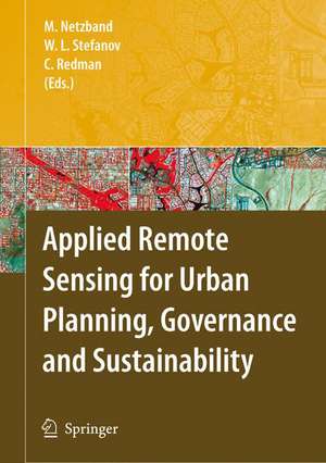
Applied Remote Sensing for Urban Planning, Governance and Sustainability
Editat de Maik Netzband, William L. Stefanov, Charles Redmanen Limba Engleză Hardback – 30 iul 2007
| Toate formatele și edițiile | Preț | Express |
|---|---|---|
| Paperback (1) | 785.88 lei 38-44 zile | |
| Springer Berlin, Heidelberg – 14 oct 2010 | 785.88 lei 38-44 zile | |
| Hardback (1) | 951.47 lei 6-8 săpt. | |
| Springer Berlin, Heidelberg – 30 iul 2007 | 951.47 lei 6-8 săpt. |
Preț: 951.47 lei
Preț vechi: 1160.32 lei
-18% Nou
Puncte Express: 1427
Preț estimativ în valută:
182.06€ • 190.60$ • 150.65£
182.06€ • 190.60$ • 150.65£
Carte tipărită la comandă
Livrare economică 05-19 aprilie
Preluare comenzi: 021 569.72.76
Specificații
ISBN-13: 9783540255468
ISBN-10: 354025546X
Pagini: 312
Ilustrații: XXXII, 278 p.
Dimensiuni: 155 x 235 x 25 mm
Greutate: 0.62 kg
Ediția:2007
Editura: Springer Berlin, Heidelberg
Colecția Springer
Locul publicării:Berlin, Heidelberg, Germany
ISBN-10: 354025546X
Pagini: 312
Ilustrații: XXXII, 278 p.
Dimensiuni: 155 x 235 x 25 mm
Greutate: 0.62 kg
Ediția:2007
Editura: Springer Berlin, Heidelberg
Colecția Springer
Locul publicării:Berlin, Heidelberg, Germany
Public țintă
ResearchCuprins
Remote Sensing as a Tool for Urban Planning and Sustainability.- Automatic Land-Cover Classification Derived from High-Resolution IKONOS Satellite Imagery in the Urban Atlantic Forest of Rio de Janeiro, Brazil, by Means of an Object-Oriented Approach.- Advances in Urban Remote Sensing: Examples From Berlin (Germany).- Spatial Analysis of Urban Vegetation Scale and Abundance.- Urban Environmental Monitoring in Buenos Aires — Determining Green Areas.- Challenges in Characterizing and Mitigating Urban Heat Islands — A Role for Integrated Approaches Including Remote Sensing.- Phoenix, Arizona, USA: Applications of Remote Sensing in a Rapidly Urbanizing Desert Region.- Application of Remote Sensing and GIS Technique for Urban Environmental Management and Sustainable Development of Delhi, India.- Berlin (Germany) Urban and Environmental Information System: Application of Remote Sensing for Planning and Governance — Potentials and Problems.- Views of Chiang Mai: The Contributions of Remote-Sensing to Urban Governance and Sustainability.- 20 Years After Reforms: Challenges to Planning and Development in China’s City-Regions and Opportunities for Remote Sensing.
Recenzii
From the reviews:
"This collection of earnest and workmanlike essays had its origins in the 100 Cities Project – formerly the Urban Environmental Monitoring (UEM) Project—at Arizona State University. … The book is intended to exemplify applications of remote sensing for urban environmental characterization, monitoring and government decision-making. … is aimed mainly at planners whose interest is in the physical environment." (John Miron, Geomatica, Vol. 62 (1), 2008)
"This collection of earnest and workmanlike essays had its origins in the 100 Cities Project – formerly the Urban Environmental Monitoring (UEM) Project—at Arizona State University. … The book is intended to exemplify applications of remote sensing for urban environmental characterization, monitoring and government decision-making. … is aimed mainly at planners whose interest is in the physical environment." (John Miron, Geomatica, Vol. 62 (1), 2008)
Caracteristici
High spatial and spectral resolution image data Includes various urban case studies Evaluation of the potentials of remote sensing of urban areas
