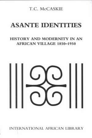
Asante Identities: History and Modernity in an African Village, 1850-1950: International African Library
Autor T. C. McCaskieen Limba Engleză Paperback – 30 apr 2001
An account of the life of a Ghanaian village during a century of tumultuous change, this study is also a richly textured microhistory and an exploration of the meanings of history and modernity in an African context. The years 1850-1950 witnessed several momentous and transformative developments in Asante history, including British annexation and colonial overrule. In Asante Identities,
T. C. McCaskie provides a nuanced study of this era 'from below, ' focusing on the everyday lives of commoners in Adeebeba, an independent village that was engulfed by the expansion of the city of Kumase in the 20th century. He tells this story through the words of the villagers themselves, drawing on life histories collected by the Ashanti Social Survey in the 1940s.
McCaskie provides a deep cultural reading that ranges over issues of selfhood and community and their impact on the colonial experience. His discussion touches on questions of identity, belief, power, money, rights, obligations, gender, sexuality, and much more. The result is a book compelling in both its historical detail and its analytic sophistication.
| Toate formatele și edițiile | Preț | Express |
|---|---|---|
| Paperback (1) | 194.41 lei 6-8 săpt. | |
| Indiana University Press – 30 apr 2001 | 194.41 lei 6-8 săpt. |
Preț: 194.41 lei
Nou
37.20€ • 40.40$ • 31.25£
Carte tipărită la comandă
Livrare economică 22 aprilie-06 mai
Specificații
ISBN-10: 0253214963
Pagini: 310
Dimensiuni: 156 x 234 x 15 mm
Greutate: 0.41 kg
Editura: Indiana University Press
Seria International African Library
Notă biografică
Cuprins
International African Library
Published in association with the International African Institute, London
Table of Contents:
Introduction
Adeebeba Lives: the Nineteenth century
Adeebeba Lives: Contextualizing Community and Identity
Adeebeba Lives: The Twentieth Century
Conclusion
6 x 9, 229 pages, 5 maps, 28 b & w illustrations
