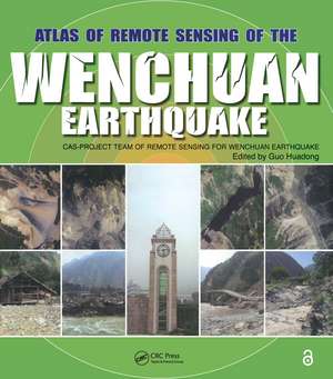
Atlas of Remote Sensing of the Wenchuan Earthquake
Editat de Guo Huadongen Limba Engleză Paperback – 4 feb 2019
Based on the accumulated data and images collected by the Project Team of Remote Sensing Monitoring and Assessment of the Wenchuan Earthquake, Atlas of Remote Sensing of the Wenchuan Earthquake documents the events as they happened in real time. The book covers the disaster from six aspects: geological, barrier lakes, collapsed buildings, damaged roads, destroyed farmland and forests, and demolished infrastructure. It also demonstrates that the Dujiangyan Irrigation Project, which has been standing for 2000 years, remains fully functioning, and keeps the Chengdu Plain operating optimally even after the earthquake.
Translated into English for the first time, the Atlas presents a pictorial summation of this unique project. It chronicles the event with over 280 before and after color images from a range of perspectives. This volume dramatically demonstrates the value of remote sensing for understanding how an earthquake unfolds and the potential of remote sensing in helping coordinate emergency relief. A pictorial record of events as they unfolded, this book provides a systematic documentation of earthquake damage that can be used to prepare for future seismic events.
Preț: 428.61 lei
Preț vechi: 553.00 lei
-22% Nou
Puncte Express: 643
Preț estimativ în valută:
82.02€ • 85.80$ • 68.13£
82.02€ • 85.80$ • 68.13£
Carte tipărită la comandă
Livrare economică 03-17 aprilie
Preluare comenzi: 021 569.72.76
Specificații
ISBN-13: 9781138112179
ISBN-10: 1138112178
Pagini: 412
Ilustrații: 22 Tables, color; 314 Illustrations, color
Dimensiuni: 248 x 280 x 20 mm
Greutate: 0.49 kg
Ediția:1
Editura: CRC Press
Colecția CRC Press
ISBN-10: 1138112178
Pagini: 412
Ilustrații: 22 Tables, color; 314 Illustrations, color
Dimensiuni: 248 x 280 x 20 mm
Greutate: 0.49 kg
Ediția:1
Editura: CRC Press
Colecția CRC Press
Cuprins
Remote Sensing Data. Geological Disasters. Barrier Lakes. Collapsed Buildings and Houses. Damaged Roads. Destroyed Farmlands and Forests. Demolished Infrastructure. Continuing Civilization.
Notă biografică
Prof. Guo Huadong is the Director General and Professor at the Center for Earth Observation and Digital Earth, Chinese Academy of Sciences(CAS), He has been engaged in remote sensing research since 1977, devoting to research on radar remote sensing, development of new earth observing systems, and remote sensing applications. He was project leader of more than 10 key programs related to earth observation. For the past over 10 years and at present, he was and is one of the principal investigators for SIR-C/X-SAR, JERS-1 SAR, ERS-1/2 SAR, Radarsat-1/2, Envisat, SRTM, and ALOS programs. He is a member of International SAR Working Group, Chairman of the Associate on Environment Remote Sensing of China, Secretary General of International Society for Digital Earth, Editor-in-Chief of International Journal of Digital Earth, member of Codata executive committee, and guest professor of 7 Universities in China. He was the Principal Scientist of Expert Group for Information Acquisition and Processing Technology, National High-tech Research and Development Program in China from 1996 to 2000. He has published more than 200 papers and 15 books. He is the recipient of 3 national awards on science and technology, and 9 awards by the Chinese Academy of Sciences.
Descriere
This atlas presents a pictorial catalogue of this unique project. It includes more than 300 color images from a range of perspectives, including geological and infrastructural. This volume demonstrates the value of remote sensing for understanding how an earthquake unfolds as well as its potential in helping coordinate emergency relief.
