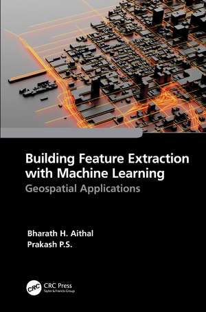
Building Feature Extraction with Machine Learning: Geospatial Applications
Autor Bharath.H. Aithal, Prakash P.S.en Limba Engleză Hardback – 29 dec 2022
- Provides the basics of feature extraction methods and applications along with the fundamentals of machine learning
- Discusses in detail the application of machine learning techniques in geospatial building feature extraction
- Explains the methods for estimating object height from optical satellite remote sensing images using Python
- Includes case studies that demonstrate the use of machine learning models for building footprint extraction and photogrammetric methods for height assessment
- Highlights the potential of machine learning and geospatial technology for future project developments
| Toate formatele și edițiile | Preț | Express |
|---|---|---|
| Paperback (1) | 308.07 lei 6-8 săpt. | |
| CRC Press – 8 oct 2024 | 308.07 lei 6-8 săpt. | |
| Hardback (1) | 452.34 lei 6-8 săpt. | |
| CRC Press – 29 dec 2022 | 452.34 lei 6-8 săpt. |
Preț: 452.34 lei
Preț vechi: 588.22 lei
-23% Nou
Puncte Express: 679
Preț estimativ în valută:
86.57€ • 89.92$ • 71.91£
86.57€ • 89.92$ • 71.91£
Carte tipărită la comandă
Livrare economică 03-17 februarie 25
Preluare comenzi: 021 569.72.76
Specificații
ISBN-13: 9781032255330
ISBN-10: 1032255331
Pagini: 144
Ilustrații: 18 Tables, black and white; 6 Line drawings, color; 11 Line drawings, black and white; 21 Halftones, color; 15 Halftones, black and white; 53 Illustrations, color
Dimensiuni: 156 x 234 x 14 mm
Greutate: 0.26 kg
Ediția:1
Editura: CRC Press
Colecția CRC Press
Public țintă
Postgraduate and ProfessionalCuprins
Introduction. Geospatial Big Data for Machine Learning. Spatial Feature Extraction. Building Height Estimation. 3D Feature Mapping. Applications and Case Studies.
Notă biografică
Dr. Bharath H. Aithal, is currently an assistant professor at Ranbir and Chitra Gupta School of Infrastructure Design and Management at Indian Institute of Technology Kharagpur. He obtained his Ph.D. from Indian Institute of Science. His areas of interest are spatial pattern analysis, Urban growth modelling, natural disasters, geoinformatics, landscape modelling, urban planning, open-source GIS, and digital image processing. He has published over 50 research papers in reputed peer reviewed journals and has presented over 100 papers in international and national conferences and symposiums. In 2020 he published with CRC Press, Urban Growth Patterns in India: Spatial Analysis for Sustainable Development and has contributed 6 book chapters to other publications.
Dr. Prakash P.S. is a postdoctoral researcher at Irish Centre of High-End Computing, Galway, Ireland, working on geo-spatial technologies. Prakash has substantial experience with earth observation datasets, including remote sensing, drone-based imagery, surveying, spatial libraries, machine learning, and artificial intelligence technologies. He has worked in geospatial technology and the renewable energy industry for over four years. His other qualifications include a Master of Technology in Geoinformatics from Bangalore's Karnataka State Remote Sensing Application Center and a Bachelor of Civil Engineering from Bangalore's Rashtreeya Vidyalaya College of Engineering.
Dr. Prakash P.S. is a postdoctoral researcher at Irish Centre of High-End Computing, Galway, Ireland, working on geo-spatial technologies. Prakash has substantial experience with earth observation datasets, including remote sensing, drone-based imagery, surveying, spatial libraries, machine learning, and artificial intelligence technologies. He has worked in geospatial technology and the renewable energy industry for over four years. His other qualifications include a Master of Technology in Geoinformatics from Bangalore's Karnataka State Remote Sensing Application Center and a Bachelor of Civil Engineering from Bangalore's Rashtreeya Vidyalaya College of Engineering.
Descriere
This book focuses on feature extraction methods for optical geospatial data using Machine Learning (ML). It is a practical guide for professionals and graduate students starting a career in information extraction. It explains spatial feature extraction in an easy-to-understand way and includes real case studies.
