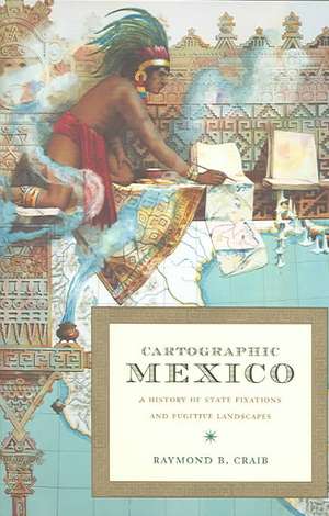
Cartographic Mexico – A History of State Fixations and Fugitive Landscapes: Latin America Otherwise
Autor Raymond B Craiben Limba Engleză Paperback – 31 oct 2004
Din seria Latin America Otherwise
-
 Preț: 161.02 lei
 -
 Preț: 195.84 lei
 -
 Preț: 169.48 lei
 -
 Preț: 218.61 lei
 -
 Preț: 261.93 lei
 -
 Preț: 301.59 lei
 -
 Preț: 264.26 lei
 -
 Preț: 231.22 lei
 -
 Preț: 302.36 lei
 -
 Preț: 265.20 lei
 -
 Preț: 191.54 lei
 -
 Preț: 240.90 lei
 -
 Preț: 299.29 lei
 -
 Preț: 301.38 lei
 -
 Preț: 211.33 lei
 -
 Preț: 261.18 lei
 -
 Preț: 239.76 lei
 -
 Preț: 265.59 lei
 -
 Preț: 305.46 lei
 -
 Preț: 237.47 lei
 -
 Preț: 262.32 lei
 -
 Preț: 265.79 lei
 -
 Preț: 263.29 lei
 -
 Preț: 298.70 lei
 -
 Preț: 302.19 lei
 -
 Preț: 324.80 lei
 -
 Preț: 238.39 lei
 -
 Preț: 383.63 lei
 -
 Preț: 264.26 lei
 -
 Preț: 236.67 lei
 -
 Preț: 306.99 lei
 -
 Preț: 236.10 lei
 -
 Preț: 268.68 lei
 -
 Preț: 300.62 lei
 -
 Preț: 335.67 lei
 -
 Preț: 304.31 lei
 -
 Preț: 308.90 lei
 -
 Preț: 307.95 lei
 -
 Preț: 261.38 lei
 -
 Preț: 264.64 lei
 -
 Preț: 315.64 lei
 -
 Preț: 269.27 lei
 -
 Preț: 327.73 lei
 -
 Preț: 262.14 lei
 -
 Preț: 262.32 lei
Preț: 264.43 lei
Nou
Puncte Express: 397
Preț estimativ în valută:
50.60€ • 52.83$ • 41.88£
50.60€ • 52.83$ • 41.88£
Carte tipărită la comandă
Livrare economică 05-19 aprilie
Preluare comenzi: 021 569.72.76
Specificații
ISBN-13: 9780822334163
ISBN-10: 082233416X
Pagini: 328
Ilustrații: 20 illustrations
Dimensiuni: 156 x 238 x 23 mm
Greutate: 0.46 kg
Editura: MD – Duke University Press
Seria Latin America Otherwise
ISBN-10: 082233416X
Pagini: 328
Ilustrații: 20 illustrations
Dimensiuni: 156 x 238 x 23 mm
Greutate: 0.46 kg
Editura: MD – Duke University Press
Seria Latin America Otherwise
Recenzii
Cartographic Mexico is an outstanding book. Raymond B. Craib addresses such important issues as spatial rationalization and its implementation in the modern state and the impact of modern technologies on the making of modernity. The empirical data and the uses of primary sources are excellent, and the arguments are theoretically sophisticated. Above all, it is an enjoyable read.Thongchai Winichakul, author of Siam Mapped: A History of the Geo-Body of a NationCartographic Mexico is a path-breaking work of deep scholarship and great theoretical sophistication in which Raymond B. Craib tells two intertwined stories. He relates the sweeping history of the Mexican states drive during the century following the Reforma to represent the national territory by mapping it scientifically, transforming local places into a national space, thus inventing Mexico on paper while making it both legible and susceptible to commodification. He also traces in great detail how this process worked itself out in the state of Veracruz, where officials, government surveyors, landowners, and peasant villagers continually confronted each other, sometimes violently, in a struggle to determine whether notions of place or space would ultimately prevail.Eric Van Young, author of The Other Rebellion: Popular Violence, Ideology, and the Mexican Struggle for Independence, 18101821"Carib has chosen a vast and richly original theme to explore . . . His analysis issubtle, imaginative and persuasive, rooted . . . in an evocative sense of localgeographies . . . Most importantly this is study that significantly contributes to ourunderstanding of modern Mexico on multiple fronts."--Jrnl of Latin American Studies,May 2006
Notă biografică
Textul de pe ultima copertă
""Cartographic Mexico" is a path-breaking work of deep scholarship and great theoretical sophistication in which Raymond B. Craib tells two intertwined stories. He relates the sweeping history of the Mexican state's drive during the century following the Reforma to represent the national territory by mapping it scientifically, transforming local places into a national space, thus inventing Mexico on paper while making it both legible and susceptible to commodification. He also traces in great detail how this process worked itself out in the state of Veracruz, where officials, government surveyors, landowners, and peasant villagers continually confronted each other, sometimes violently, in a struggle to determine whether notions of place or space would ultimately prevail."--Eric Van Young, author of "The Other Rebellion: Popular Violence, Ideology, and the Mexican Struggle for Independence, 1810-1821"
Cuprins
Descriere
Analyzes spatial history of 19th and early 20th century Mexico, particularly political uses of mapping and surveying, to demonstrate multiple ways that space can be negotiated in the service of local or national agendas.


