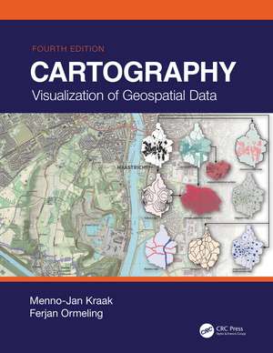
Cartography: Visualization of Geospatial Data, Fourth Edition
Autor Menno-Jan Kraak, Ferjan Ormelingen Limba Engleză Hardback – 29 iul 2020
Written by the leading scholars in cartography, this work is a comprehensive resource, perfect for senior undergraduate and graduate students taking courses in GIS (geographic information system) and cartography.
New in This Edition:
- Provides an excellent introduction to general cartographic visualization principles through full-colour figures and images
- Addresses significant changes in data sources, technologies and methodologies, including the movement towards more open data sources and systems for mapping
- Includes new case studies and new examples for illustrating current trends in mapping
- Provides a societal and institutional framework in which future mapmakers are likely to operate, based on UN global development sustainability goals
| Toate formatele și edițiile | Preț | Express |
|---|---|---|
| Paperback (1) | 359.47 lei 3-5 săpt. | +32.97 lei 5-11 zile |
| Taylor & Francis – 25 sep 2023 | 359.47 lei 3-5 săpt. | +32.97 lei 5-11 zile |
| Hardback (1) | 638.09 lei 6-8 săpt. | |
| CRC Press – 29 iul 2020 | 638.09 lei 6-8 săpt. |
Preț: 638.09 lei
Preț vechi: 846.67 lei
-25% Nou
Puncte Express: 957
Preț estimativ în valută:
122.11€ • 127.02$ • 100.81£
122.11€ • 127.02$ • 100.81£
Carte tipărită la comandă
Livrare economică 14-28 aprilie
Preluare comenzi: 021 569.72.76
Specificații
ISBN-13: 9781138613959
ISBN-10: 1138613959
Pagini: 261
Ilustrații: 4 Tables, color; 220 Illustrations, color
Dimensiuni: 210 x 280 x 20 mm
Greutate: 1.18 kg
Ediția:4 ed
Editura: CRC Press
Colecția CRC Press
Locul publicării:Oxford, United Kingdom
ISBN-10: 1138613959
Pagini: 261
Ilustrații: 4 Tables, color; 220 Illustrations, color
Dimensiuni: 210 x 280 x 20 mm
Greutate: 1.18 kg
Ediția:4 ed
Editura: CRC Press
Colecția CRC Press
Locul publicării:Oxford, United Kingdom
Cuprins
1. Geographical Information Science and Maps 2. Data Acquisition 3. Map Characteristics 4. GIS Applications: Which Map to Use? 5. Map Design and Production 6. Topography 7. Statistical Mapping 8. Mapping Time 9. Maps at Work: Presenting and Using Geospatial Data in Maps and Atlases 10. Maps at Work: Analysis and Geovisualization 11. Cartography at Work: Maps as Decision Tools
Notă biografică
Menno-Jan Kraak is professor of Geovisual Analytics and Cartography at the University of Twente, Faculty of Geoinformation Sciences and Earth Observation / ITC. Currently he is head of ITC’s Geo-Information Processing Department. He is also serving as President of the International Cartographic Association (ICA) for the period 2015-2019. He has written more than 200 publications, among these the book Mapping Time. He is a member of the editorial board of several international journals in the fields of cartography and GIScience.
Ferjan Ormeling retired as honorary professor of Cartography at Utrecht University (where he focused his research on thematic cartography, atlas cartography and toponymy), and now works as a member of the Explokart research group at the University of Amsterdam. He advises on atlas projects on behalf of the International Cartographic Association, and teaches toponymy courses in developing countries for the United Nations Group of Experts on Geographical Names.
Ferjan Ormeling retired as honorary professor of Cartography at Utrecht University (where he focused his research on thematic cartography, atlas cartography and toponymy), and now works as a member of the Explokart research group at the University of Amsterdam. He advises on atlas projects on behalf of the International Cartographic Association, and teaches toponymy courses in developing countries for the United Nations Group of Experts on Geographical Names.
Recenzii
"While the overall structure of the book has been preserved from previous editions, the content was substantially re-vised, with new material that reflects emerging trends and changes in technology."
–– Menno-Jan Kraak and Ferjan Ormeling, Cartographic Perspective
–– Menno-Jan Kraak and Ferjan Ormeling, Cartographic Perspective
Descriere
This fourth edition serves as an excellent introduction to general cartographic principles and as an examination of the best ways to optimize the visualization and use of spatio-temporal data. It discusses the art, science, and technology of making and using maps, and also examines the societal and institutional framework related to mapmaking.
