Computing in Geographic Information Systems
Autor Narayan Panigrahien Limba Engleză Hardback – 10 iul 2014
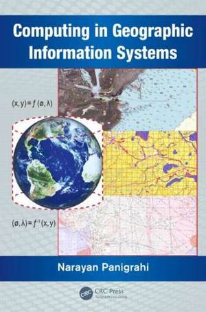
Computing in Geographic Information Systems considers the computational aspects, and helps students understand the mathematical principles of GIS. It provides a deeper understanding of the algorithms and mathematical methods inherent in the process of designing and developing GIS functions. It examines the associated scientific computations along with the applications of computational geometry, differential geometry, and affine geometry in processing spatial data. It also covers the mathematical aspects of geodesy, cartography, map projection, spatial interpolation, spatial statistics, and coordinate transformation. The book discusses the principles of bathymetry and generation of electronic navigation charts.
The book consists of 12 chapters. Chapters one through four delve into the modeling and preprocessing of spatial data and prepares the spatial data as input to the GIS system. Chapters five through eight describe the various techniques of computing the spatial data using different geometric and statically techniques. Chapters nine through eleven define the technique for image registration computation and measurements of spatial objects and phenomenon.
- Examines cartographic modeling and map
| Toate formatele și edițiile | Preț | Express |
|---|---|---|
| Paperback (1) | 356.18 lei 6-8 săpt. | |
| CRC Press – 23 oct 2019 | 356.18 lei 6-8 săpt. | |
| Hardback (1) | 617.91 lei 6-8 săpt. | |
| CRC Press – 10 iul 2014 | 617.91 lei 6-8 săpt. |
Preț: 617.91 lei
Preț vechi: 939.19 lei
-34% Nou
Puncte Express: 927
Preț estimativ în valută:
118.24€ • 124.02$ • 98.43£
118.24€ • 124.02$ • 98.43£
Carte tipărită la comandă
Livrare economică 01-15 aprilie
Preluare comenzi: 021 569.72.76
Specificații
ISBN-13: 9781482223149
ISBN-10: 1482223147
Pagini: 310
Ilustrații: 72 black & white illustrations, 11 black & white tables
Dimensiuni: 156 x 234 x 18 mm
Greutate: 0.48 kg
Ediția:1
Editura: CRC Press
Colecția CRC Press
ISBN-10: 1482223147
Pagini: 310
Ilustrații: 72 black & white illustrations, 11 black & white tables
Dimensiuni: 156 x 234 x 18 mm
Greutate: 0.48 kg
Ediția:1
Editura: CRC Press
Colecția CRC Press
Public țintă
Professional Practice & DevelopmentCuprins
Introduction. Computational Geodesy. Reference Systems and Coordinate Transformations. Basics of Map Projection. Algorithms for Rectification of Geometric Distortions. Differential Geometric Principles and Operators. Computational Geometry and its Application to GIS. Spatial Interpolation Techniques. Spatial Statistical Methods. An Introduction to Bathymetry. Spatial Analysis of Bathymetric Data and Sea GIS. Measurements and Analysis Using GIS. Appendix. Appendix-B. Glossary of GIS Terms. Bibliography.
Notă biografică
Dr. Narayan Panigrahi is a practicing geo-spatial scientist in the Centre for Artificial Intelligence and Robotics (CAIR), Bangalore, India. He obtained his master's degree from the J.K. Institute of Applied Physics and Technology, University of Allahabad, his M Tech from the Indian Institute of Technology (IIT), Kharagpur, and his PhD from IIT, Bombay, India. His current research interests include geographical information science, design and optimization of algorithms for computation of spatial data in vector and raster form obtained through different sensors, and application of GIS for resource mapping and operation planning.
Descriere
This book explores key concepts in GIS such as geodesy; the coordinate or referencing system for referring objects on Earth’s surface. It explains how the spatial data and 3D surface of Earth are projected on to a flat surface to make a map through different map projection methods. It examines how three different types of geometry help in the analysis of spatial data. It also discusses the mathematical formulations of how to compute physical parameters of geometric and spatial quantities using different spatial data.
