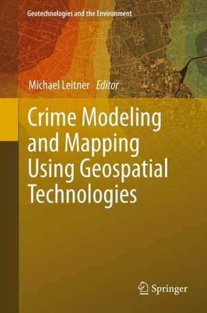
Crime Modeling and Mapping Using Geospatial Technologies: Geotechnologies and the Environment, cartea 8
Editat de Michael Leitneren Limba Engleză Hardback – 18 ian 2013
In 1996, the US National Institute of Justice (NIJ) established the crime mapping research center (CMRC), to promote research, evaluation, development, and dissemination of GIS technology. The long-term goal is to develop a fully functional Crime Analysis System (CAS) with standardized data collection and reporting mechanisms, tools for spatial and temporal analysis, visualization of data and much more. Among the drawbacks of current crime analysis systems is their lack of tools for spatial analysis.
For this reason, spatial analysts should research which current analysis techniques (or variations of such techniques) that have been already successfully applied to other areas (e.g., epidemiology, location-allocation analysis, etc.) can also be employed to the spatial analysis of crime data. This book presents a few of those cases.
| Toate formatele și edițiile | Preț | Express |
|---|---|---|
| Paperback (1) | 952.26 lei 43-57 zile | |
| SPRINGER NETHERLANDS – 25 iun 2015 | 952.26 lei 43-57 zile | |
| Hardback (1) | 967.08 lei 43-57 zile | |
| SPRINGER NETHERLANDS – 18 ian 2013 | 967.08 lei 43-57 zile |
Din seria Geotechnologies and the Environment
- 15%
 Preț: 649.71 lei
 - 18%
 Preț: 1408.89 lei
 - 18%
 Preț: 1007.49 lei
 - 18%
 Preț: 945.79 lei
 - 20%
 Preț: 566.50 lei
 - 18%
 Preț: 952.09 lei
 - 18%
 Preț: 948.92 lei
 - 15%
 Preț: 652.31 lei
 - 18%
 Preț: 951.77 lei
 - 15%
 Preț: 639.25 lei
 - 15%
 Preț: 652.17 lei
 - 24%
 Preț: 746.98 lei
 - 24%
 Preț: 778.70 lei
 - 18%
 Preț: 952.72 lei
 - 18%
 Preț: 968.34 lei
 - 24%
 Preț: 790.70 lei
 - 18%
 Preț: 995.63 lei
 - 18%
 Preț: 886.92 lei
 - 5%
 Preț: 1106.69 lei
 - 18%
 Preț: 1215.04 lei
 - 15%
 Preț: 636.12 lei
 - 15%
 Preț: 502.22 lei
Preț: 967.08 lei
Preț vechi: 1179.37 lei
-18% Nou
Puncte Express: 1451
Preț estimativ în valută:
185.05€ • 193.70$ • 154.02£
185.05€ • 193.70$ • 154.02£
Carte tipărită la comandă
Livrare economică 31 martie-14 aprilie
Preluare comenzi: 021 569.72.76
Specificații
ISBN-13: 9789400749962
ISBN-10: 9400749961
Pagini: 460
Ilustrații: XIII, 446 p.
Dimensiuni: 155 x 235 x 30 mm
Greutate: 1.07 kg
Ediția:2013
Editura: SPRINGER NETHERLANDS
Colecția Springer
Seria Geotechnologies and the Environment
Locul publicării:Dordrecht, Netherlands
ISBN-10: 9400749961
Pagini: 460
Ilustrații: XIII, 446 p.
Dimensiuni: 155 x 235 x 30 mm
Greutate: 1.07 kg
Ediția:2013
Editura: SPRINGER NETHERLANDS
Colecția Springer
Seria Geotechnologies and the Environment
Locul publicării:Dordrecht, Netherlands
Public țintă
ResearchCuprins
From the Contents: Spatial Heterogeneity in Crime Analysis.- When Does a Drug Market Become a Drug Market? Finding the Boundaries of Illicit Event Concentrations.- Convicted Sex Offender Residential Movements.- Street-Level Spatiotemporal Crime Analysis: Examples from Bronx County, NY (2006–2010).- Exploring Spatial Patterns of Crime Using Non-Hierarchical Cluster Analysis.- Reconstitution of the Journeys to Crime and Location of their Origin in the Context of a Crime Series. A Raster Solution for a Real Case Study.- Journey-to-Crime by Gender and Age Group in Manchester, England.- Crime Scene Locations in Criminal Homicides: A Spatial Crime Analysis in a GIS Environment.
Notă biografică
Michael Leitner is a Professor at the Department of Geography and Anthropology at the Louisiana State University in Baton Rouge (USA).
At LSU, he is teaching courses in (advanced) computer cartography, GIS, methods of spatial analysis, aerial photo interpretation, and how GPS collected data can be used for the analysis, modeling, and visualization in a GIS environment.
His current research interests include automated map generalization, the visualization of data quality and its effect on spatial decision support, the utilization of GPS for computer mapping, GIS, and spatial analysis, and the development of new techniques (for example, spatial association) for the spatial analysis of crime data. His research has been published in refereed journals and proceedings and has been presented at (inter)national conferences.
He also works for the Center of Geoinformatics at the University of Salzburg, Austria.
Textul de pe ultima copertă
Recent years in North America have seen a rapid development in the area of crime analysis and mapping using Geographic Information Systems (GIS) technology.
In 1996, the US National Institute of Justice (NIJ) established the crime mapping research center (CMRC), to promote research, evaluation, development, and dissemination of GIS technology. The long-term goal is to develop a fully functional Crime Analysis System (CAS) with standardized data collection and reporting mechanisms, tools for spatial and temporal analysis, visualization of data and much more. Among the drawbacks of current crime analysis systems is their lack of tools for spatial analysis.
For this reason, spatial analysts should research which current analysis techniques (or variations of such techniques) that have been already successfully applied to other areas (e.g., epidemiology, location-allocation analysis, etc.) can also be employed to the spatial analysis of crime data. This book presents a few of those cases.
Caracteristici
Poses interesting questions on crime in a geospatial context Tackles various sorts of crime and places them in a geospatial context Discusses a few applications and implementations of GIS Includes supplementary material: sn.pub/extras
